
The world of fleet management and logistics can be incredibly complex, involving multiple drivers, numerous stops, countless roads, each with its own set of limits and regulations. Without an efficient system in place, drivers may struggle to make calculated decisions, and organizations may face significant challenges in planning, mitigating risks, and effectively managing their operations.
Esri has long provided routing solutions that offer users valuable insights for location-based analysis and decision-making. Additionally, there has been a persistent need for accurate GPS information to support all aspects of a routing operation. Accurate GPS information relies on clean GPS data, which is the foundation of Esri’s new offering, Snap to Roads.
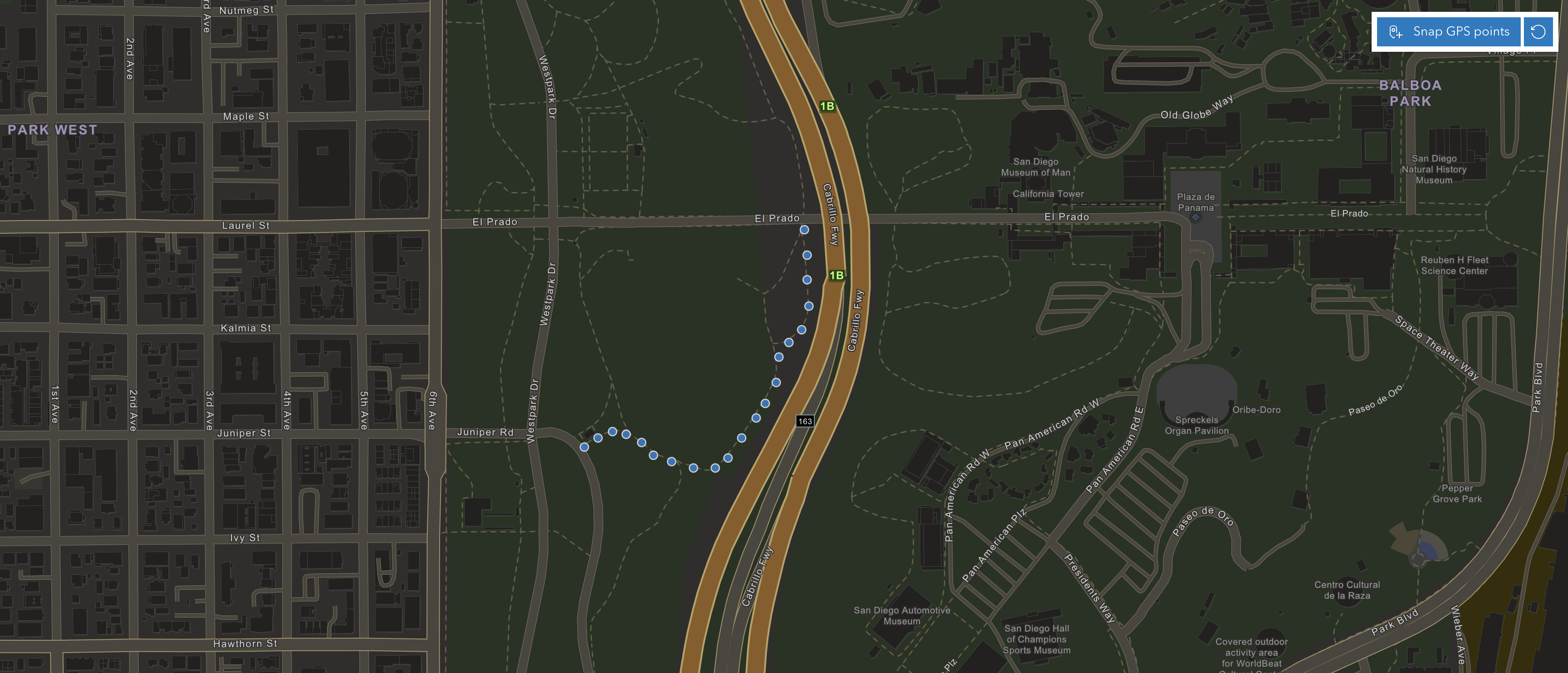
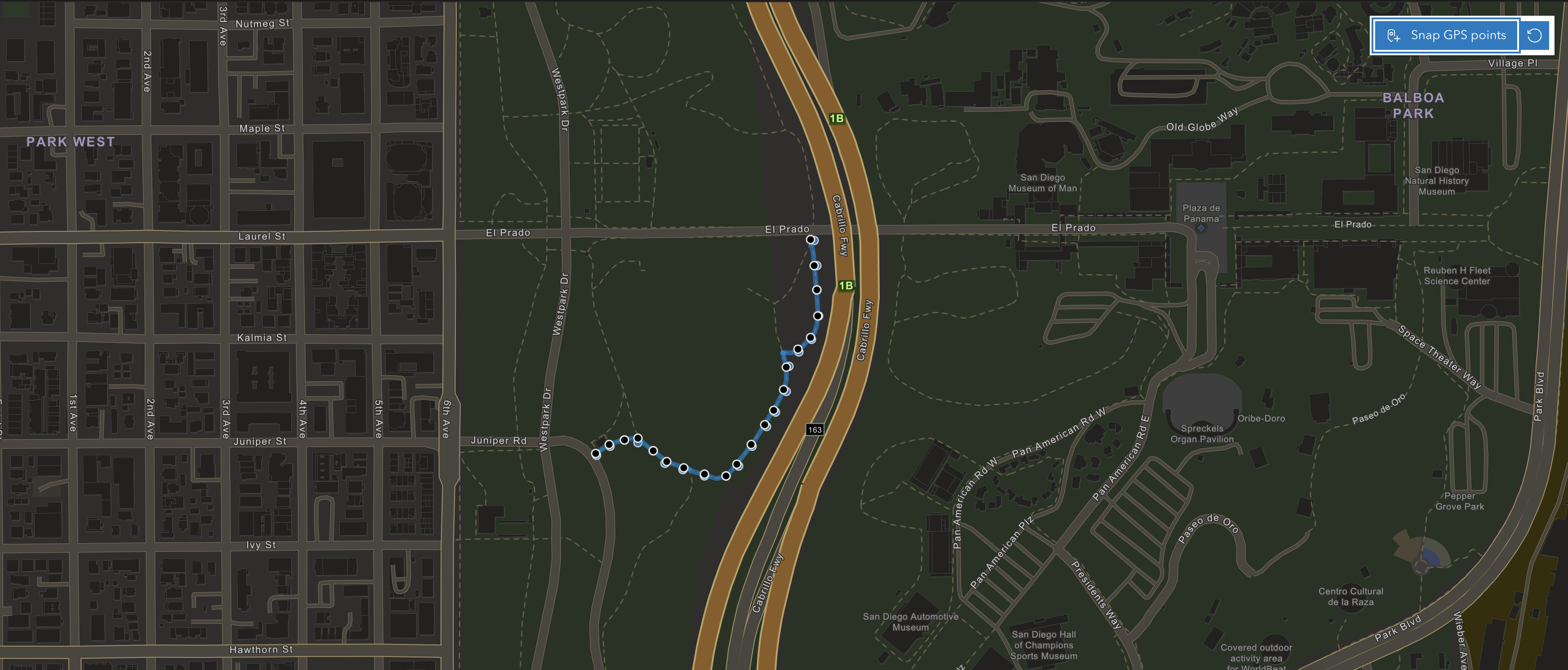
Snap to Roads, a feature of the ArcGIS Routing service, is designed to clean GPS data by aligning GPS data points collected by customers to road networks, ensuring the accuracy and reliability of GPS information. It works by snapping GPS points to the corresponding streets and can also provide the shape of a route, along with street attributes such as posted speed limits, length, associated with each road segment.
Organizations looking to improve efficiency can leverage the many benefits and functionalities of Snap to Roads. Let’s explore a few:
- Save time and maintain consistency with reusable routes: By aligning GPS data to the road network, Snap to Roads enables the creation of detailed and accurate route layers that can be reused for future operations. Businesses can cut down the travel time of their vehicles and also maintain consistency in the way they deliver goods.
- Promote adherence to planned routes to mitigate risks and conserve resources: Snap to Roads helps organizations confirm that their drivers followed the planned routes. Adhering to planned routes is critical for optimizing fuel consumption, reducing travel time, and lowering the risk of deviations that may lead to accidents or loss of goods.

- Ensure compliance with speed regulations: Snap to Roads can help users compare GPS attributes such as speed, with road characteristics such as speed limits, and then report speed limit violations. This benefit allows organizations to take corrective actions, ensuring that their drivers adhere to traffic laws, maintain a good safety record, and avoid preventable accidents.
- Accurate route planning and analysis: Snap to Roads corrects GPS data points that may be slightly off due to signal issues or other factors, aligning them with the actual road network. It ensures that the data used for route planning and analysis is precise and reliable.
Snap to Roads greatly contributes to driver and fleet safety. It saves time and costs, helps organizations stay compliant, and enhances overall efficiency, ultimately improving customer service.
How to Access Snap to Roads
Developers can seamlessly integrate Snap to Roads into applications and solutions with an ArcGIS Location Platform or ArcGIS Online subscription.
For additional information and to begin using the Snap to Roads service, please review this help topic or visit our website.


Article Discussion: