
Introduction
Every decade, the U.S. Census provides updated population counts that directly impact the allocation of political representation. Following the 2030 Census, the fixed total of 435 seats in the U.S. House of Representatives will be redistributed among the 50 states through a process known as apportionment. This calculation is based on state-level population totals and has further downstream effects on both Electoral College representation and the allocation of certain categories of federal funding.
Shifts in population—driven by migration, economic opportunities, and demographic changes—are expected to produce notable adjustments in seat distribution. Esri’s preliminary demographic projections indicate that the 2030 apportionment cycle could result in some of the most substantial representation changes in recent decades. This blog offers an initial outlook based on Esri’s projected 2030 seat allocations and some of the interesting stories behind the numbers.
Understanding Apportionment
Apportionment is the process of allocating U.S. House seats to states based on population counts from the decennial census. The U.S. uses the Method of Equal Proportions, which ensures that each seat represents roughly the same number of people nationwide. Every state is guaranteed at least one seat.
This process has shifted political power by region as the nation’s population has grown. Historically, the West and South regions have gained congressional seats while the Midwest and Northeast have lost congressional seats.
The Method of Equal Proportions in Action
Over the last 20 years, Esri has leveraged its Esri Updated Demographics population estimates to forecast congressional seat allocations in anticipation of the decennial U.S. Census. Watch as each of the 435 seats are assigned state-by-state using Esri’s 2030 population projections:
2030 Projected Winners and Losers

Projection Accuracy
Esri has a proven track record of utilizing its Esri Updated Demographics population estimates to forecast congressional seat allocations prior to the release of the decennial U.S. Census. These forecasts have been applied to both the 2010 and 2020 apportionment cycles.
- 2010 Census – Esri’s model achieved 100% accuracy, correctly predicting the allocation of all 435 U.S. House seats.
- 2020 Census – Esri’s model correctly predicted 12 of the 13 state changes.
There are several key considerations that provide important context when analyzing Esri’s 2020 projections:
- Relative Accuracy – Esri’s 2020 projections outperformed the U.S. Census Bureau’s Population Estimates Program (PEP) when compared against vintage 2020 estimates for projected seat allocations. Esri had more correct predictions and fewer incorrect predictions compared to Census PEP.
- Census 2020 Data Quality – The 2020 Census exhibited reduced accuracy compared to prior cycles. The official count had a net undercount estimated between 800,000 and 1.1 million people. This error was unevenly distributed, with 6 states undercounted and 8 states overcounted, potentially influencing apportionment outcomes. Esri projected that Texas would gain three seats. Texas only gained two seats but was statistically close to gaining a third seat. Holding other states constant at 2020 counts, Texas needed to count an additional 210,000 people to gain three seats. Texas had an estimated undercount of approximately 560,000 people based on the Census Post Enumeration Survey.
2030 Projections – why now?
In June of 2025, Esri released the latest vintage of Updated Demographics, which includes current year (2025) population estimates and five year (2030) population projections*. Instead of waiting until the official 2030 estimates are published in five years, we conducted an early analysis of potential congressional apportionment outcomes using Esri’s current five-year projections.
While other organizations have also produced 2030 apportionment forecasts, many rely on straight-line interpolation—extending observed trends from 2020 to a mid-decade point directly through to 2030. This method assumes constant growth rates, which can be misleading because population dynamics often shift within a decade due to migration patterns, economic changes, and other demographic factors.
Esri’s 2030 projections avoid this limitation by employing a multi-method modeling framework rather than simple linear extrapolation. The approach integrates:
- Cohort-component modeling – accounting for births, deaths, and migration by age and sex cohorts.
- Housing component modeling – accounting for occupancy and persons per household as drivers of population change.
- Future development pipeline data – incorporating planned housing and infrastructure projects to anticipate localized growth.
By combining results from these complementary methods, Esri produces more robust and adaptive projections that better reflect the complex, evolving nature of population change over the decade.
*For this analysis, Esri Updated Demographics July 1st estimates were date shifted to April 1st estimates to align with the 2030 Census reference date.
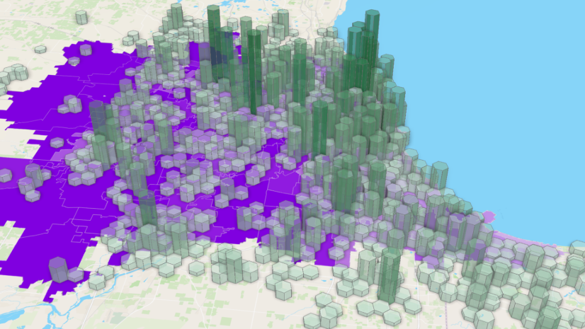
Explore the Esri 2030 Apportionment Map in
ArcGIS Living Atlas of the World
click on the map to explore

Behind the Numbers – states on the cusp
The following scenarios are based on population counts at the state level, assuming all other states are held constant at Esri’s 2030 projected values.
Hanging on to the last seat by the skin of their teeth:
- Connecticut is awarded the 431st seat as its final allocated seat. If Census 2030 counts 19,868 or 0.55% fewer people than Esri’s projection, then Connecticut would not get its 5th seat and would lose 1 seat.
- Alabama is awarded the 432nd seat as its final allocated seat. If Census 2030 counts 25,124 or 0.48% fewer people than Esri’s projection, then Alabama would not get its 7th seat and would lose 1 seat.
- Wisconsin is awarded the 434th seat as its final allocated seat. If Census 2030 counts 3,690 or 0.06% fewer people than Esri’s projection, then Wisconsin would not get its 8th seat and would lose 1 seat.
- Michigan is awarded the 435th seat as its final allocated seat. If Census 2030 counts 4,149 or 0.04% fewer people than Esri’s projection, then Michigan would not get its 13th seat and would lose 1 seat.
Losing a seat – so close but no cigar:
- Minnesota is awarded the 379th seat as its final allocated seat. If Census 2030 counts 51,525 or 0.87% more people than Esri’s projection, then Minnesota would maintain its 8th seat and not lose 1 seat.
- Pennsylvania is awarded the 408th seat as its final allocated seat. If Census 2030 counts 95,789 or 0.73% more people than Esri’s projection, then Pennsylvania would maintain its 17th seat and not lose 1 seat.
- California is awarded the 427th seat as its final allocated seat. If Census 2030 counts 16,442 or 0.04% more people than Esri’s projection, then California would get its 50th seat and only lose 2 seats.
Almost there – so close to getting one more:
- Washington is awarded the 395th seat as its final allocated seat. If Census 2030 counts 71,172 or 0.85% more people than Esri’s projection, then Washington would gain its 11th seat.
- Florida is awarded the 426th seat as its final allocated seat. If Census 2030 counts 243,721 or 1.01% more people than Esri’s projection, then Florida would gain its 31st seat.
Gaining a seat, but just barely:
- Georgia is awarded the 433rd seat as its final allocated seat. If Census 2030 counts 34,917 or 0.3% fewer people than Esri’s projection, then Georgia would not get its 15th seat and would remain at its 2020 allocation of 14 seats
Explore Esri Demographics
Esri Demographics contains over 15,000 demographic and socioeconomic estimates created by Esri’s Data Development team. Topics include population, housing, consumer spending, market potential, ArcGIS Tapestry, and much more. It is available throughout ArcGIS in the following products:
- ArcGIS Living Atlas
Ready to use layers and maps - ArcGIS Business Analyst
Identify sites and evaluate markets with ArcGIS Business Analyst, demographic mapping software. - ArcGIS Location Platform
Enhance workflows and apps with the ArcGIS GeoEnrichment Service – Enrich data with additional location-based information about people and places in a specific area. - ArcGIS Online and ArcGIS Pro
Enrich your data with demographic data in ArcGIS Online using Enrich Layer and in ArcGIS Pro using Enrich. - Buy Esri Demographics
Access high-quality, location-based data from the Esri Store.
Contact us at datasales@esri.com.


Article Discussion: