The November 2026 release of ArcGIS Experience Builder in ArcGIS Online makes it easier to build smarter experiences, design for any screen, and help users get more from their data.
Leading the release is AI Chat (Beta), a new conversational experience for exploring data, navigating the app, and completing tasks using natural language. You’ll also find a streamlined responsive design workflow, greater control over app publishing, and enhancements across many widgets. Let’s dive in.
Quick links
- AI Chat (Beta)
- Enhanced responsive design
- More control over app publishing
- New template
- Message action enhancements
- Widget enhancements
- Accessibility updates
- More information

AI Chat (Beta)
AI Chat introduces a new way for users to interact with apps using natural language. Users can ask questions about an app, explore its data and content, and perform supported widget operations through conversation. Available capabilities depend on the app’s data and configuration. Responses can include text, tables, charts, maps, legends, feature details, and lists, depending on the request.
For example, after a storm causes utility outages, a dispatcher wants to identify the most critical outages and send crews where they are needed most. The dispatcher asks AI Chat, “Show me the open high-priority work orders in a table.” AI Chat returns eight work orders, including the number of customers affected, helping the dispatcher quickly determine which has the greatest reported impact.
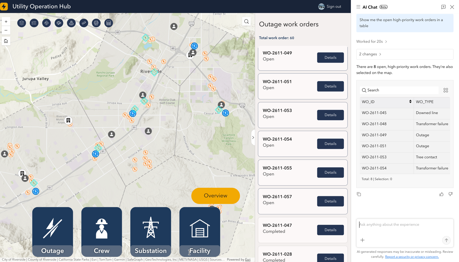
Users can ask AI Chat to:
- Summarize, query, filter, select, sort, or group data and calculate statistics.
- Find places and addresses, navigate the map, change layer visibility, or go to a bookmark.
- Navigate pages and views, open windows or panels, and change configured languages or themes.
- Work with supported widgets, such as displaying results in a Table widget, changing selections in a Chart widget, measuring or drawing on a map, creating routes, printing, and sharing.
Enable AI Chat
Go to the General pane to add AI Chat to a new or existing app. No rebuilding is required.
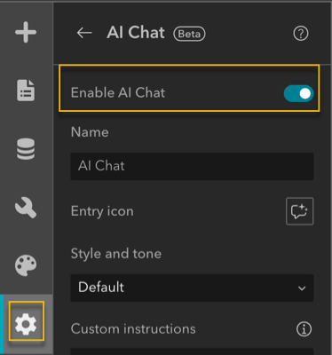
Note: This option is available only to signed-in ArcGIS users in organizations where AI agents are enabled. Credit consumption will apply after the beta period.
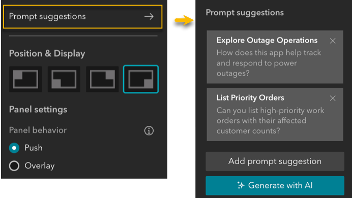
You can customize AI Chat to fit the purpose and audience of your app. Configuration options include response style and tone, instructions, suggested prompts, layout, and more. AI can also generate suggested questions based on the app’s data and configuration.
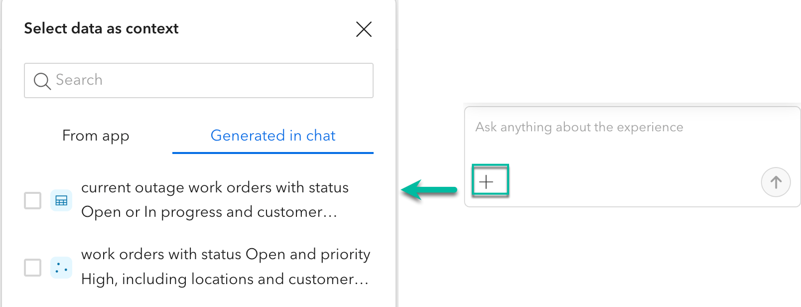
Keep your data in context
Users can add app data or data generated during the conversation as context for their next prompt. AI Chat prioritizes the selected data when processing the request, making it easier to continue exploring a particular dataset or result. If no data is selected as context, AI Chat determines which app data is most relevant to the request.
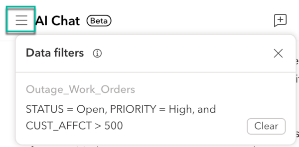
Filters applied through AI Chat are also visible in the Data filter panel, where users can review a description of the current filters and clear them when needed.
Review and undo changes
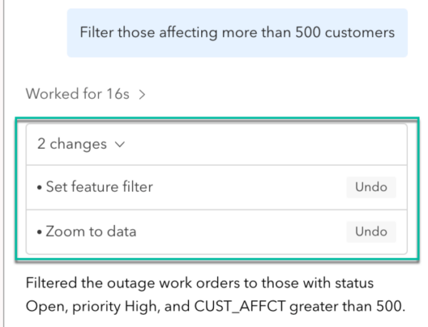
When AI Chat makes supported changes to an app, the response identifies what changed. Some operations also provide an Undo option, allowing users to reverse the change before continuing to the next prompt.
AI Chat also supports multilingual conversations. You can ask questions in a language different from the app’s configured language, and AI Chat responds in the language you use.
Enhanced responsive design
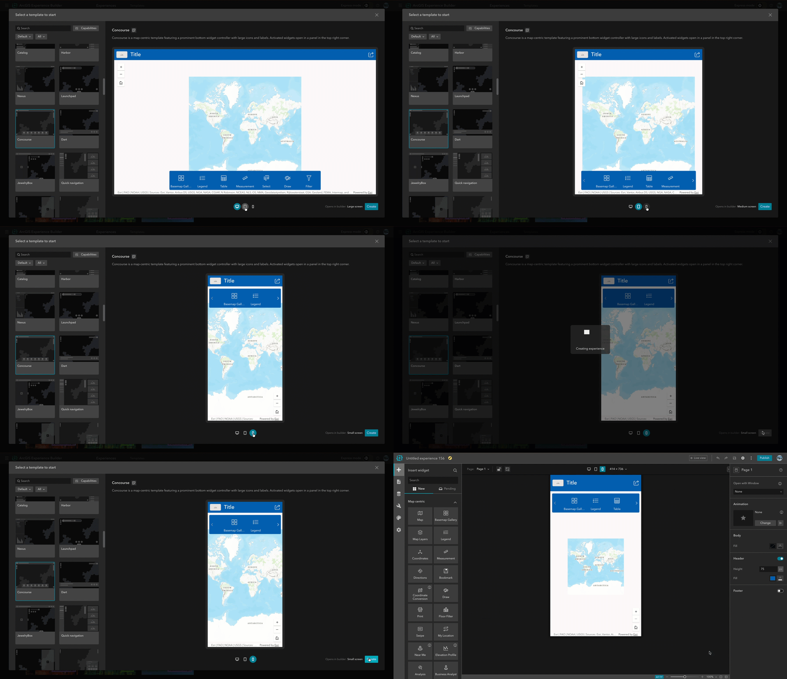
Designing an experience for different screen sizes is now more streamlined. When you create a new app, you can choose which screen size to start with: large, medium, or small, based on your target audience. For example, if your audience primarily uses phones, you can begin with the small-screen layout and then optimize the experience for other screen sizes. With the new interactive template preview, you can also see how each template works across all three screen sizes before choosing one.
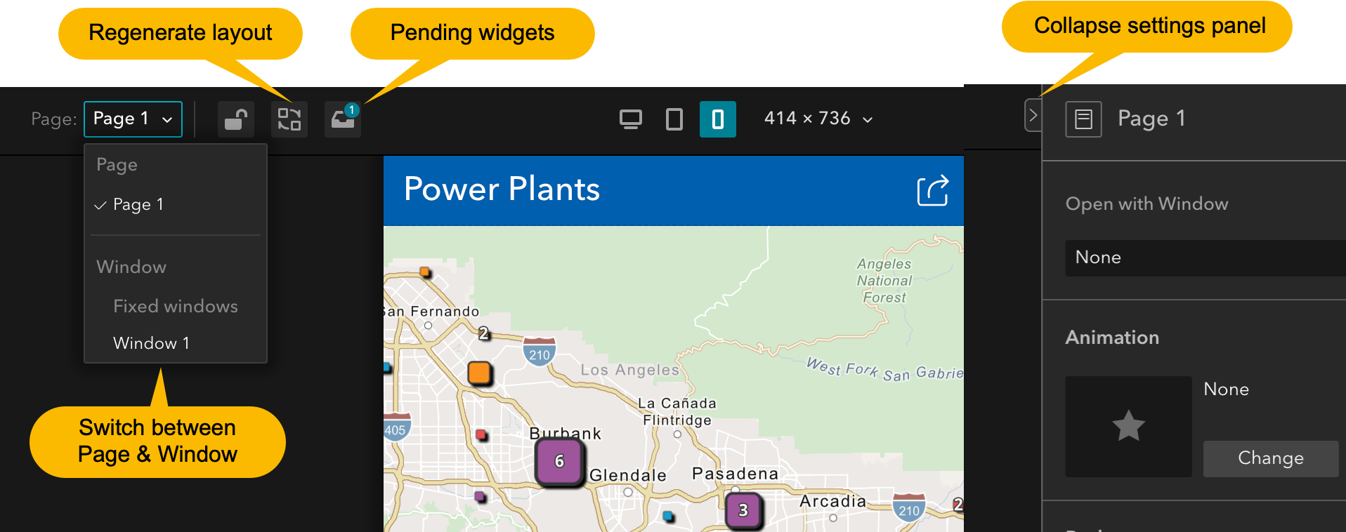
Customizing layouts across screen sizes is also simpler. The previous Auto and Custom layout options for medium and small screens have been removed. Simply switch to a screen size and customize its layout directly. Layout tools have also moved above the canvas, bringing commonly used responsive design controls together. You can quickly navigate between pages and windows without leaving the canvas and collapse the settings panel to create more room to design.
Other improvements include:
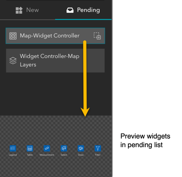
- Pending widgets: Preview a widget in the pending list and review its settings before adding it.
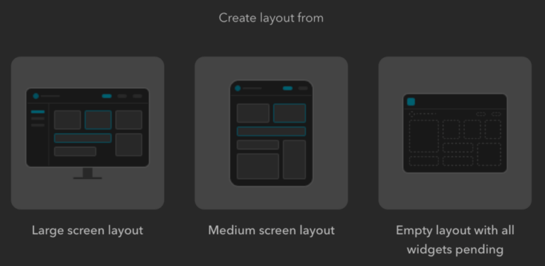
- Regenerate layout: Rebuild the current device layout based on another screen size or start with an empty layout without reconfiguring existing widgets.
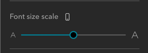
- Responsive font scaling: Text font sizes can now scale across screen sizes. Instead of duplicating a Text widget to use different font sizes, you can use the same widget and configure font scaling for each screen size in the widget, creating a more consistent reading experience across devices.
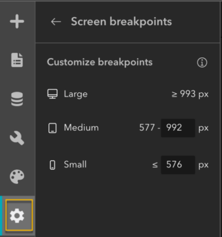
- Screen-size breakpoints: Customize screen-size breakpoints in General settings so you can optimize the transition between desktop, tablet, and phone layouts for the screen sizes your users commonly use.
More control over app publishing
You now have more control over published apps with two new capabilities: discard draft changes and unpublish.
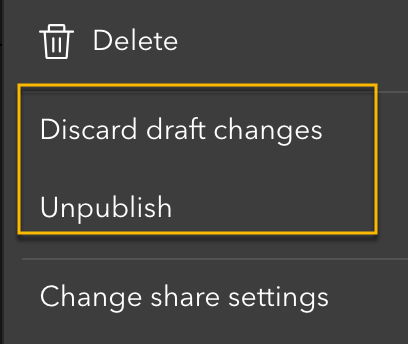
Discard draft changes reverts an app to its most recently published version, making it easier to abandon unwanted changes and return to a known state.
Unpublish removes the published version so the app is no longer accessible to others. Your draft is preserved, allowing you to continue editing the experience and publish it again when it is ready.
New template
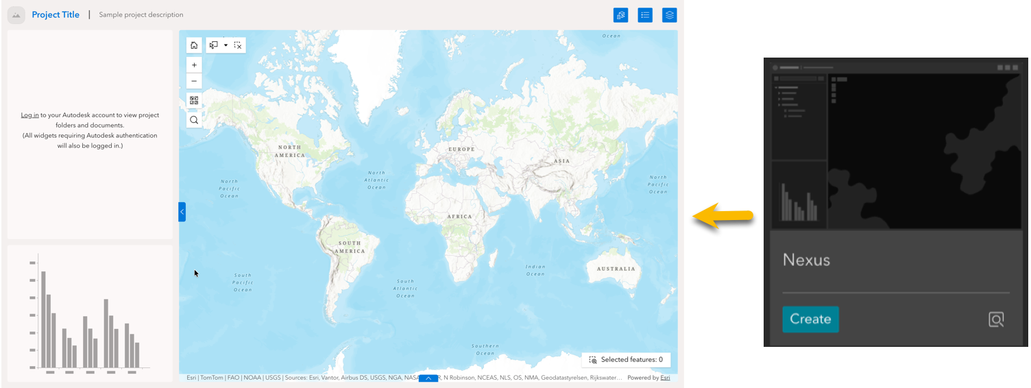
The new Nexus template provides a ready-to-use starting point for connected building information modeling (BIM) and GIS workflows. It includes preconfigured Autodesk and Experience Builder widgets, reducing setup and helping you create integrated BIM and GIS experiences more quickly.
Message action enhancements
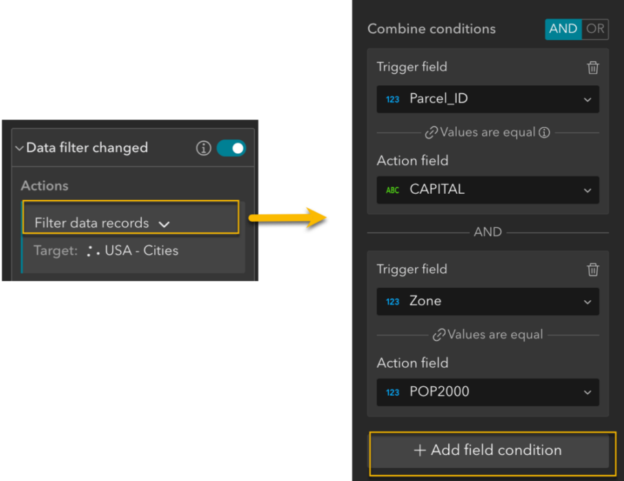
Message actions now provide more flexibility for filtering workflows. For the Data filtering changed trigger, the record limit has increased from 1,000 to 3,000 records. When configuring the Filter data records action, you can also match multiple field pairs between the trigger and action data.
Widget enhancements
Text
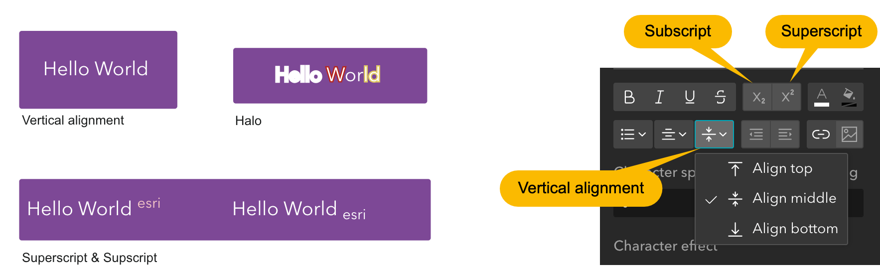
In addition to responsive font scaling, the Text widget gives you more control over styling and formatting. You can vertically align text to the top, middle, or bottom, use subscript and superscript formatting, and add a text halo to improve readability.
Arcade styling has also been enhanced with support for text.highlightColor, allowing highlight colors to be dynamically customized using Arcade.
Map
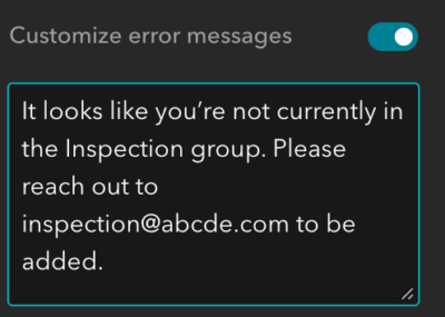
When a map cannot be loaded, for example, because a user doesn’t have permission to access it, you can configure a friendly message to provide helpful guidance.
Table
The Table widget can now respect a layer’s visible scale range, avoiding queries against layers outside their current visible range and improving performance with large datasets.

The View in Table data action now honors the target Table widget’s configuration, including displayed fields and their order.
Query
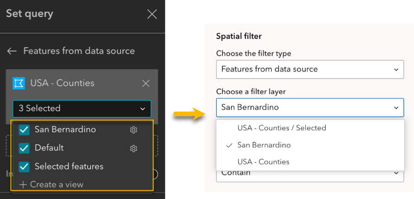
Spatial queries can now use the default or a customized data view in addition to the previously supported selected view, giving you more flexibility in choosing which data to query.
Edit
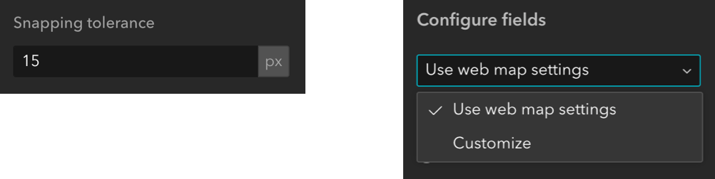
When configuring fields, Use layer settings has been renamed Use web map settings and now supports both pop-up and form settings. You can also configure snapping tolerance in pixels, providing more control over editing behavior.
Near Me
The Near Me widget now supports searching without a buffer distance, along with several other enhancements. You can batch configure settings in full mode, use dynamic attributes, group features by unique value combinations, and add a logo and notes to PDF reports. For more information, see the related blog post.
Business Analyst
The Business Analyst widget adds a highly requested selection tool for workflow mode. Users can select up to 10 point or polygon features from a map and use the selected sites to run comparison reports or batch-export infographics. The capability also supports message actions from the Select widget. For more information, see the related blog post.
Document Explorer and Link Explorer
BIM and GIS workflows continue to expand. You can link Autodesk Forma BIM and CAD documents to GIS features directly from Experience Builder using the Document Explorer widget and manage or delete those links using the Link Explorer widget.
Elevation Profile
The Elevation Profile widget adds support for data source message actions and Knowledge Graph data sources. The display of underground objects has also been aligned with the Elevation Profile experience in Scene Viewer for greater consistency.
Oriented Imagery Viewer
The Oriented Imagery Viewer widget includes several enhancements. When exploring 3D images, you can now use a frustum filter to search based on camera frustums instead of 2D footprint polygons, helping you more accurately identify the best image for a selected location in a scene. You can also use depth images in oriented imagery layers for more precise depth-aware calculations and visualization.
Accessibility updates
This release includes additional accessibility improvements. Default templates have been reviewed for proper heading use, and ArcGIS Online showcase templates created by the Experience Builder team have been improved to better support accessibility requirements.
More information
Explore more Experience Builder stories and resources:
- Learn how coding skills can accelerate custom widget development in Building Custom Experience Builder Widgets with an Agent Skill.
- See how the Toronto Transit Commission uses GIS-based web applications to coordinate construction activities in complex operational environments in Mind the Overlap: Toronto Transit Commission Maps Conflicts Before They Happen.
For the complete list of updates, see What’s new. If you have questions, contact experiencebuilder@esri.com.
Thank you,
The ArcGIS Experience Builder Team


Article Discussion: