In the ArcGIS GeoAnalytics Engine 2.1 release (June 2026), we are bringing an exciting new capability for GeoEnrichment at scale. With this release we are also incorporating a variety of improvements in usability and performance for working with your vector and raster data sources.
Let’s take a look at the new features included in the GeoAnalytics Engine 2.1 release:
GeoEnrich your data with US Demographics at scale
In GeoAnalytics Engine 2.1, we are introducing a new tool to GeoEnrich your data with locational context. This enables highly accurate demographic and contextual estimation by proportionally allocating attributes within complex geographic boundaries, something traditional spatial joins cannot fully replicate.
In our initial release of this capability, GeoAnalytics Engine includes a sample enrichment dataset with a set of US Demographic data variables. Additional demographic datasets will be available for licensing from Esri later this year.
The GeoEnrich tool integration transforms enrichment from a desktop-scale workflow into an enterprise-grade, Spark-native capability designed for billions of records. It gives analytics teams the power to enrich, model, and operationalize spatial context seamlessly within their existing pipelines, producing analytic ready outputs without moving data out of governed environments.
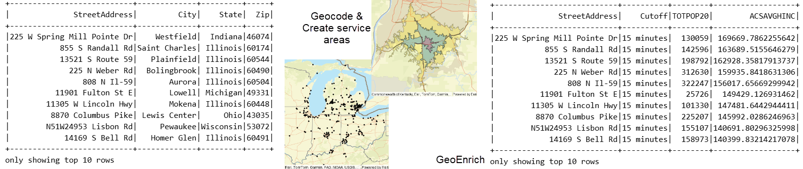
The GeoEnrich capabilities are a perfect partner to the existing geocoding and network analysis capabilities within GeoAnalytics Engine. They allow users to perform end-to-end analytics from geocoding, to creating service areas, GeoEnrichment with valuable demographics, and then subsequent modeling to analyze patterns across their datasets.
Functionality, performance, and usability improvements
In addition to the GeoEnrichment capability, we have also made a number of general improvements to the raster functionality, plotting performance, and overall product usability. Highlights of these enhancements include:
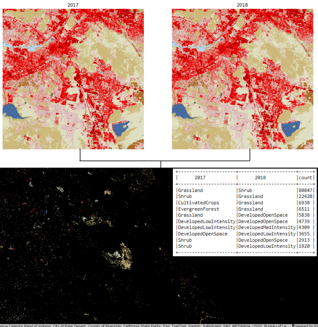
- A new CompositeBands tool to create a single combined raster from multiple bands. This allows you to create new raster datasets with specific band combinations and order, which can be useful for combining datasets when individual bands are in separate files, or for analyses such as change detection analyses across multiple time steps. For instance, you can create a single composite dataset with two years of landcover data and then use RT_Apply to identify and analyze all areas where the landcover has changed over time.
- Binning in zonal statistics to allow for easy calculation of zonal statistics using regular geometric bins as squares, hexagons, or h3 bins.
- Additional parameters available with registering a GIS when working with feature services from ArcGIS Enterprise so that an Enterprise API key and an SSL certificate can be added via parameters when registering the GIS. These will make it easier to work with your secure data in Enterprise.
- The DBSCAN method in Find Point Clusters now supports use of geodetic distance in calculations. This provides greater flexibility for point cluster analysis, allowing users to work directly with data in geographic coordinate systems without requiring a transformation.
- General performance and usability enhancements, including improved rendering speed with plotting, and reliability with feature service writing.
We update ArcGIS GeoAnalytics Engine a few times a year to make spatial analytics a seamless part of your data science workflows. We are always looking forward to hearing from you about the features you need for your big data spatial analytics!
For more information on the latest enhancements, check out the product release notes. For resources on getting started, tips and tricks with various tools, and much more be sure to check out the GeoAnalytics Engine Community Site.


Article Discussion: