-
-
March 23, 2021
| Caitlin Scopel
|
Water
-
-
-
-
-
-
-
February 23, 2021
| Multiple Authors
|
Announcements
-
February 22, 2021
| Multiple Authors
|
Sharing and Collaboration
-
-
February 18, 2021
| Steve Kopp
|
Analytics
-
-
-
-
February 5, 2021
| Matthew Ballard
|
Field Operations
-
-
-
February 2, 2021
| Multiple Authors
|
Constituent Engagement
-
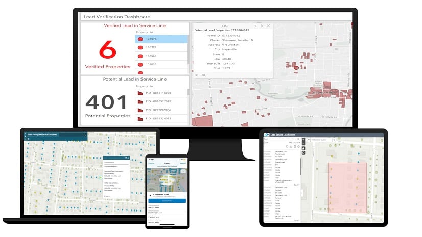
February 2, 2021
| Christa Campbell
|
Water
-
February 1, 2021
| Mark Bierman
|
Administration
-
January 31, 2021
| Multiple Authors
|
Sharing and Collaboration
-
-
January 27, 2021
| Multiple Authors
|
Developers
opens in new window