Saudi Aramco, headquartered in Saudi Arabia, is one of the world’s largest integrated energy and petrochemical companies. The company specializes in the exploration, production, refining, and distribution of oil and gas, while investing heavily in advanced technologies to enhance energy efficiency and sustainability. Saudi Aramco plays a pivotal role in meeting global energy demand and driving innovation across the energy sector.
Navigating Remote Work Safely
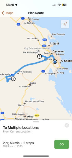
Saudi Arabia’s vast and varied terrain, spanning 2.15 million square kilometers, creates significant challenges for Saudi Aramco’s field workforce. To overcome these obstacles, the company leveraged its ArcGIS Enterprise environment to deploy ArcGIS Navigator, enabling mobile workers to safely and efficiently reach remote locations across the Kingdom.
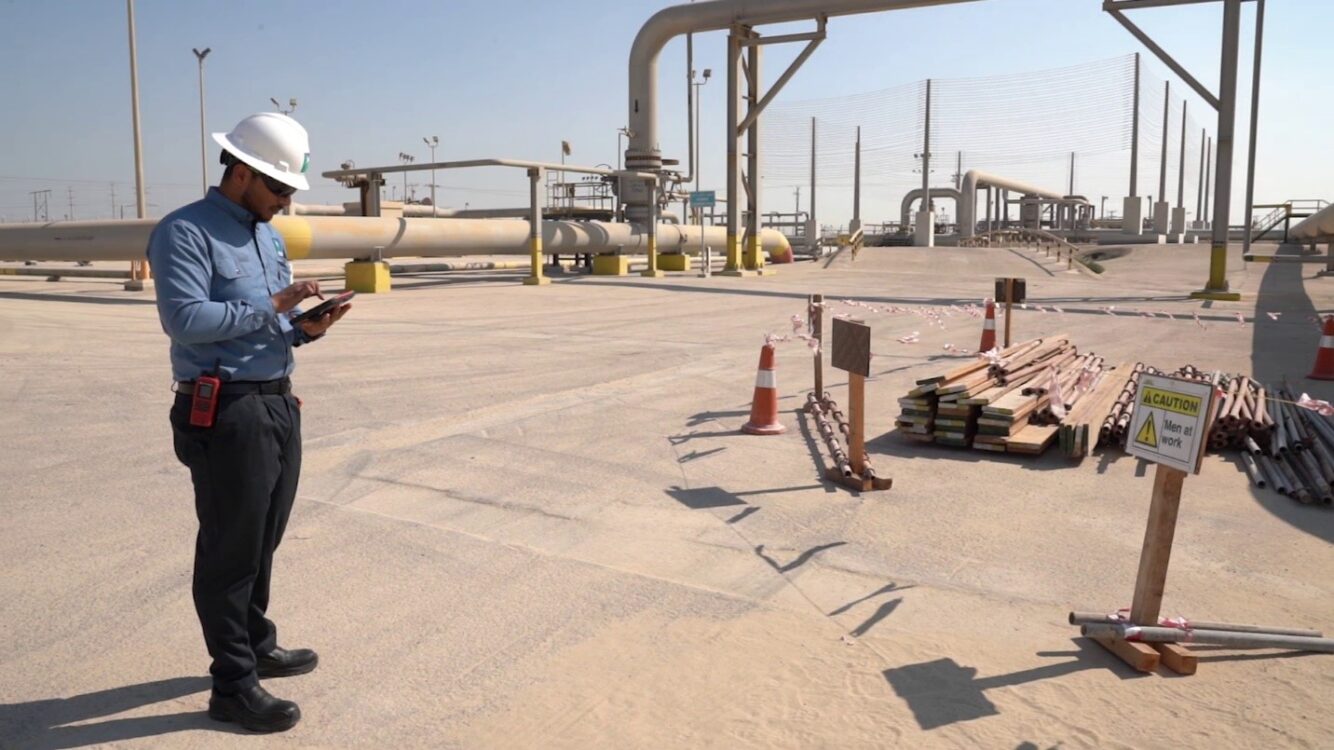
Safety is Saudi Aramco’s top priority when field crews travel across the Kingdom’s remote and often challenging terrain to operate facilities, maintain infrastructure, or explore new sites. ArcGIS Navigator, enhanced with custom mapping data, provides reliable turn-by-turn directions to worksites and facilities, helping workers reach remote locations more safely and efficiently.
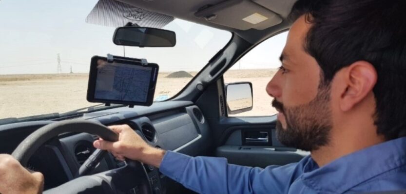
Saudi Aramco continually invests in initiatives to enhance the safety of employees working in remote areas. ArcGIS Navigator is one such solution, combining commercial road data with Saudi Aramco’s custom mapping data to enable location search, on-screen routing, and voice-guided navigation.
Challenges in Remote Areas
Mobile workers in remote areas face harsh weather and unpredictable conditions, including extreme temperatures, heat stress, hydration challenges, and sandstorms. They must be prepared to adapt plans and destinations based on changing circumstances and be familiar with new routes when moving between locations. Historically, Aramco’s field operators relied heavily on personal experience or guidance from more seasoned colleagues. Switching to unfamiliar areas was difficult, often requiring paper maps or assistance to navigate desert terrain. Connectivity in these regions is limited, some areas lack GSM coverage, and radio signals can be unreliable. Night shifts add further risk, as driving on skid roads—unpaved desert routes connecting commercial roads to remote work sites—poses significant hazards even for experienced drivers. These roads are typically referenced using satellite imagery, aerial photos, or GPS data from Aramco’s fleet vehicles. Given these challenges, the likelihood of getting lost has been a persistent concern.
ArcGIS Navigator equips mobile workers with a comprehensive, up-to-date map on a single device, enabling them to overcome field challenges such as limited connectivity, nighttime driving, and reliance on more experienced colleagues. It supports optimized planning of field activities and enhances emergency response capabilities at any time.
Implementation with Esri Products
GIS experts from Saudi Aramco’s Corporate Applications Department (CAD) integrated over 2 million street segments from Esri’s ArcGIS StreetMap Premium with more than 50,000 skid road segments to create a new, comprehensive road network. This enhanced network enabled mobile workers to navigate remote business locations more efficiently and safely.
The ArcGIS StreetMap Premium Custom Roads dataset for the Middle East was used to extract Saudi Arabia’s road network. Skid road data was collected and processed by Saudi Aramco teams from Drilling & Workover Services and Geomatics Services. Using ArcGIS Pro with the ArcGIS Network Analyst extension, the team merged StreetMap Premium data with Saudi Aramco’s skid roads, created locators for remote facilities, and built a complete topology of the combined road network.
Ease of Use with Great Benefits
ArcGIS Navigator is an intuitive tool that runs on both iOS and Android devices and works seamlessly, even when offline. Users can download and visualize Saudi Aramco mapping data, search for remote assets, add destinations, and navigate using pre-planned routes or field visits created in the office. It provides a reliable, structured way to reach any destination efficiently.
With over 1,000 users across 30+ upstream and downstream departments, feedback shows that ArcGIS Navigator streamlines field activity planning, reduces reliance on field services personnel for guidance, and enables faster arrival at job sites, which is a critical advantage during urgent situations. Users also highlighted its intuitive design, noting that the application is easy to use and requires no special training.
Reducing Environmental Footprint
Using ArcGIS Navigator has helped Saudi Aramco reduce its environmental footprint by eliminating thousands of paper maps that require frequent updates and printing. The app also promotes sustainable driving by guiding drivers along designated roads and optimal routes, reducing the environmental impact of remote travel. Uncontrolled off-road driving is a major contributor to land degradation in arid regions, and Navigator helps mitigate this risk.
Secure Digital Transformation
ArcGIS Navigator operates within Saudi Aramco’s Mobile Device Management (MDM) system as part of the company’s approved application suite, ensuring compliance with strict security standards. If a device is lost, data can be remotely wiped to maintain security. The app is a key component of Saudi Aramco’s Digital Transformation Program, which aims to position the company as the world’s leading digitalized energy corporation by adopting advanced technologies in analytics, IoT, robotics, additive manufacturing, and ICT. Access to ArcGIS Navigator is restricted to authorized users who must request permission through the company’s secure authorization system.
Building on Success to Advance Field Operations
Saudi Aramco’s deployment of ArcGIS Navigator has fundamentally elevated the way field operations are planned and executed across its vast operational footprint. By harnessing Navigator’s reliable routing, especially in areas with limited connectivity, and integrating it with the broader ArcGIS system, teams now access precise, authoritative navigation that improves safety, reduces delays, and enhances operational predictability. This digital navigation capability has streamlined field workflows, reduced dependency on legacy methods, and strengthened coordination for both routine tasks and critical responses. As a result, Saudi Aramco continues to advance its operational excellence, further unlocking the value of location intelligence across its field workforce and supporting its broader goals for efficiency, safety, and innovation.


Commenting is not enabled for this article.