Consumer expectations for engaging applications or websites continue to rise as the competition for users attention gets increasingly challenging. An engaging and informative experience that avoids complicated user journeys is more critical than ever, especially if the goal is to turn first-time users into returning customers. By effectively leveraging location intelligence, product and business leaders can significantly increase the value they provide to users while increasing the likelihood their applications gain adoption. Through integrating location-based elements or adding location data to solutions, you can reveal unique insights about places and the people who live, work, or play there.
ArcGIS Location Platform, built by Esri, offers developers access to high-quality maps, location services, data hosting and market leading ready to use premium data. Some of the most frequently used services include:
- The ArcGIS Basemaps service offer an extensive range of styles that enable users to choose what best fits the context, tone, and style of their application.
- The ArcGIS Geocoding service has incredible accuracy from authoritative commercial data providers as well as national government agencies and the Esri community.
- The ArcGIS Routing service enables developers to find routes, generate turn-by-turn directions, generate service areas and more so users will always know the next step.
In addition to quality services, Location Platform supports developers leveraging its services alongside popular open-source libraries like Leaflet, Maplibre and Cesium, providing flexibility product leaders are looking for. Trusted by leading organizations for its versatility, quality, and scalability, discover how organizations are harnessing the power of the ArcGIS Location Platform.
How Others are Leveraging ArcGIS Location Platform
ArcGIS Location Platform’s comprehensive documentation, extensive services, and competitive pricing contribute to its trust and adoption by leading technological companies. It is used across various industries by market leaders such as Salesforce, IBM, SAP and Autodesk. It also supports a diverse range of applications, such as Airspace Link, Crexi, OpenGov, and GEM. These organizations leverage the technology in unique ways to enhance their mapping capabilities and drive innovative solutions.

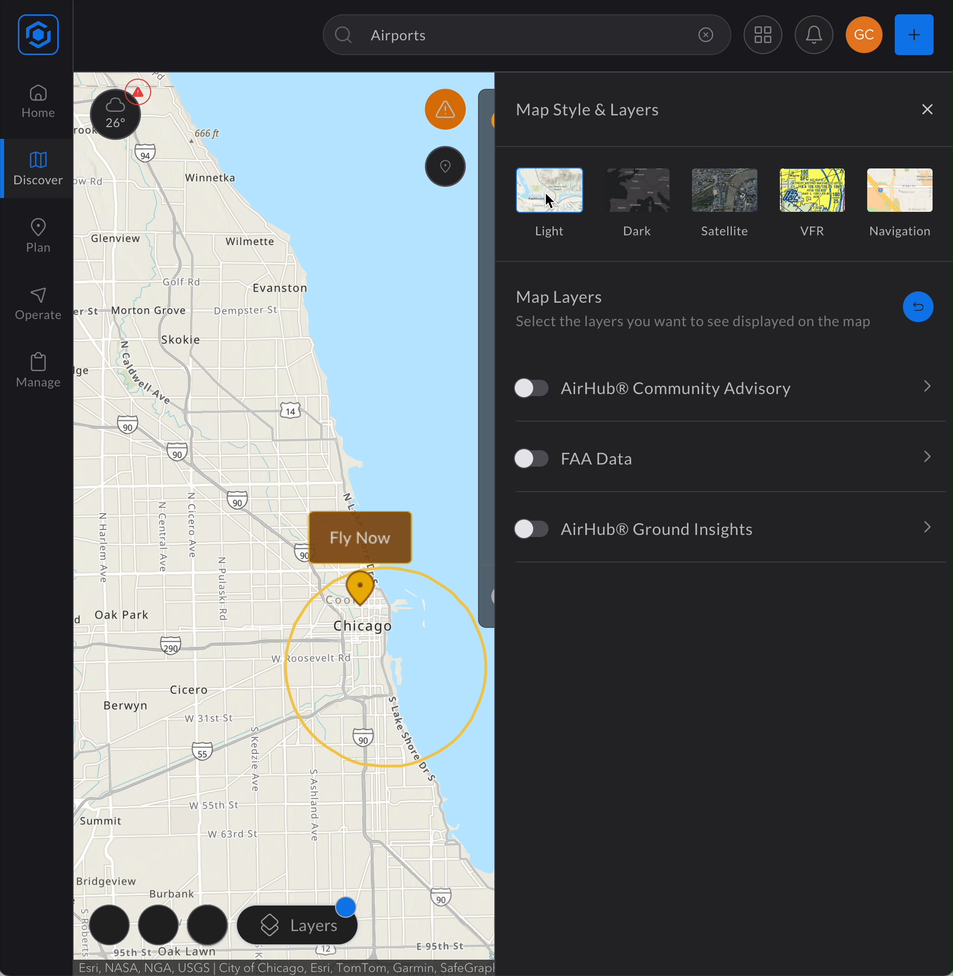
Airspace Link, a drone operations management system, enables users to maintain compliance when flying everything from FAA registered drones to commercial and recreational drones. Airspace Link utilizes ArcGIS Location Platform’s high-quality basemaps to give users location-based context, geocoding to address search, and data enrichment to provide data and information about the fly area.

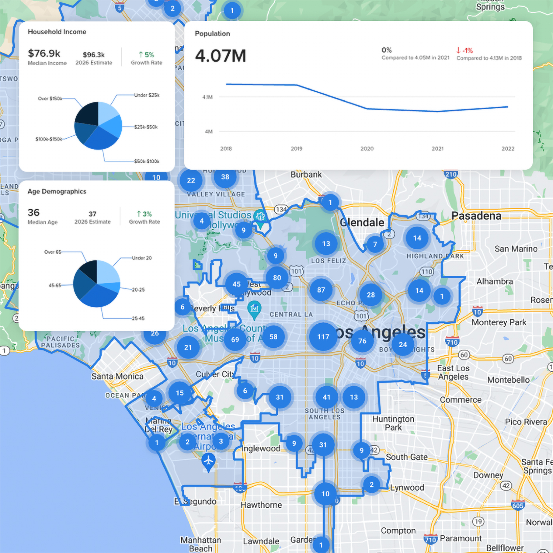
Crexi, a commercial real estate solution, provides demographics and psychographics for areas across the nation to enable informed decision making by its users. Using ArcGIS Location Platform’s authoritative data in the data enrichment service, they provide real estate investors with the median household income, the median age, the population over time, and more. Essential information for precise site selection.

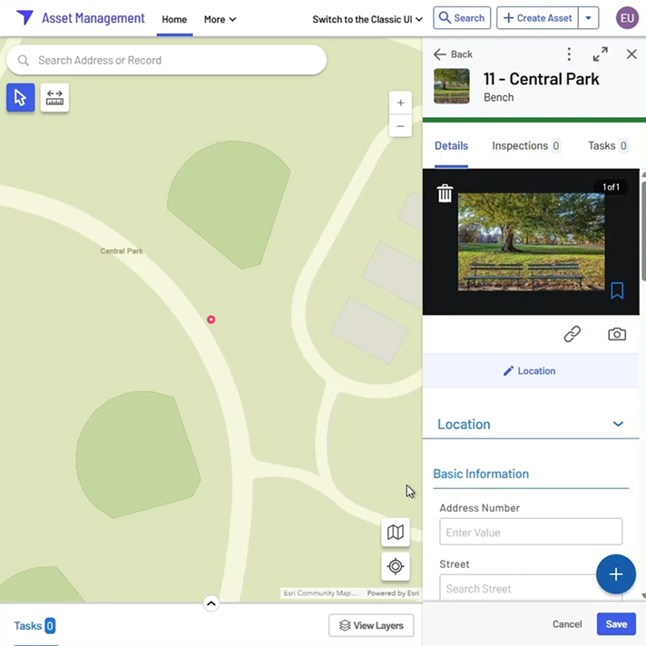
OpenGov, an asset and request management system, empowers local and state government entities to serve their communities with increasing efficiency. OpenGov uses the basemaps service for location context and geocoding service for pinpoint accuracy while managing service requests such as graffiti removal.

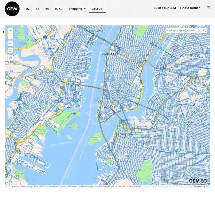
GEM, a manufacturer of small electric vehicles, is enabling local transport with a design that reduces costs and emissions. The company uses the ArcGIS Location Platform basemaps, enables auto-suggest search functionality with geocoding, and enhances their user experience through data enrichment and routing. These services help users find the best roads to drive for low-speed electric vehicles.
Migrate with Ease
When evaluating potential mapping and location services providers, product and business leaders face a complex landscape of considerations. Beyond the need for high-quality, comprehensive location services, they must also ensure a successful integration with their existing technology stack and infrastructure. To achieve this, they require confidence in their ability to migrate or evolve applications efficiently, without unforeseen delays or costs.
Comprehensive Support & Resources
While innovative functionality is essential, it can take time for teams to fully adopt new technology. To make the learning curve much more manageable for development teams, ArcGIS Location Platform and Esri offer essential support and resources.
- Learn how to use the technology with interactive examples that demonstrate the location services in action and thorough documentation on Esri Developer.
- Crowdsource answers from peers who are actively working with the same technology on Esri Community.
- Attend local and regional Esri events to network, answer questions, and learn about the latest technology.
- Gain access to Esri’s expertise with a global partner network and long history with numerous industries. Obtain technical support and project-specific consulting.
With comprehensive resources at their disposal, users and their teams can navigate the integration of location services with confidence, ensuring a smooth start to their projects.
Competitive Pricing
Getting started with ArcGIS Location Platform is straightforward, thanks to its generous monthly free allowance of services usage. This enables users to begin developing and experimenting right away, with the monthly replenishment of the service limit helping keep costs down in the long term. Its predictability allows users to scale their applications or business systems at their own pace, without the confusion surrounding budget concerns.
In today’s complex and rapidly evolving digital landscape, the integration of location-based features is no longer a nice-to-have set of features. Rather it is a necessity for organizations aiming to stand out and grow their businesses through delivering more value to their users. By leveraging ArcGIS Location Platform, organizations can not only improve their existing applications but introduce transformative capabilities and products that drive business growth and enhance user satisfaction. Its flexibility, comprehensive support, resources, and cost-effective pricing make it an attractive and scalable option.
Learn more about ArcGIS Location Platform or sign up for an account to start experimenting with the technology.


Article Discussion: