We’re excited to announce the next major release of the ArcGIS Location Platform, packed with exciting updates that bring greater flexibility, improved data quality, and enhanced capabilities for developers and organizations. Set to roll out between June and August 2025, these updates make it easier than ever to build and scale high-quality location-based solutions using our powerful mapping APIs. Here’s a look at what’s coming and why it matters.
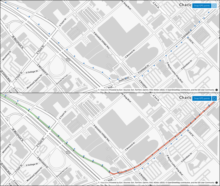
Snap to Roads with ArcGIS Routing Service (Available late June 2025)
Precision matters in routing, and with the new Snap to Roads capability in the ArcGIS Routing service, developers gain the ability to automatically align location data with the most accurate road geometries. This feature enables improved data quality by minimizing GPS drift, ensuring that raw data is not only cleaned but also enriched with valuable road attributes—like road type, direction, and access restrictions. This enhancement not only improves your routing and directions but also allows you to create routes more efficiently, making your routing and mobility solutions smarter and more reliable.

ArcGIS Basemap Services Get Even Better with Two Big Updates (Available August 2025)
This release introduces two significant updates to ArcGIS Basemap Services, enhancing performance, cost efficiency, and data openness.
- Basemaps Sessions: Traditionally, developers paid for basemaps based on the number of tiles viewed. With Basemaps Sessions, developers can now pay a single fee for unlimited tile views during a session or a set duration. This flexible pricing model is ideal for interactive applications where users frequently navigate across multiple tiles. It provides a cost-effective solution at scale, offering more predictable pricing for apps with high user engagement. Location Platform developers can choose the model that best fits their usage patterns, making it easier to integrate the mapping API into their digital maps for apps.
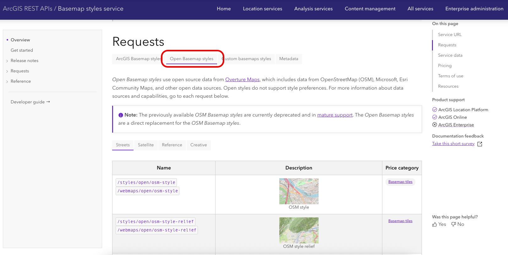
- Open Basemaps: We are excited to introduce a new family of basemaps built from Overture Maps, a collaborative effort that combines data from OpenStreetMap, Esri Community Maps, Microsoft, and other sources. These Open Basemaps offer a curated, high-quality, and open alternative for developers who value data transparency and accessibility. They leverage a trustworthy, community-driven data foundation, making them perfect for projects that prioritize open mapping ecosystems. Whether you are creating digital maps for apps or need robust mapping API capabilities, these updates ensure you have the tools to build more reliable and efficient location-based solutions.

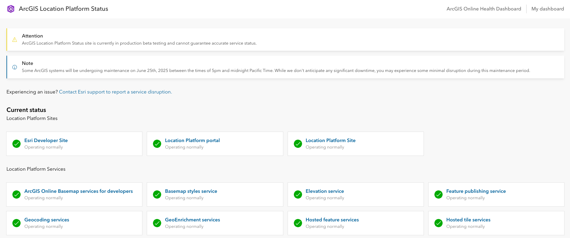
ArcGIS Location Platform Status Dashboard (Available June 2025)
Transparency and reliability are essential when working with a cloud-based platform. The new ArcGIS Location Platform status dashboard provides a centralized, real-time view of service health, availability, and incident history. Accessible through the ArcGIS Trust Center, this tool keeps Location Platform users informed and enables them to make confident operational decisions. Quickly identify when and where issues occur and review the 30-day incident history section for a detailed look at past events.

API Key and GeoEnrichment Service Updates
We’ve made several updates that could impact your solutions, and we want to make sure you’re aware of them in case you need to make any changes. Here are the key updates:
- ArcGIS GeoEnrichment Service June Release: This update introduces new demographic capabilities to your solutions. Specifically, it includes the Esri 2025 US Demographics data and discontinues the Esri 2023 US Demographics data. If you use this service, we recommend reviewing the technical guide: ArcGIS GeoEnrichment – Summary and Guidance for June 2025 Release.
- Deprecation of Legacy API Keys: Starting June 2026, any app or solution that uses a legacy API key will no longer be able to connect to ArcGIS services and will lose access to those services. The system will display an error message indicating that the API key is invalid. While the app may still open and run, certain features will not function correctly. For more information, check out the Legacy API Keys Retirement Tech Support Article.
Key Takeaways
This summer release of the ArcGIS Location Platform underscores our commitment to providing developers with open, flexible, and high-performance location capabilities. Whether you are improving logistics routing, building location-enabled applications, or ensuring your services are up and running, these enhancements offer the innovative tools needed to succeed.
Stay tuned as these features begin to roll out in mid-June 2025.
Learn more about ArcGIS Location Platform by exploring Esri’s website or sign up for an account to start experimenting with the technology. Also, stay in the loop with the latest in Developer technology by subscribing to the Esri Developer Newsletter.


Commenting is not enabled for this article.