The August 2021 update to ArcGIS QuickCapture brings great enhancements and new features. In this 1.10 release we added new options to help you collect richer information, without compromising the rapid data capture user experience.
About ArcGIS QuickCapture
ArcGIS QuickCapture is Esri’s rapid data collection mobile app. Use QuickCapture to give field users the simplest and most effective user experience for documenting field observations. QuickCapture is as simple to use as the camera app in your phone, but much more powerful, allowing you to collect the location of events in the field and automatically enrich your observations with multiple attributes. With a single tap in your phone you will be able to record the what, the where and the when; and share that information with the rest of your organization through ArcGIS.
If you are not familiar with the BIG button user experience of QuickCapture, you can give it a try through the various sample configurations we share through this gallery. Photo inspections, quick asset damage reports, bioblitz and much more! You can also create your own projects from scratch as shown in this tutorial
What’s new in 2 minutes
One observation, multiple photos
Until this release, you could only associate a single photo with a field observation. Starting with version 1.10, you can configure your QuickCapture projects so users can associate more than one photo with an observation. For example, if you are documenting a water leak, you can set the exact geographic location of the leak and then associate multiple photos of the event. The mobile app will let you take, review and send multiple photos for a single observation as attachments to ArcGIS.
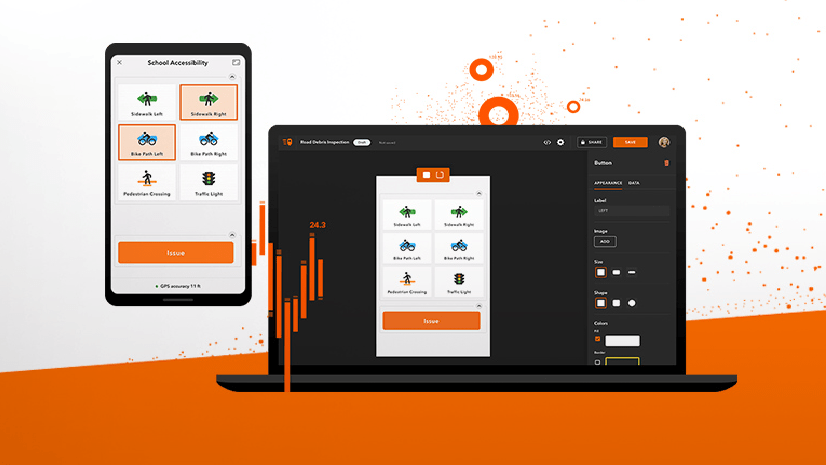
As shown in the screenshot below, in QuickCapture designer you can define the number of photos users can associate with an observation. For example:
- a minimum of 0 and a maximum of 1: taking a photo is optional
- a minimum of 1 and a maximum of 1: taking a photo is required
- a minimum of 1 and a maximum of 5: You must take at least one photo, but optionally could take up to 5
- etc

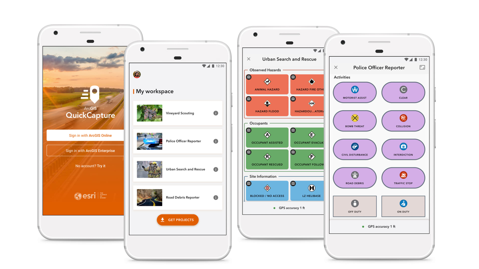
Multiple project user inputs
A project user input is a dialog used to collect information from the user prior to data collection. When new features are collected, project user inputs can automatically populate fields.
For example, in a post-storm damage report situation you may want to use a project user input to collect the incident name. After end users type or select the appropriate incident name once, it gets associated features subsequently collected. Project user inputs can be changed any time during data collection, giving extra flexibility to the end user.
With this new update, you can configure your QuickCapture apps with up to three project user inputs. In the screenshot below, field users enter the team, district, and cost center prior to data collection. Once this information is entered, the QuickCapture app will automatically add this information to the appropriate features as they are collected.

For more information on project user inputs and how to configure them, check our documentation or this blog post.
Other enhancements
We also added a handful of minor yet important features:
- You can now set the minimum horizontal accuracy required for features collected through your QuickCapture project. This project setting is applied to point observations, but also to vertices in lines and polygons.
- Slovak is now a supported language.
- A new QuickCapture organizational setting lets you present the oAuth dialog through an external web browser. In this way, you can enable SAML PKI authentication through the QuickCapture app.
- We added a new Cancel option to button user inputs. It is useful in cases where users tap a button in error. When this button is pressed, the feature collected is automatically deleted.
- We extended the length of the hint text for button and project user inputs in the mobile app to four lines of text.
- Fixed various bugs
Next steps
We plan on releasing one more update before the end of the year to introduce support for location tracking in ArcGIS QuickCapture along with a few other features and enhancements.


Article Discussion: