What’s New in Site Scan for ArcGIS: Scaling Drone Operations and 3D Visualization
Drone programs are capturing more data than ever before and expectations for high‑quality, shareable results continue to grow. Site Scan for ArcGIS is introducing new capabilities that help teams keep pace:
- Processing larger missions
- Creating Gaussian splats for more immersive 3D visualizations
- Sharing 360° views using oriented imagery for richer context across workflows
Process Larger Drone Missions in a Single Project
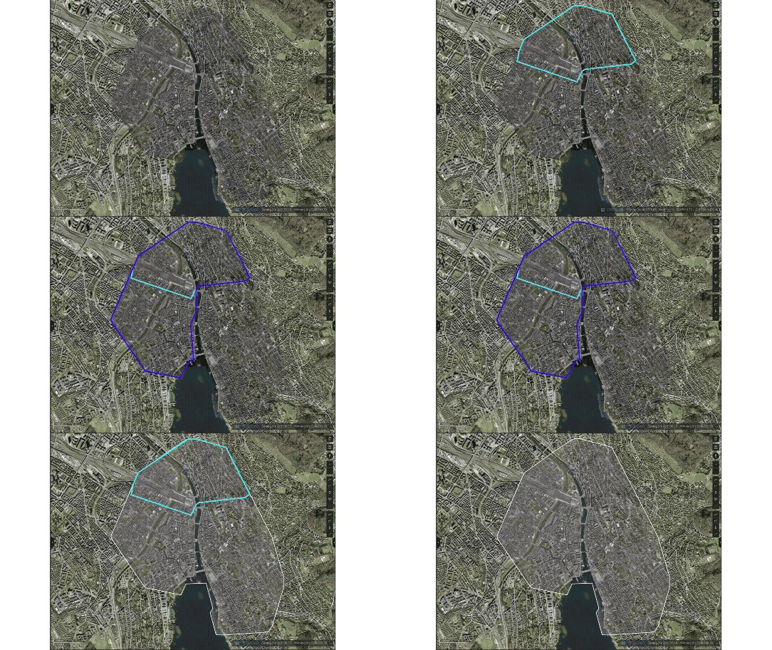
As drone programs grow, so do mission sizes. Teams are flying longer routes, capturing higher resolution imagery, and collecting denser datasets, especially when preparing projects for advanced 3D outputs. In April, Site Scan increased the amount of imagery that can be processed within a single mission, making it possible to handle significantly larger datasets without breaking work into smaller pieces.
Organizations with a named user license (a per‑user licensing model typically used by smaller teams or individual operators) can now process up to 5,000 images or 150 gigapixels per mission (whichever comes first). For organizations with a Custom Subscription (a tiered, organization‑wide model) the limit increases to 10,000 images or 300 gigapixels per mission. Pro tip: if you’re not sure which type of license you have, clicking Merge Missions at the top of the mission list will display your photo and gigapixel limit.
This added scale supports larger sites and more complete datasets captured in one flight or across coordinated missions. It is especially valuable for workflows that depend on dense, well‑connected imagery, such as Gaussian splat generation, where larger and more continuous image sets help produce richer, more complete visual results.
By reducing the need to split missions or manage multiple uploads, teams can spend less time on data management and more time on analysis and decision making. With the ability to process larger missions, you now have one cohesive set of outputs instead of multiple smaller sets. This makes it easier to use results in downstream workflows, helping teams move faster from capture to deliverables while scaling reality mapping across inspections, construction monitoring, transportation networks, and utility corridors.
Generate Gaussian Splats in the Cloud for Ultra‑Realistic 3D
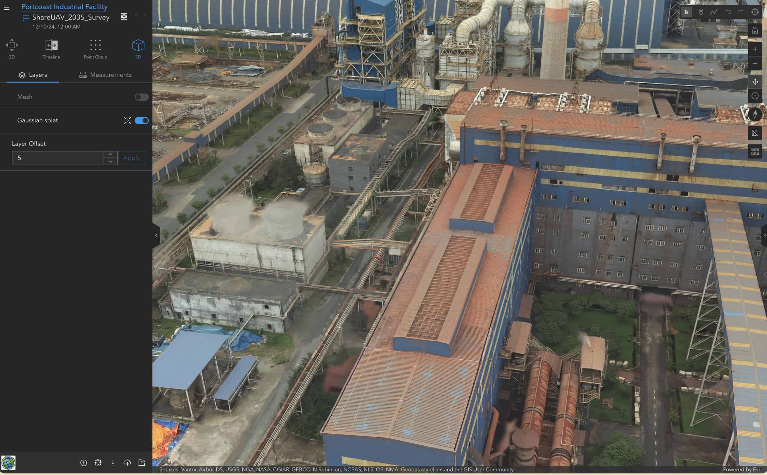
Site Scan now supports cloud‑based generation of Gaussian splat layers, enabling highly realistic 3D visualizations directly from drone imagery without the need to invest in or manage specialized hardware. This capability is available for organizations with a Custom Subscription, making it easy for larger programs to take advantage of advanced visualization at scale. Due to limitations in AWS infrastructure, Gaussian splats will not be available to European customers who have explicitly requested EU hosting.
Gaussian splats capture subtle surface details, depth, and visual context that make 3D scenes feel more lifelike and easier to interpret. With processing handled entirely in the cloud, teams can generate immersive 3D content as part of their existing Site Scan workflows, without introducing new infrastructure or complexity.
When paired with larger mission support, teams can capture more comprehensive datasets and translate them into highly detailed 3D representations. The result is richer outputs that improve visual analysis, strengthen communication with stakeholders, and support more confident decision-making across projects.
To create a Gaussian splat for an existing mission, you’ll need to reprocess your data, being sure to select Generate Gaussian Splat Layer under Processing Settings.
Learn more on Gaussian Splats in this blog.
Share 360° Views with Oriented Imagery
Site Scan now makes it easier to publish and share 360° panoramic imagery using oriented imagery, helping teams incorporate an immersive, first-person perspective into their maps, scenes, and apps to better communicate site conditions.
By publishing panos as oriented imagery layers in ArcGIS Online, teams can incorporate intuitive, 360° views into their GIS to create a more complete digital representation of real‑world environments. This enhances situational awareness for office‑based teams and stakeholders who were not on site, making it easier to validate observations, conduct virtual inspections, and communicate project details more clearly.
From Larger Missions to Immersive Outputs
Together, these updates reinforce Site Scan’s role as a scalable, cloud‑native reality mapping platform. By combining support for larger missions with next‑generation 3D visualization capabilities, Site Scan enables organizations to grow their drone programs while keeping data processing and visualization streamlined and reliable.
Learn more about the latest Site Scan capabilities and how they fit into your reality mapping workflows on the Esri Community.



Article Discussion: