A few years ago, the ArcGIS StoryMaps content lead informed the team that we needed to make our existing stories meet accessibility standards within three months. At the time we were asking, “What does that mean?” and “Should we just unpublish half our stories?”
This presented us with a big challenge, and we recognize that many organizations can probably relate. If you also learned that your ArcGIS StoryMaps content needs to comply with Section 508 or Title II of the Americans with Disabilities Act (ADA) regulations, Title III of the Americans with Disabilities Act regulations, or legal regulations outside of the United States such as EN 301 549, this article is for you.
By the end of this article, you’ll understand:
- Who needs accessible content
- What digital accessibility means
- Who needs to comply with accessibility standards
- What a content audit is
- How to create a workflow to retrofit your stories
This article focuses on what digital accessibility means for ArcGIS StoryMaps and how to plan and prioritize retrofitting stories. Check out our Accessibility Learn Path for resources on how to create accessible content.

We ultimately decided that removing stories should be a last resort. We also decided to include accessibility considerations into our production workflow for new stories. In the meantime, retrofitting stories was possible, and we realized the learning curve for creating accessible content is gentle. Now, let’s help you understand how you can apply this same process to your own work.
Who needs accessible content?
Around 20% of people experience accessibility challenges. When a person encounters a mismatch between their environment and their abilities, even a temporary one, the person may not be able to meet their needs.
Some common accessibility challenges include:
- hearing or vision deficiency
- cognitive difficulties
- motor or physical impairments
- literacy and language barriers
What does accessibility mean?
Accessibility, in simple terms as it applies in the digital space, describes how easy something is to perceive, use, or understand. As it relates to ArcGIS StoryMaps, a big part of accessibility is that your audience must be able to access content in more than one way.
For example, information or interaction must not rely on a single sense for a person to be able to access it, i.e., vision, hearing, interaction only with a mouse, et cetera. You need to provide alternative ways to access visual content, such as alternative text, so screen readers can read aloud descriptions of graphics. If the content contains audio, the media needs a viewable written transcript. Contrast or use of color must also not create a barrier or cause confusion.
Accessibility also applies to language. For example, some organizations require plain language to ensure content meaning is clear. And some organizations need to make content available in multiple languages for accessibility reasons.
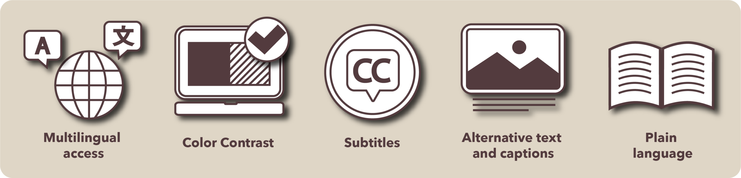
The ideas above will likely be the main focus for retrofitting for most story authors, though for complete details, see the Web Content Accessibility Guidelines, (WCAG) site. The WCAG criteria are the benchmark for how to assess accessibility. As of 2026, WCAG 2.2 is the latest set of recommended guidelines.
Who needs to make accessible content?
Accessibility standards such as Section 508 already apply to many government agencies in the United States. However, they may be new and unfamiliar to some organizations such as state and local agencies in the United States that need to comply with updated Title II accessibility standards. Many governments around the world, as well as many businesses, and most educational institutions, also need to comply with minimum digital accessibility standards. To verify what rules apply to you, please check your country’s laws or with your legal counsel.
Why isn’t it already accessible?
You may have heard that ArcGIS StoryMaps is already accessible and wonder why you need to do anything. The ArcGIS StoryMaps app is designed to handle some WCAG guidelines automatically. It also includes tools you need to create accessible stories; however, story authors need to use the provided tools and verify that their story is accessible. For example, the builder includes tools for authors to assign tags to the author’s text, which creates the story structure for screen reader navigation. The builder also includes tools for adding alternative text or transcripts to media the author adds to their story.
Now that you have some baseline knowledge about what accessibility is, you need to decide what to update.

How do I set up a content audit?
If the term “content audit” is unfamiliar, it’s basically adding content details into a spreadsheet or database with some metrics, and then systematically reviewing your content against those metrics. For example, maybe you already have an analytics dashboard that has your story information in it. If not, start by setting up a spreadsheet or list of your stories in another content management system.
The best way to create a spreadsheet is by contacting your ArcGIS Organization administrator for assistance running a content report.

Open the content report as a spreadsheet, and make sure it has columns such as:
- story title and URL
- date published or updated
- structure and headings
- plain language
- alternative text
- sufficient contrast
- available languages
- map accessibility
- captions or transcripts for audio and video content
- priority level
- other information or notes
After your content audit system is set up, you’ll want to conduct your audit and decide which stories to retrofit and how to prioritize them. Some ideas to prioritize your audit include:
- content type, such as emergency evacuation procedures, versus non-required content, etc.
- date created
- maintenance requirements
- editor availability
- view statistics
Once your audit is done, you can decide your story retrofit priorities and assess how to assign tasks. Depending on your needs, you may consider doing the audit and retrofit concurrently. We prioritized stories that were newer and provided examples of how to use product features such as different content blocks.
How do I create a retrofit workflow?
We assigned story authors to review their own stories, and we had volunteers review stories made by former team members and assist with some updates for prolific authors. You may want to implement an established production workflow adapted to align with the tasks and our downloadable PDF checklist items and assign each specialist a task. Make sure you track your progress on your content audit spreadsheet.

The story structure and writing
The person most familiar with the text should handle the story structure tags, ideally the author. Same for ensuring the readability, paragraph length, using plain language, and appropriate story length. Check out this story structure article for more information.
Alternative text for media accessibility
Alternative text is dependent on story context and usually best done by the author or editor, since they are familiar with the content. You may ask your organization administrator to enable the built-in AI tools within the ArcGIS StoryMaps builder to help draft alternative text. An author or editor needs to review any AI content to ensure generated text supports your story’s content.
Make sure to add captions to visuals when needed. If you use software to produce closed captions, transcripts, and subtitles for media, also ensure a human reviews it.
Visuals and media accessibility
A designer or cartographer is the best person to review the theme, media, and map design.
Theme and maps
The theme builder is where you choose story colors, typefaces and fonts, and basemaps. Assess the fonts and typeface, including the weight, style, and letter spacing for readability and contrast. When in doubt, use basic sans serif fonts.
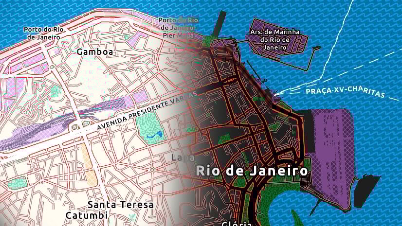
Since maps fall under visual design, the design person would want to test the contrast on maps if you don’t have a formal cartographer. Depending on your map needs, and your audience, you may want to consider using high contrast maps.
Making maps accessible may require a design overhaul, yet in the meantime, create descriptive written descriptions for artistic and functional maps or include directions for vital information such as voting locations or emergency evacuation routes.
The ArcGIS StoryMaps theme builder includes a contrast checker for theme elements. However, you may want to supplement this with 3rd party software, such as Sim Daltonism, to preview how a story looks to people who have color vision deficiency to ensure the content you add within the story is accessible.

You may also want to consider creating an accessible standard theme for your organization if you don’t already have one.
Check other media and visuals
Review your content for embedded text in visuals, such as words on a photo or screen grabs with text and make adjustments. Screen readers are unlikely to recognize or read aloud text embedded in graphics.
Check for legibility and sufficient contrast of text over images on covers, floating sidecars, and slides. A docked sidecar or opaque background may be necessary against background images.
The StoryMaps builder includes a block that supports accessibility to create simple infographics, charts, and data tables. If your data does not fit into the built-in blocks, consider adding a link to download the source data to ensure all users can access it.
Assess your video and audio files for both length and for a secondary access method such as closed captions or transcripts.
Review language accessibility
StoryMaps supports over 40 languages to help reach your audience. If you need to share your story in multiple languages, you may want to consider duplicating your story for translation. Then you can specify the language in your story’s language settings.

Where can I find ArcGIS StoryMaps compliance information?
You can find more compliance information on the Accessibility in ArcGIS StoryMaps documentation page. The Esri Accessibility Conformance Reports site includes all available Voluntary Product Accessibility Template (VPAT) conformance reports on Esri products and is updated as new test results become available.
As mentioned before, the ArcGIS StoryMaps builder includes features that enable creating and consuming accessible content. However, you, as the story’s author, need to use the tools to make your story accessible to your audience.
Your takeaway
This process helped the ArcGIS Storytelling team retrofit our stories, and you can do this, too. By including accessibility considerations into our workflow for new stories, accessibility is a routine part of producing new stories and not an afterthought.
Remember to use the story preview to make sure your story is accessible on mobile devices. If you still have questions that we didn’t address, consider asking them in Esri’s Accessibility Community or by leaving product feedback within the ArcGIS StoryMaps builder in the menu under the question mark next in the top toolbar.
Thank you to Ashley Du for the accessibility icon illustration. All other images and illustrations are © 2026 Adobe Stock. All rights reserved.


Commenting is not enabled for this article.