A new update to ArcGIS Survey123 is now available. This release focuses on improvements to the Survey123 field app and Survey123 Connect.
Here are the highlights:
- Better form grid layouts and signature capabilities for the field app
- Image annotation tools now support editing
- Faster visualization and analysis in the Survey123 website
- Various critical fixes and enhancements
Better grid layouts
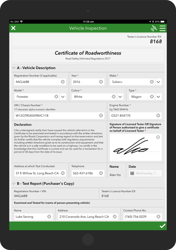
Grid layouts help you build more professional forms. With them, you can compact questions side by side in a single row. Use grid layouts to:
- Optimize the use of your form in larger screens
- Mimic traditional paper forms
- Reduce the amount of vertical scrolling needed to navigate the form
The screenshot below shows an example of a form using a grid layout:

While grid layouts are not new to Survey123, this release introduces two enhancements:
Better support for nested groups and repeats
The use of nested groups (groups within groups) and repeats (a group of questions that can be entered multiple times) is common in complex forms. We have expanded the XLSForm syntax to help you better arrange these nested elements. You can now define the horizontal space (span) that a nested element should occupy in its containing group.
Two grid styles: Dynamic and fixed
Up until now the positioning of elements in a grid layout was always dynamic: Elements would automatically adjust to optimally fit questions within the screen. In many cases, this dynamic grid style works well, but sometimes it creates undesired effects. You can now choose to use a fixed grid style for either the entire form, or specific groups.
To learn more, check the Survey123 Tricks of the Trade: Groups, Grids and Pages and the Group section in the Appearances help topic.
Enhanced signatures
Signatures are often used for accountability and auditability. For example, when an auditor needs to sign-off some work, or when an inspector needs to certify the condition of an asset. Survey123 allows you to collect electronic signatures. Users are presented with a box to sign and the signature is saved as an image. Signatures from Survey123 are stored as attachments. You can view them in web map popups, dashboards, and include them in Survey123 reports too!
This update includes some key improvements to signatures in the field app:
- More space to sign: In the Survey123 field app, the signature pad now pops up as a new dialog on top of the form. This gives end users more space to sign.
- Inbox support: You can view signatures and add new ones to records from the Survey123 inbox. This is great for approval and sign-off workflows.
- Control the dimensions of the signature image: As the author of a form, you can now control the dimensions of the signature attachment.
To learn all the details, check the Survey123 Tricks of the Trade: Signatures blog post.
Edit image annotations
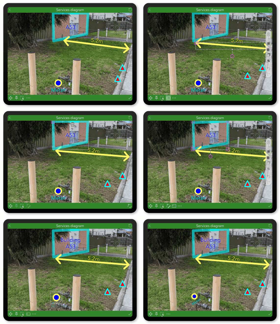
Using Survey123, you can annotate photos, diagrams, and maps. In an asset inspection form, annotating a diagram of the asset can help highlight areas that need attention. In a damage assessment form, you can use annotations to draw on top of a photo.
This release lets users select, move, delete, resize and reshape existing annotation graphics. This provides more flexibility to annotate images accurately and effectively.

More updates to the Survey123 annotation tools are coming in early 2022. Specifically, options to create custom annotation tools. This will let you tailor your tool palette to the specifics of your business workflow. If you want to learn more, sign up for the ArcGIS Early Adopter Community and join the Survey123 beta testing opportunity. You will find documentation, forums, and beta builds of Survey123 version 3.14.
Various critical fixes and other enhancements
- The Analyze tab in the Survey123 website gets a performance boost. Having lists with thousands of choices should no longer be a problem.
- Are you a fan of custom JavaScript functions? Check the Scripts tab in Survey123 Connect as it now lets you control the font of your source code.
- BUG-000143746 Geosearch crashes Survey123 on Android devices when an organization is configured with a custom geocoder
- BUG-000143901 Android OpenSSL 1.1.1l crashes on Android 6 armv7 devices
- The new maxSuggestions property in the body::esri:style XLSForm column allows you to control the maximum number of candidates the geocode appearance can return
Next steps and learning more
We are aiming for more one 3.13 minor update before the end of the year. Just like this release, it will include some targeted enhancements and fixes. The next major update (version 3.14) will take place in early 2022. If you want to learn more about road map features, join the Survey123 beta through the ArcGIS Early Adopter Community.
For detailed description of what is new in this and previous releases, check the What’s New help topic in the Survey123 documentation.

Commenting is not enabled for this article.