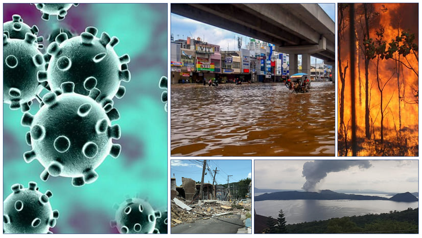
Emergency management is an ongoing process—one that depends heavily on location and location intelligence. During disasters utilities and telecoms traditionally rely on GIS for maps. These were often paper maps. Progressive organizations place GIS at the heart of emergency management. Why? Because it gives them more insight into what’s happening and how to react.
Utilities and telecoms use GIS to fuse disparate data. They perform spatial analysis. This helps them understand the relationship between damage, people, and responders. They collect real-time information from the field. And most importantly GIS helps them to disseminate information widely.
These three stages of emergency management rely on information based on location:
Prepare
First, preparedness entails finding weaknesses in the network. ArcGIS Insights draws connections between disaster impacts and network flaws. Connections like where a substation or a treatment plant is in relation to a flood zone or landslide area. As a result, this gives companies the ability to mitigate the risk; in advance of a disaster.
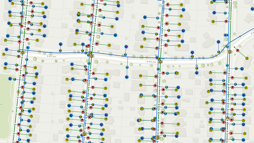
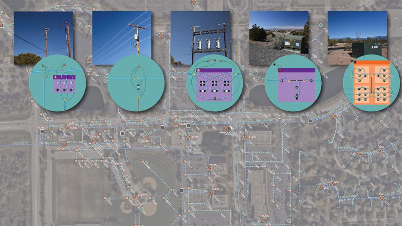
Next, companies require complete, accurate, and timely data. Esri ArcGIS Utility Network provides a precise model of the network. It delivers rapid access from the field. And quality control tools. Too often, the time between a change in the field to when it is recorded in the GIS is too long. It’s bad enough during routine events to have shoddy data, but during a disaster, it is much worse.
Lastly, GIS can help preplan response options. It can determine the optimal drive times and routes. Navigator for ArcGIS is an essential tool for this phase. Companies need to preplan routes. These could be between emergency centers and warehouses or staging areas. GIS can identify data from outside the company to have readily available at a moment’s notice. Data such as weather feeds, imagery, customer data, real-time video feeds, backup power locations are crucial. GIS can provide data about staging areas for emergency responders. It can help companies make decisions about when to request help from outside crews.
Respond
Finally, response happens during or just shortly after the disaster happens. It is too late for preparation. The time to check the strength of a pole is not when the wind is blowing at 120 mph. The response needs quick and accurate damage assessment. It demands efficient logistics and deployment of crews. Hence, utilities and telecoms work hard to limit the interruption of services.
So, this is the most critical question to be answered during the event: “What is going on right now?” Utilities and telecoms are often challenged when coordinating resources. It is essential to collaborate with all agencies involved. They need to know which streets are impassible. They need to see what bridges are out, where fires are raging, and which shelters need power. ArcGIS Dashboards pulls real-time feeds along with accurate facilities data to give complete situational awareness. It provides the pulse of what’s going on to all elements of the organization. Lastly, Dashboards provide an easy way to brief officials, the public, and the media.
Companies need a fast and easy way to assess damage. Field tools such as Collector, Survey 123, and Tracker for ArcGIS offer automation for both the collection and the communication of the damage rapidly.
Recover
Once the event is over, the arduous work of putting the system back together begins. Now, workers focus on fixing the damage. The challenge during recovery is to make sure everyone is on the same page. Constant communication is essential. Companies don’t want the northern division cleaning up small problems while the southern division is still dealing with major issues. A common operating picture of the current state of the system proves critical. Again, the use of ArcGIS Dashboards provides the perfect means of keeping all stakeholders apprised of the rebuilding effort.
Esri’s Field Operations apps can assure accurate documentation of the rebuilding effort. Workers are busy. Things are hectic. Information can be missed or lost if the staff is still relying on paper processes. Data quality can be at risk. Using field tools along with ArcGIS Utility Network can ensure the recovery effort is fast, but not at the expense of data accuracy.
So, GIS enables feedback from the field so staff can answer important questions: What is being installed and where? Where are the crews, and are they accounting for their work?
Companies can continuously perform spatial analysis. As a result, emergency management embraces the where of equipment, people, and event factors. Hence, location matters.
For more information on how GIS is at the heart of emergency management, join us for a three-part ½ hour webinar series beginning on May 12th at 9:00 AM Pacific Time. The first webinar covers prepare. The second will focus on respond. The final webinar will discuss recover. To register, click here.
There is a lot at stake when you are running a complex operation like this: you know, the expectation of restoring as quickly as possible and as safely as possible. Maps and GIS help that. I think, without it, we probably wouldn’t be as successful as we were.


Article Discussion: