U.S. Census Bureau
2020 Census: State Apportionment Data
Use Esri’s portfolio app to access seven maps with state apportionment data from the U.S. Census Bureau.
Explore resources to help you modernize your organization with GIS

2020 Census: State Apportionment Data

Esri FedGIS 2021 Making a Difference Award
VIDEO
COVID-19 Demographic and Economic Resources
VIDEO

Securing the census

Geospatial Technology Underpins 2020 Census
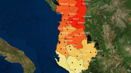
INSTAT Albania improves census accuracy

Egypt digitizes national census with GIS

Ireland boosts citizen engagement with ArcGIS Hub

Nepal’s government conducts census in six weeks

Streamlining census processes in Portugal
Get access to the latest thinking and methods in GIS for official statistics by ordering GIS and the 2020 Census: Modernizing Official Statistics.

Covering every stage of the census process, these tutorials help modernize population and housing census workflows. Learn how to use ArcGIS to plan work, conduct field data collection, monitor operations, and disseminate authoritative data.

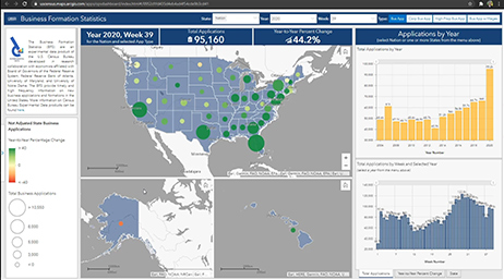
This app provides a suite of services for small businesses and economic developers alike.

Response Outreach Area Mapper (ROAM) is a simple web-based tool that identifies hard-to-survey areas and provides tools to better understand how to reach these citizens.

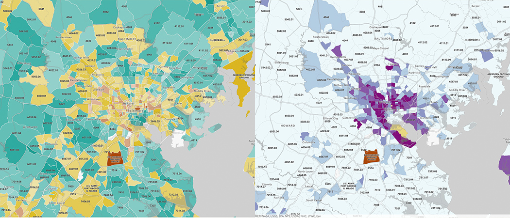
This dashboard provides selected demographic, business, and resilience information to help users identify potentially underserved areas.