Design what-if scenarios
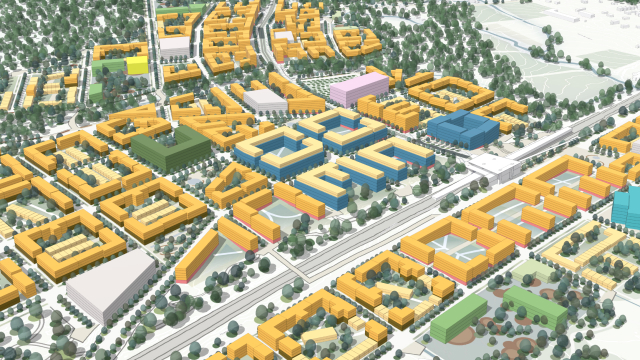
Explore zoning and land-use changes by comparing current and proposed buildable volumes. Test the allocation of plausible building forms to evaluate impact.
Empower your team with 3D modeling for streamlined decisions and easier collaboration with your stakeholders and community
Explore zoning and land-use changes by comparing current and proposed buildable volumes. Test the allocation of plausible building forms to evaluate impact.
With ArcGIS Urban, zoning data is automatically converted into 3D, allowing you to assess capacity with 3D representations. Evaluate proposals and simplify the validation and management of your zoning and land-use.
Conduct 3D scenario planning confidently with editing and design tools. Rezone and redevelop parcels with tools that measure as you draw and generate plausible buildings automatically based on adjustable parameters like floor area ratio (FAR), maximum height, setback, and coverage.
USE CASE
Guide your next comprehensive plan update with adaptable, responsive land-use scenarios designed to reflect changes occurring in all sectors. Move beyond static, regulatory practices and explore emerging trends and issues with scenario planning tools for analysis and land-use interventions.

USE CASE
Apply 3D scenario modeling and combine a concrete vision with short-term action on neighborhood plan areas with ArcGIS Urban. Achieve urban transformation through a more analytical and parametric-driven process that is both dynamic and creative.
