Improve on-time performance monitoring with real-time mapping
Public transit agencies strive to deliver reliable, efficient service that meets rider needs and supports mobility goals. On-time performance is a critical metric that influences everything from daily operations to long-term planning.
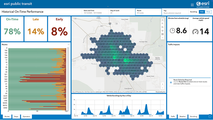
Esri’s Transit On-Time Performance solution enables agencies to monitor real-time service reliability and analyze historical trends. This solution uses ArcGIS Velocity, an application for ingesting, visualizing, and analyzing streaming data from Internet of Things (IoT) sensors. By using General Transit Feed Specification (GTFS) data and real-time vehicle locations, agencies can make data-driven decisions that lead to improved rider trust and cost-effective operations.