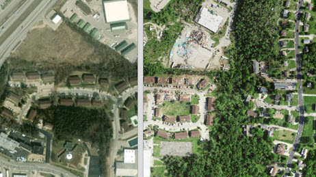
Jefferson City Post-Event Imagery Swipe Map
Post event imagery from Surdex showing Jefferson City (Cole County) after severe weather passing through.

Access severe weather data, live feeds, technology, and resources
Manage your severe weather response with live feeds and sensor data for tornados, hail storms, wind storms, winter storms, and severe thunderstorms.
This map is intended to provide general awareness of severe weather.

View agency and industry best practices using geospatial technology for severe weather response and recovery.
Jefferson City Post-Event Imagery Swipe Map
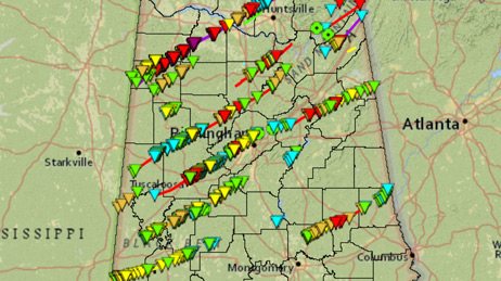
Remembering Alabama’s 2011 Tornadoes
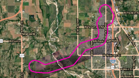
Tornado Map of Norman, Oklahoma
Use this collection of applications, map layers and live data feeds to help plan and manage your severe weather response.
Request embedded maps or interview topic experts for your disaster-related editorial features and news stories.
Explore ArcGIS Solutions, incident-specific data, resource catalogs, and live data feeds to support your disaster response.
See how we help organizations maximize impact for people, planet, prosperity, and peace.
If you need GIS software or support for your current disaster response, please request assistance by completing the form. All requests should be fully justified and are subject to approval.