Over the past decade, climate driven disruptions have continued to grow in both frequency and severity, impacting communities and businesses alike. This seemingly never-ending barrage of perils is evident by the rapid increase in 10-K filings attributed to declining profit margins and events like natural disasters, droughts, and supply-chain disruptions. Despite the cost of these events, many businesses fall short of investing in resilience strategies at scale. This is likely because decision-makers and executives are oftentimes unable to fully understand how regional-specific risks impede their operations or the downstream impact they will have – a problem that the geospatial approach is uniquely suited for.
The geospatial approach is a framework for decision making that integrates and contextualizes disparate date through a spatial lens, enabling decision makers to visualize and intuitively understand complex relationships. In the context of enhancing business resilience, the geospatial approach empowers organizations to create a digital twin of their core operations, overlaying data regarding regional (or even hyperlocal) risks.
Utilizing open data that is available from the Federal Emergency Management Administration’s (FEMA) National Risk Index (NRI), companies can quickly understand where various perils are likely to impact their operations moving forward with intuitive web apps and dashboards.
Below I will walk though how businesses can utilize ArcGIS Pro and ArcGIS Online to quickly create a dashboard to understand physical risks associated with climate driven disruptions. For this example, I will be leveraging FEMA’s NRI dataset at the census block level, with a sample business portfolio.
NOTICE: This sample Data used herein has not been derived from actual business data. Esri has manipulated and applied certain assumptions, analyses, and opinions to the Data solely for educational purposes. Assumptions, analyses, opinions applied, and actual outcomes may vary. Esri is not inviting reliance on this Data, and the User should always verify actual Data and exercise their own professional judgment when interpreting any outcomes.
To build the National Risk Index Dashboard, download the National Risk Index Shapefile, available here at the census block level. Additionally, ensure that the business portfolio data also is in shapefile format. (Learn how to export your data as a shapefile from this documentation page). If you do not have an existing shapefile containing your business sites, you can also upload a CSV with site addresses to geocode the X and Y information.
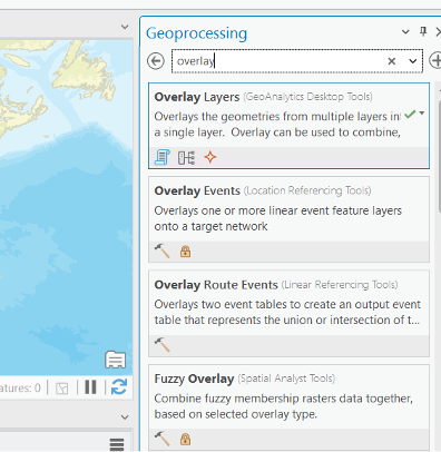
On the top ribbon, open the geoprocessing pane by clicking on Analysis and then Tools. The geoprocessing pane opens on the right and you can search for the Overlay Layers option.
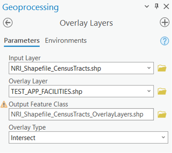
Choose the NRI data as the input layer and the facilities data as the output layer and run it.
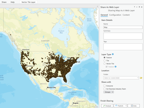
Once its complete, use the “Share” tab located in the top ribbon and click on the “Publish Web Layer” button in the “Share As” group and then Publish to ArcGIS Online.
On the ArcGIS Online homepage, click on the “App Launcher” button in the top-right corner and select “Dashboards” from the available apps.
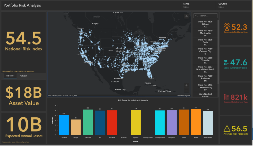
Click on the “Create Dashboard” button to start a new dashboard. Use the (+) Add Element option to add the published map layer and graphs and charts to the dashboard.
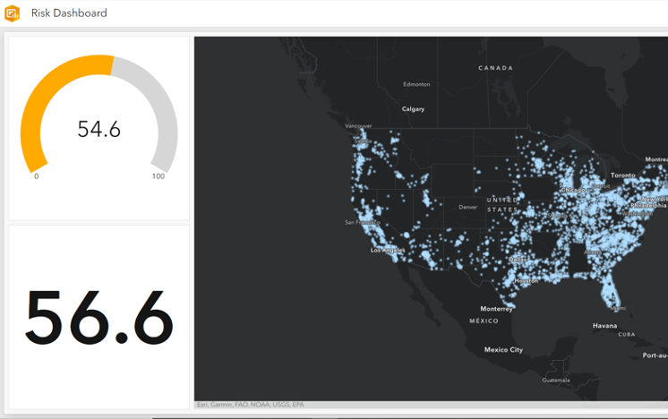
The FEMA NRI data provides individual risk scores for different hazards. It also provides insights into estimated losses and a comparative risk percentile. The variables together can help provide a holistic risk overview of an area.
When business executives understand their risks, where they are coming from, and how they can impact their operations, the company is in a better position to create effective plans and strategies to mitigate disruptions proactively. As companies continue to be affected by a growing number of risks, building resilience strategies to anticipate and mitigate external threats has become necessary —ensuring long-term stability and growth.