As the first and only single-line rail network connecting Canada, the U.S., and Mexico, CPKC needed a more scalable way to build and maintain a trusted inventory of track infrastructure across its system. By combining LiDAR, imagery, Esri technology, machine learning and automated quality control, CPKC created a comprehensive geospatial asset inventory that supports better efficiency, stronger data consistency, and safer operations. CPKC’s engineering asset management and GIS teams launched a multi-year Track Asset Management (TAM) program to create a comprehensive, high-accuracy geospatial inventory of track and wayside infrastructure across the railway.
The challenge
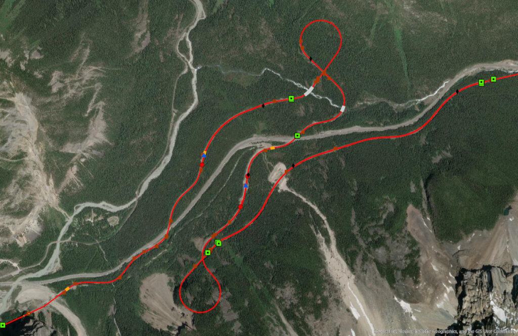
CPKC’s engineering asset management and GIS teams launched a multi-year Track Asset Management (TAM) program to create a comprehensive, high-accuracy geospatial inventory of track and wayside infrastructure across the railway. The scope was significant: main and non-main rails, yard track, turnouts, derails, bridges, road crossings, signs, signals, overhead wire crossings, and related assets across more than 40 roadmaster areas (RMAs) and over 15,000 miles of CPKC track across a total network of more than 20,000 miles.
CPKC’s goal was to create a system of record to support engineering decision-making across the network. Without automation and standardized quality control, the program risked delays, rework, inconsistent outputs, and reduced confidence in the data. Transforming raw point clouds into GIS-ready engineering assets required more than extraction alone. CPKC needed to align physical locations with tabular asset data, apply consistent naming and attribution standards, define asset extents, and meet strict positional tolerances of approximately 5 centimeters horizontally and vertically. Traditional manual workflows could not efficiently support that level of scale, precision, and consistency.
Collaboration
CPKC engaged Bartlett & West as its data services provider to help operationalize the program at scale. With more than 35 years of experience serving Class I, regional, and short line railroads, Bartlett & West brought rail domain knowledge, machine-learning capabilities, and deep Esri platform expertise to design a workflow that could improve both throughput and data quality.
The solution
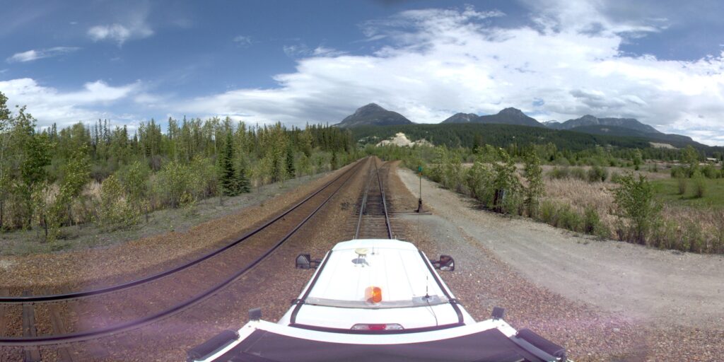
Together, CPKC and Bartlett & West developed an end-to-end workflow to capture, extract, validate, and deliver engineering asset data that could support long-term asset management across the railway. CPKC worked closely with roadmasters in the field to verify features, naming, and attributes for track and wayside assets. The company deployed hi-rail LiDAR collection crews for main and non-main track and used fixed-wing aircraft to collect imagery and data over yards across the system.
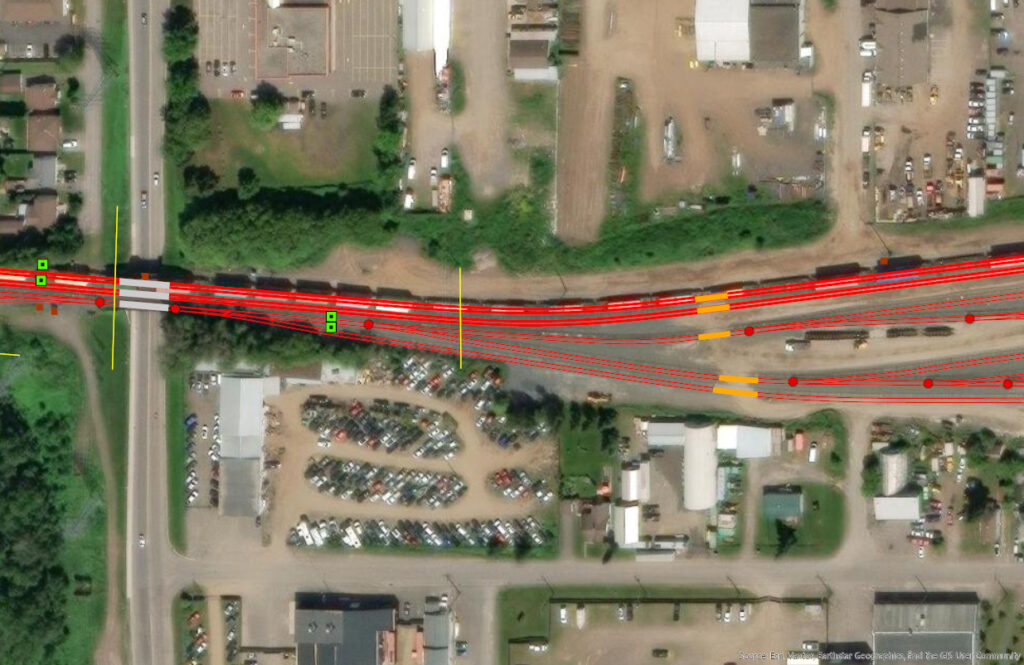
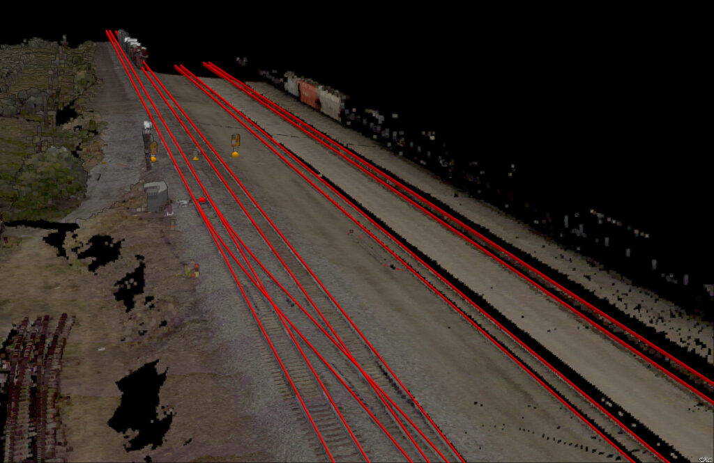
Bartlett & West applied its proprietary IRIS machine-learning technology, trained on CPKC business rules, to identify and extract track and wayside features from LiDAR data. GIS analysts then reviewed and refined the candidate features in ArcGIS Pro, resolving machine-learning gaps, enforcing geometry standards, populating attributes from source files, and merging multiple scans where needed.
In the final quality-control stage, ArcGIS Attribute Rules and automated checks validated geometry, topology, relationships, and labeling, while defined handoffs, schema governance, and ongoing feedback between CPKC and Bartlett & West strengthened the workflow over time.
The results
Over five and a half years, the workflow delivered more than 140,000 extracted and attributed features with single-digit error rates per RMA. The program successfully processed more than 15,000 miles of CPKC track across a total network of over 20,000 miles and billions of LiDAR points while meeting CPKC’s approximate 5-centimeter horizontal and vertical accuracy requirements and prescribed schema.
As the workflow matured, turnaround times improved, documentation and source-data alignment became more standardized, and quality issues were tracked through a formal governance structure.
The result is one of the rail industry’s most comprehensive and accurate engineering asset inventories, giving CPKC a stronger foundation for planning, prioritizing resources, improving efficiency, and supporting safer operations across its network.
“Our collaboration with Bartlett & West has successfully bridged the gap between raw field data and operational intelligence. By extracting precise asset geometry from our in-house LiDAR and camera scans, Bartlett & West served as the catalyst for our data enrichment. Ingesting this refined information back into our GIS has not only elevated CPKC’s source spatial system of record but has also revolutionized our Track Asset Management by providing highly accurate data for inventory and deficiency management.”
Michael Robb, Senior Manager, GIS Enterprise, CPKC