
Most recent
Sulphur Springs Valley Electric Cooperative Converts Unsorted Imagery into GIS-Ready Assets
SSVEC has engaged AerialSphere's team to convert these photos into ArcGIS native content using their XPGEO Studio web app

Dominion Energy Transmission Improves Asset Management with Visual AI
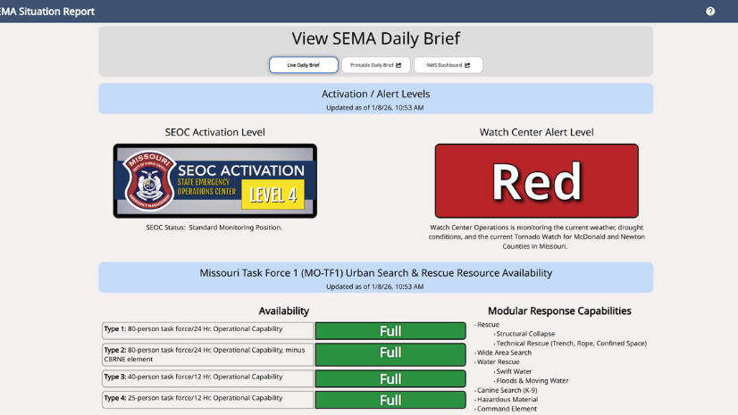
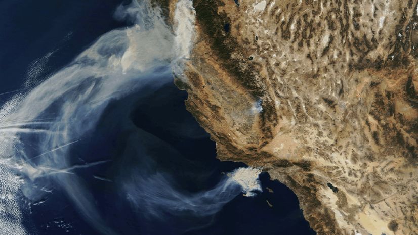
From Firehose to Focus: How Missouri SEMA Modernized Situational Awareness with GIS

Multiple Authors|
Jamaica’s Preparedness and GIS Readiness Drove a Successful Hurricane Melissa Response

From Top-Down Systems to a Local–National Mesh
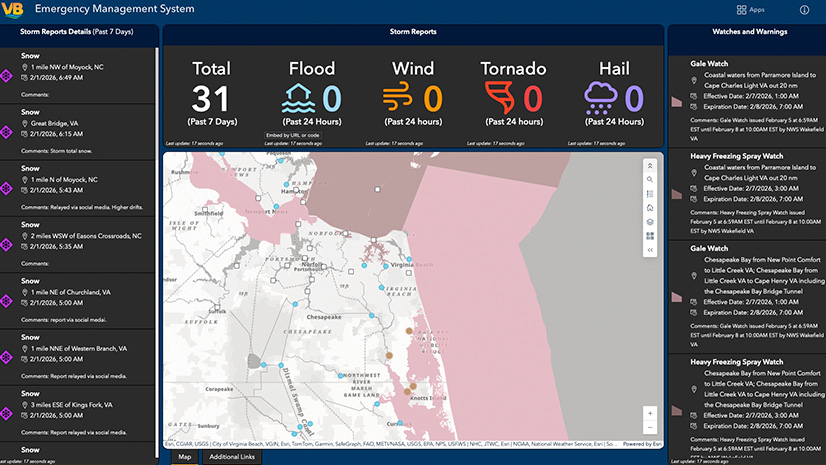
Expert Advice: Virginia Beach Emergency Management’s Top Tips for Transitioning Incident Management Systems
Esri Water|
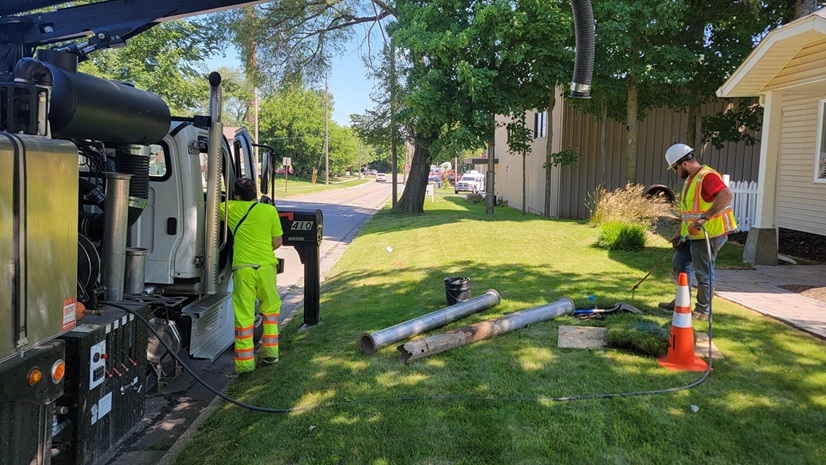
Potholing and GIS: Prioritization Planning for Lead Service Line Replacement

Agriculture Intelligence (AgI): Lessons from “Old School” Artificial Intelligence (AI)
Esri Water|
GIS-Driven Automation Transforms SSO Monitoring at Clark County Water Reclamation District

Esri Water|
Mapping Leaks, Saving Water: MAWC’s GIS-Powered Leak Detection Strategy

Esri Water|
Clark County Water Reclamation District Transforms Wastewater Operations with ArcGIS Indoors and Digital Twin Technology
Esri Water|
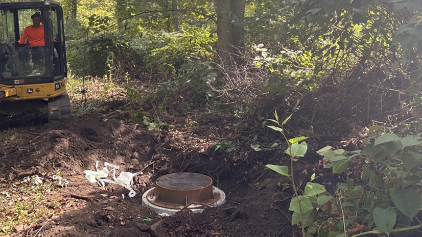
From Hard to Find to Hard to Miss: Mapping Manholes in Rural West Virginia

Announcing Our New Blog Series: Rethinking Humanitarian Action with a Geographic Approach

GIS Enables N1 to Outmaneuver Historic Storm Surge

More Money? No Problem: Using GIS to Show Transit’s ROI and Lobby Funding Support
Rebecca Kahrhoff|
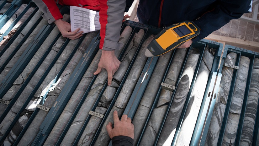
Top 10 GIS Mining Workflows In Exploration

Trusted Applications of Geospatial AI for Agriculture

Esri Telecommunication Team| February 13, 2026
ECC Technologies Builds a Single Source of Truth for Fiber Network Delivery with Esri

Esri Water|
East Valley Implements ArcGIS Utility Network for Modern Data Management

Effective Humanitarian Response Requires Integrated Systems
An Organizational Approach to Modernizing Your GIS with Imagery

ArcGIS as a Planning System — Q1 Update

The Geographic Approach and the Power of Local
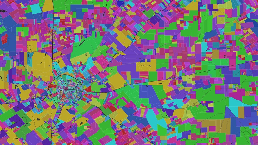
New Year, New Parcel Resolution: Migrate to ArcGIS Parcel Fabric

Multiple Authors|
Why Transit and Why Now?

Rebecca Kahrhoff|