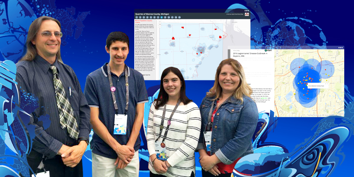
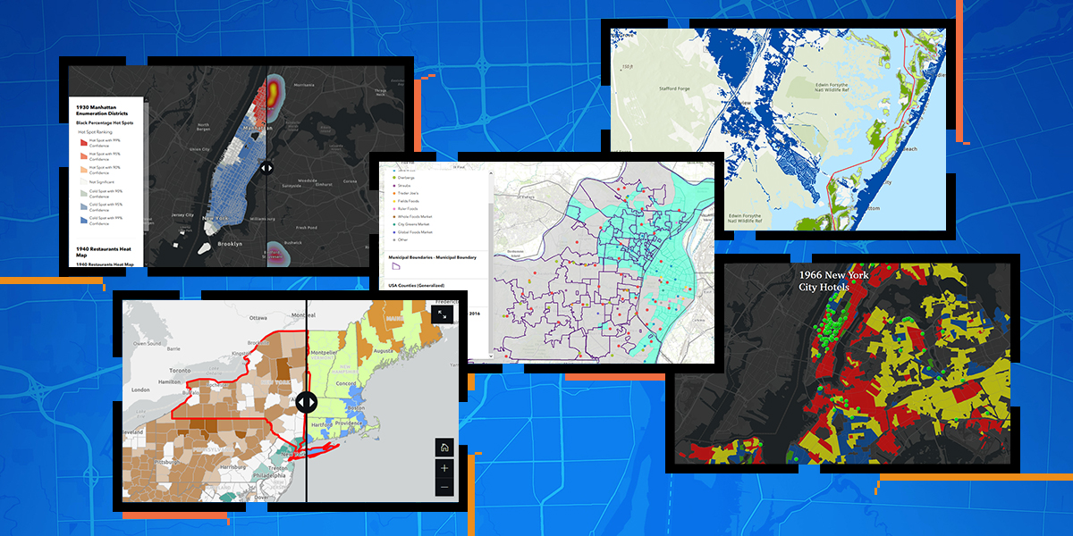
The spatial patterns of the hospitality industry in New York City from the 1930s to the 1960s were quite distinct, while the spatial patterns of grocery stores in the city and county of St. Louis today are more subtle. Those interpretations are from the winners of the 2021 ArcGIS Online Competition for US High Schools and Middle Schools.
In 2017, to mark the 25th year of its program for schools, Esri launched a competition for students. It succeeded and grew in 2018 and 2019, but was hamstrung by the pandemic in 2020. In the 2020–21 school year—which many teachers have described as being, by far, the worst of their career—could students meet the challenge? Yes!
About the Competition
The competition challenges students in high schools (grades 9–12) and middle schools (grades 4–8), individually or in pairs, to research a topic of interest in their state and construct a story map. States manage parts of the event, and 42 committed to it this year. Students in 34 states submitted a total of 645 entries, and 112 high school students and 79 middle school students received $100 awards from the states, all numbers near or beyond all-time highs. Full information plus results from all five years of the competition, including links to all the creations of all awardees, are available here.
The task for students is not easy. It takes time and practice for young learners to build key skills in research, storytelling, and use of GIS; less experienced students create a “what’s where” report. The best projects address a geographic question for which there may not be a clear answer. Students follow the same steps used by geographic information system (GIS) professionals: seek and perhaps create geographic data, explore it, analyze it, interpret it, and build an appropriate presentation. And while it is OK for students to seek some guidance, they need to make the decisions and do the work themselves, rather than have someone say, “Do this first, do that next, then come back and see me.” Finally, instead of an image centric or text-heavy final report, the guidelines emphasize interactive maps and analyses so viewers can explore and understand why the researchers came to their conclusions.
Student Winners
The work that students can do is impressive, especially when they have had sufficient exposure to the fundamentals of data, cartography, analysis, and presentation. Looking at all the winners and honorable mentions from 2017 onward, the trend has been toward more sophistication. (No national winners or honorable mentions were designated in 2020, owing to the sudden onset of the pandemic.) As more teachers get comfortable with GIS and discover the capabilities of ArcGIS Online, we can expect this trend to continue.
How can GIS professionals help?
Several states haven’t yet participated in the competition, so stepping up to help or lead a state team would be huge. Some states have reported that they have plenty of volunteers to judge but not enough leaders to get the event under way.
No state has blanket participation, so there is unlimited opportunity to help educators learn about GIS and the competition. GIS professionals in some states have committed time and dollars to provide appropriate instruction to teachers, and it has made a huge difference. See this blog post and this article about Minnesota.
Students can engage even without introduction at school, but they need an appropriate login that protects their privacy, which a properly implemented ArcGIS schools mapping software bundle provides. School districts, schools, and youth clubs could use a hand in getting this software (licensed free to schools, districts, and clubs for instructional use) set up and operating.
Schools, districts, and clubs would benefit from a steady stream of appropriate consumable projects that build geographic awareness in educators, students, and parents in the community and state. Got a citizen science app letting people report when dandelions appear or what kinds of pets kids have in the school district? Or a series of one-week competitions (“Create a map about X”) that open on a Wednesday and end the following Tuesday? Nobody can go from deciding to go for a hike to summiting Mt. Everest in two months. Students need ramped, scaffolded experiences that have some personal meaning to them to do a good job in the competition.
The future for the student winners of the competition is very bright indeed. Before even entering college, they have demonstrated a strong interest in and high capacity for developing a way of thinking and using a suite of tools that many seek, respect, and reward. We need to provide these opportunities for many times more students. See the competition info, and work with other GIS professionals, educators, and friends to ensure that the event blooms in your state.