“Chesapeake Bay Oyster Recipes” is one of many bits of paper, magazine cutouts and handwritten recipes in a small, tattered notebook that takes pride of place in my collection of cookbooks. This particular notebook was actually a collection of my great grandmother’s recipes, later passed to my grandmother, and later to me.
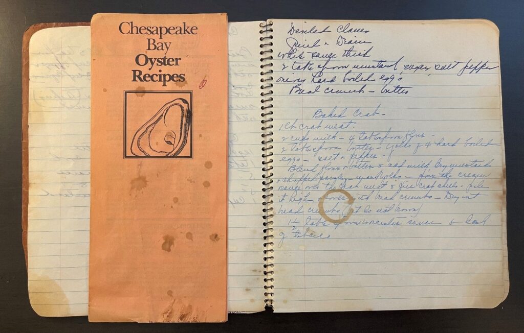
It is filled with the recipes that my great grandmother cooked regularly for my grandmother in their little house on the Eastern Shore of Virginia. Sweet potato biscuits, baked crab and deviled clams are just a few of the recipes that flood me with memories of visiting her nearly every year of my childhood. If we arrived and the weather was cold outside, she inevitably had fresh oyster stew on the stove ready to serve as we walked in the door.
These recipes often rely on ingredients endemic to the Eastern Shore; Blue Crabs, the Eastern Oyster, and the beautiful Hayman Sweet Potato.
Yet, climate change, over-consumption and a litany of other impacts continue to result in declines to healthy habitats that support these and other species along the coastlines, tidal marshes, wetlands and other areas of the coastal U.S. and globally. Not only do these habitats contribute to a delicious variety of recipes, but they protect us from storm surges, flooding, coastal erosion and other issues that are exacerbated by climate change. Ensuring their health, in turn, ensures our own health and wellness.
This is why at least two programs in the Infrastructure Bill were given a bit of a boost – Habitat Restoration and Coastal Zone Management. Collectively, these two programs include $700 million as part of the nearly $47 Billion earmarked in the Infrastructure Bill for climate resilience. The application date for these two programs is set to open the 2nd quarter of 2022 with additional funds opening throughout the year for other related programs.
Many organizations are already applying a geospatial approach to tackling these complex challenges. I was delighted to come across a variety of applications from the Chesapeake Bay Foundation and I’d like to share a few examples here.
Restoring any kind of habitat requires that we know a few basic things such as:
- Where are these habitats and where are they most threatened?
Living Shorelines on the Nansemond River Story Map includes a variety of Swipe maps that allow the user to examine erosion of coastline through time. In addition to these tools, the Story Map allows the Chesapeake Bay Foundation to guide the public through what they’re seeing, how it’s being addressed and other important pieces of contextual information.
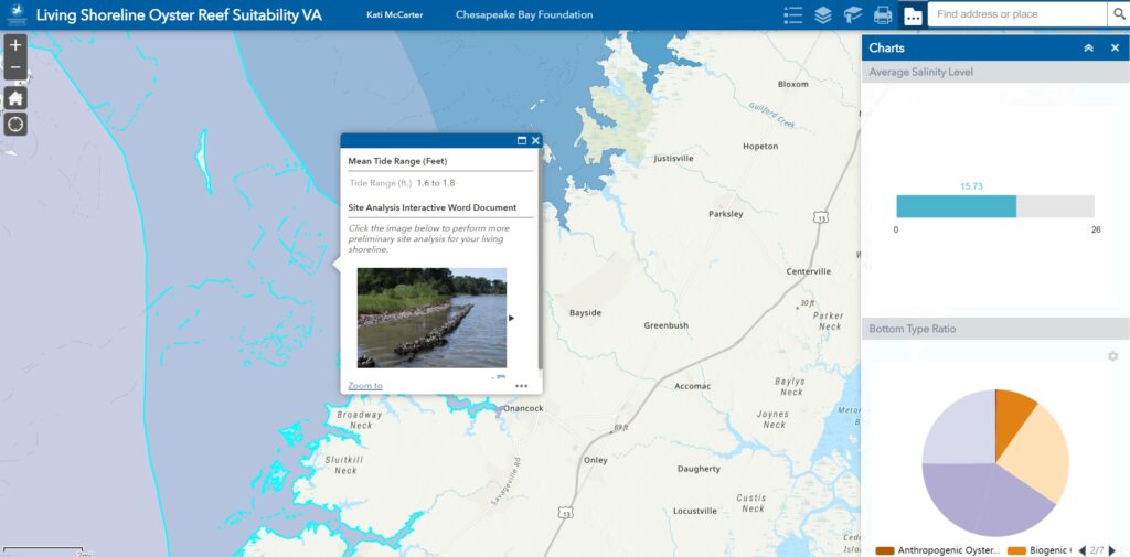
- Where are suitable locations to target restoration?
This ArcGIS Web App, Living Shoreline Oyster Reef Suitability, allows the user to explore a range of suitability metrics both spatially and then broken down in a series of charts. These can be exported out for the end user to include in reports, or the user can link out to other kinds of forms and applications for the specified area.
- Where have we implemented habitat restoration already and how is it doing?
This very simple but effective map allows users to see generally where oyster reef restoration has been implemented since 1996 throughout the Chesapeake Bay. This map takes it a bit further, overlaying oyster sanctuaries, oyster plantings and other key elements along with various widgets to allow the end user to conduct some basic queries and analyses on their area of interest throughout the bay.
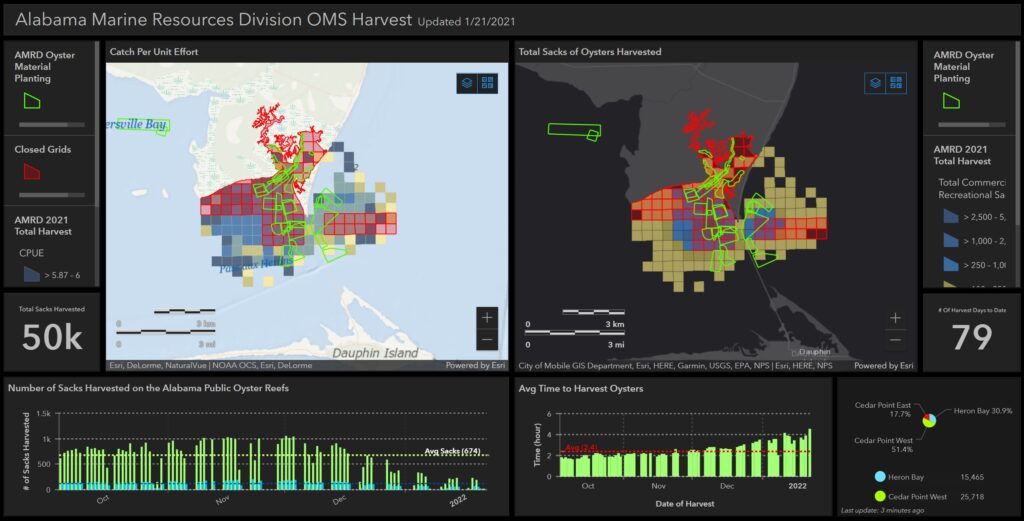
This great dashboard out of the Alabama Marine Resources Division tracks oyster harvest throughout the years. Visualizing data like this, across both space and time, can help stakeholders make informed management decisions that not only protect our shorelines and these special habitats, but also the livelihood of fisherman and other economics supported by healthy ecosystems.
As organizations across our coastal communities prepare to apply for these grants, I’m looking forward to seeing even more examples of how they embrace Esri’s innovative spatial technology. Whether it’s to conduct the fieldwork, visualize these habitats and their complex interactions, analyze the success of their restoration efforts, or provide context to stakeholders – these tools will help ensure a more sustainable future. My cookbook still has a few empty pages I’d like to fill!
Learn more about how GIS can align with federal funding programs.