Nearly every county in the United States today is dealing with the challenge of homelessness and housing policy, whether that is a lack of affordable housing or growth capacity issues.
As the trend of counter-urbanization continues to develop in the face of the COVID-19 pandemic, many counties are facing the potential of exceeding their planned growth capacity, particularly regarding single-family housing. We covered this topic in the Esri Industry Blog this summer when it was developing, but the main drivers are civil unrest in cities, technology enabling effective remote work, lack of access to amenities in cities and record low interest rates. This is putting an added level of stress on county planning departments that, up until March 2020, had no reason to believe they would see the increase in growth many are seeing now. For many counties, this will require a swift update to comprehensive plans. Consequently, it will require quick decision-making from elected and appointed officials.
As a former planner, I know that being able to justify and validate your policy to administrators is a crucial skill. Many planners have learned the same tough lesson that I did, which is that anecdotal evidence is not enough in this field. It is not enough for me to tell you that this proposed development is a good idea. My decisions need to be driven by authoritative data. In other words, going before the planning commission or county commission with the argument, “I think this development will be very beneficial for this neighborhood,” does not carry the same weight as: “This development will add 125 people, 75 office jobs, and 100 retail jobs. It will also incur x thousands of gallons of water and wastewater per day.”
Location has always been at the forefront of planning. It is what drives developers to pursue specific sites and it is what drives public opinion. GIS has always been used in this arena to design land use and sites, but this evolving technology is now being used to help validate policy. At the center of this is the proliferation of focused, powerful web and mobile-based apps that require no GIS software on the user’s machine.
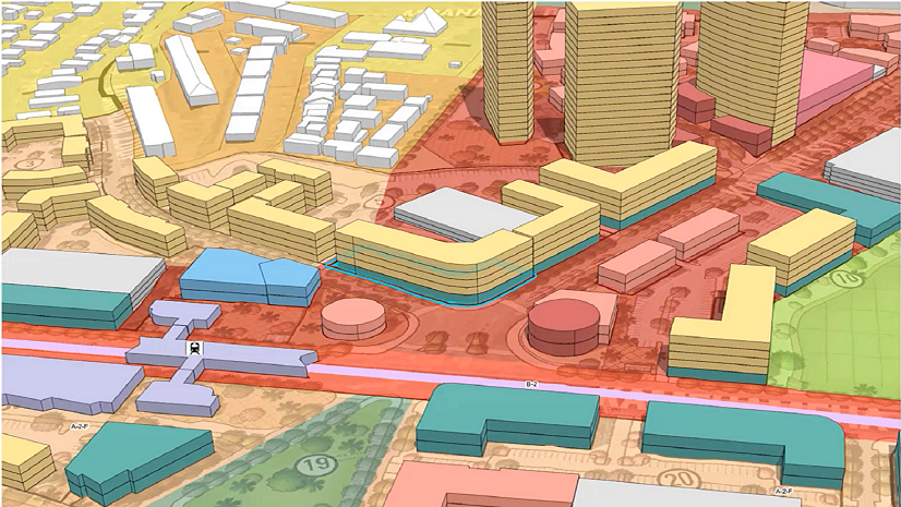
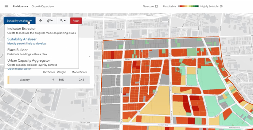
Honolulu County, Hawaii has been using ArcGIS Urban to help design new developments in neighborhoods. Now, with an add-on to this web app called the Policy Validation App, decision makers can analyze location to make broader decisions about the direction of growth in their county; and they can do this without being GIS experts or even having any traditional GIS software.
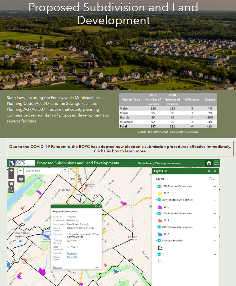
Bucks County, Pennsylvania has deployed ArcGIS Hub to provide transparency in the planning process, but one of the aspects to this that appealed to me was providing the recent history of development in the county. Now, when new commissioners, new planners and even new developers arrive in Bucks County, they can see what types of development have been proposed, approved and rejected in an easy-to-use web map. From the standpoint of policy development, this helps administrators make more consistent decisions.
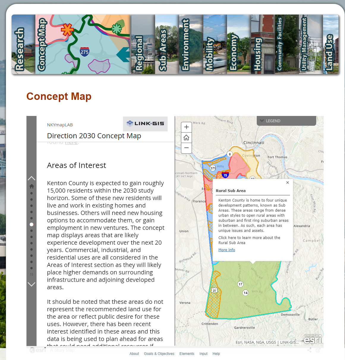
In Kenton County, Kentucky, the GIS lab uses ArcGIS StoryMaps to communicate changes to the 2030 comprehensive plan, which includes ongoing housing policy development.
Policy development is also being driven by the pursuit of racial equity, particularly in terms of understanding where resources need to be allocated. Where would providing affordable housing positively impact the most disadvantaged citizens the most? Who among this demographic has access to necessary goods and services, like grocery stores, health care and so forth? Which part of our population is most likely to be displaced?
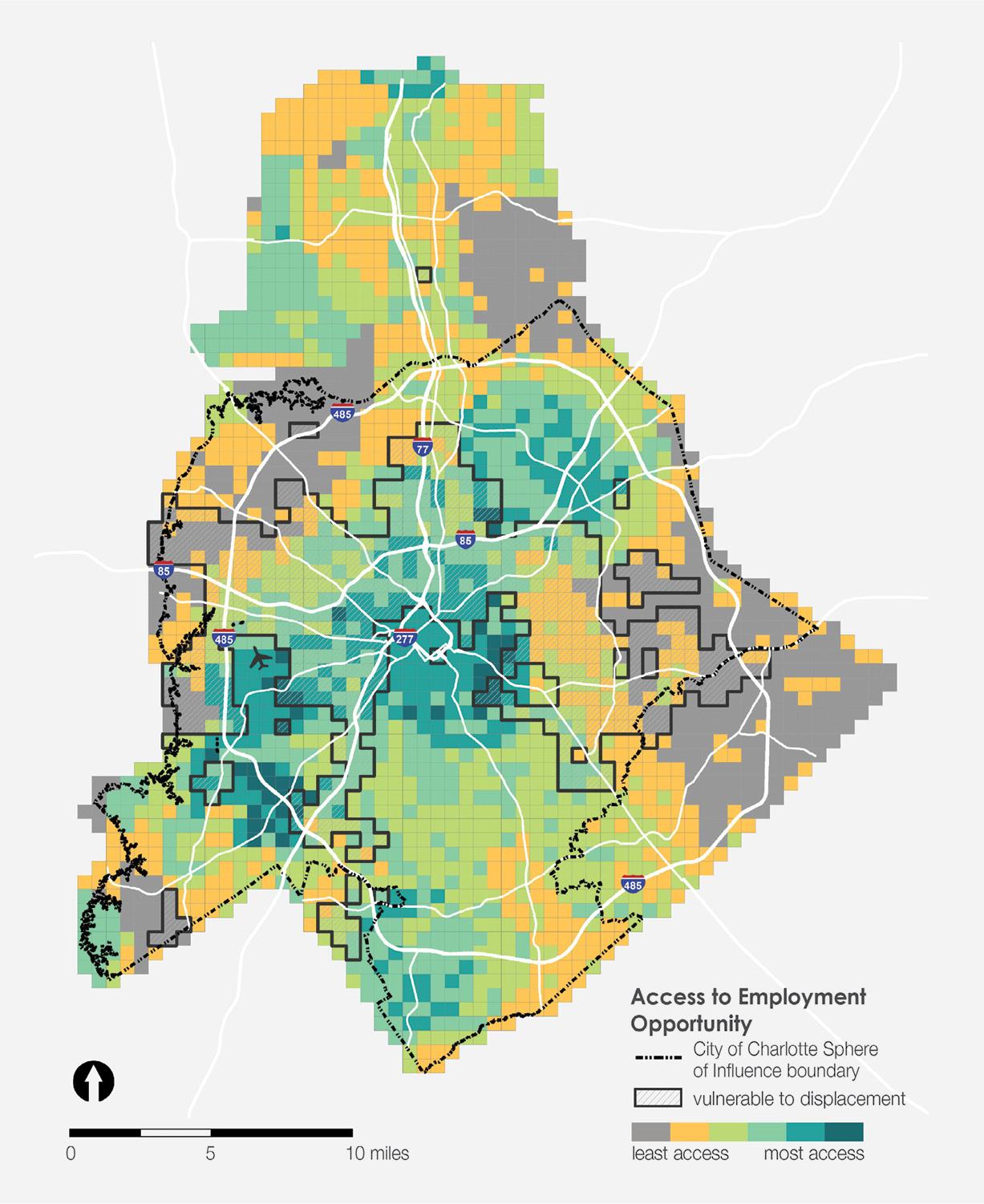
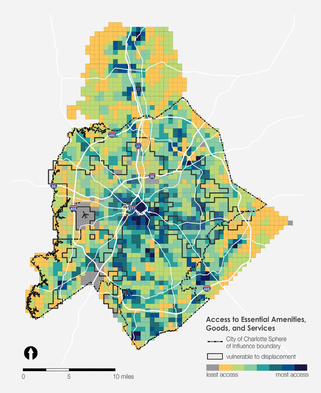
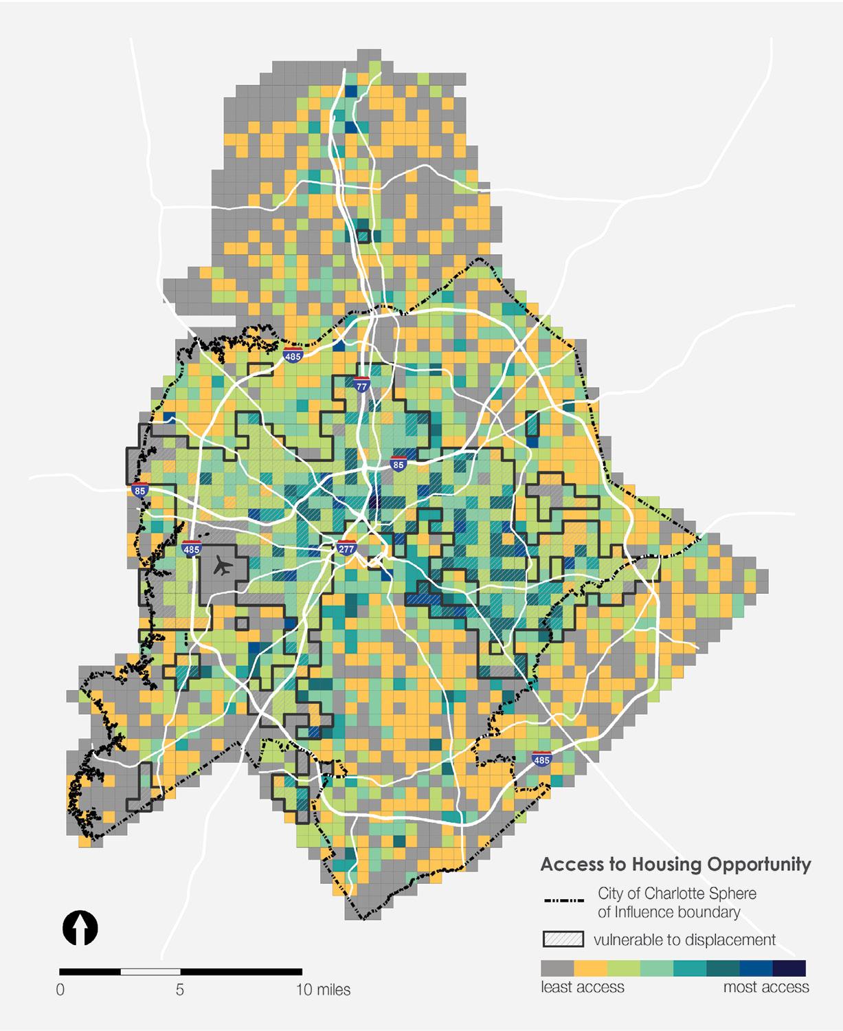
At Esri, we are focusing on tools that can bring in these key elements to create neighborhood typologies and identify the most suitable areas for different types of housing. GIS provides the answers to these questions and empowers county leaders to take a data-driven approach to policy development that benefits all its citizens.