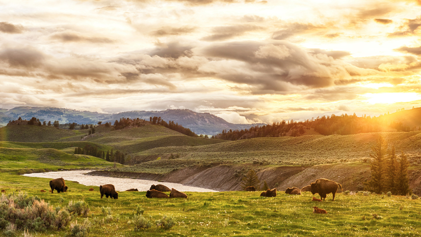
Tribal Nations steward vast lands and resources across North America, balancing economic development with deep cultural and spiritual connections to their homelands. While extractive industries like timber harvesting, mineral extraction, and oil and gas development have long provided revenue streams, these activities often exact substantial environmental and cultural costs on both the ecosystems and traditions that Tribes work to preserve.
Today, Tribal communities are turning long practiced stewardship into economic opportunity, shifting away from extractive industries in the process. Carbon credit programs—part of the broader environmental commodities market—enable Tribal Nations to purchase ancestral lands, provide member services, and invest in infrastructure while actively protecting natural resources rather than depleting them.
The National Indian Carbon Coalition (NICC), a programmatic arm of the Indian Land Tenure Foundation (ILTF) has recognized that Tribal communities need accessible tools to navigate this opportunity. As a Tribally led nonprofit partnering with Indigenous communities across the United States and Canada, ILTF-NICC developed the Tribal Carbon and Co-Benefits Hub. By harnessing the power of geographic information system (GIS) technology in this context, the Hub makes mapping tools more accessible to Tribal Nations through a centralized platform delivering data and guidance directly to Tribal decision-makers.
The Hub provides an easy-to-use interface for Tribal communities to assess carbon project opportunities and better understand the potential co-benefits these projects could provide. While some Tribal Nations have robust GIS capacity, many do not; the Tribal Carbon and Co-Benefits Hub are a first step in making these tools accessible for Tribal Nations and Indigenous communities while centering Indigenous voices in regenerative ecosystem service markets.
The Hub’s landing page offers a high-level overview of the Tribal Carbon and Co-Benefits (TCCB) resource and quick access to its key components and featured applications. The first of these applications is the Tribal Carbon & Co-Benefits Atlas, a foundational tool for exploring landscape characteristics across different themes and geographies. The atlas makes publicly available geospatial data accessible to all Tribes, and it provides an initial step for assessing existing conditions to support informed land management decisions.
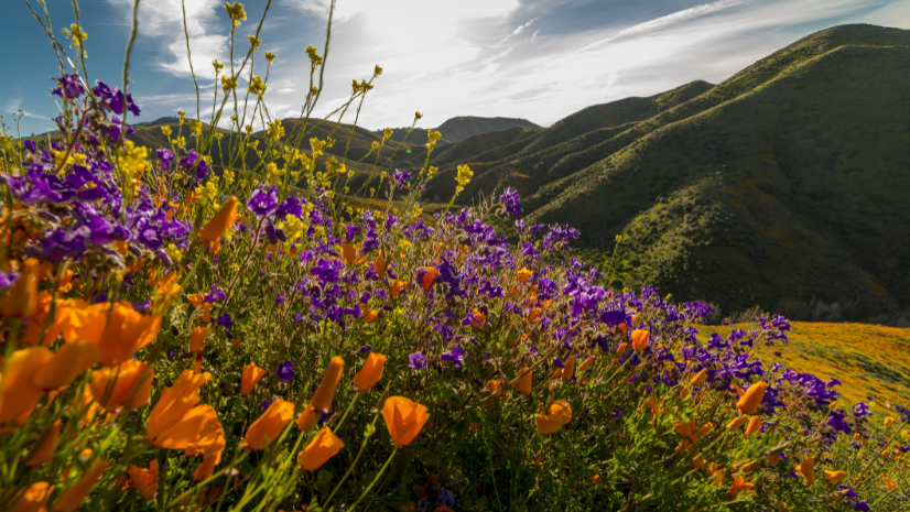
Some of what Tribes stand to protect through tools like the atlas cannot be quantified; it lives in the cultural traditions the land sustains. For the Fond du Lac Band of Lake Superior Chippewa (and other Upper Midwest Tribes), that tradition is wild rice.
The health of wild rice in the homelands of the Band tells a longer story; one rooted in the relationships between species, water, and land that the Band has tended for generations. At the center of that story are the native ash trees surrounding wild ricing area, whose root and canopy systems help regulate the water conditions rice needs to thrive. Today, the emerald ash borer, an invasive beetle species, is threatening those trees, and by extension, the wild rice communities that depend on them. Tools like the TCCB Atlas can help make that invisible threat visible; mapping where invasive species are encroaching and giving Tribal land managers the knowledge to act before that balance is lost.
To see how, consider the steps Tribal members might take within the atlas.
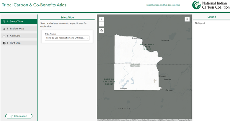
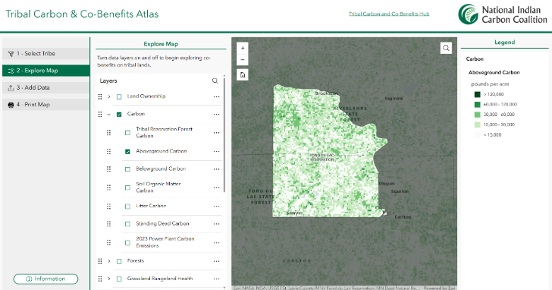
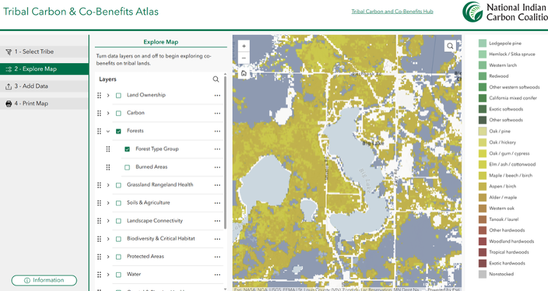
A user would first select their Tribe from a drop-down list of federally recognized Native American Indian reservations. By toggling publicly available data layers organized by category, they can identify where carbon storage is highest within and around their reservation boundary. This provides a baseline understanding of viability for potential carbon projects that could be explored further in collaboration with ILTF-NICC.
Turning to co-benefits, a Tribal member could turn on the publicly available data layers showing the distribution of forest cover types. This allows the user to focus on the locations of ash tree stands surrounding known culturally significant wild ricing areas.
The next question to answer is, where do emerald ash borer populations exist in relation to these areas? This would help determine risk to ash trees and, by extension, wild rice. Because the Tribal Carbon & Co-Benefits Atlas includes publicly available data with national coverage for the United States, the invasive pests’ layer does not provide the level of detail needed to understand the specific locations of current infestations. In this case, users can add their own data or draw from ArcGIS Online and ArcGIS Living Atlas of the World directly within the Tribal Carbon & Co-Benefits Atlas. More detailed, state-level data showing confirmed emerald ash borer observations across Minnesota can be added directly to the map to fill this gap.
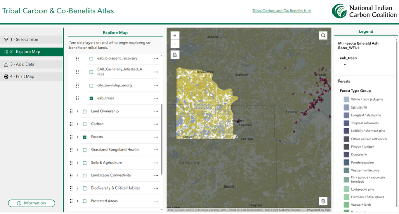
The resulting map shows encroachment of emerald ash borer at the eastern edge of the Fond du Lac Reservation. This indicates that preventive management is likely critical to protect the ash trees that contribute to sustaining the conditions needed to grow wild rice.
Tribal communities hold generations of knowledge about the cultural, spiritual, and ecological importance of their homelands. The Tribal Carbon & Co-Benefits Atlas complements this knowledge by assembling authoritative, publicly available datasets that help build a broader understanding of potential carbon storage and land management co-benefits on lands of interest to Tribal Nations and Indigenous communities. Tribal users can print and download the maps they make to share within their community. In addition, users can use the atlas to discover publicly available data they can seamlessly access in their own GIS environments. When used alongside traditional ecological knowledge and Tribal wisdom, the atlas offers a clear way to explore, assess, and communicate future land management strategies.
The atlas also supports the broader work of land stewardship and rematriation, helping Tribes identify areas suitable for carbon projects alongside private, state, and federal land buy-back opportunities, including the Federal Land Buy-Back Program.