Customer Spotlight Story
Con Edison is one of the largest and most complex energy delivery companies in the United States, supplying essential power and fuel across New York City and Westchester County. The utility operates a highly reliable electric network that serves 3.8 million electric customers across a 604‑square‑mile service area, reflecting its role as a core provider of urban energy infrastructure.
In addition to electricity, Con Edison delivers natural gas to 1.1 million gas customers in Manhattan, the Bronx, Queens, and Westchester County, making it one of the nation’s major gas distributors. Known for its extensive underground and overhead systems, the company supports dense metropolitan demand while advancing modernization and resiliency efforts.
The organization employs approximately 14,000 people in six major groups—Central Operations, Gas Operations, Electric Operations, Customer Operations, Customer Energy Solutions, and Environment, Health & Safety.
CHALLENGE
Con Edison historically relied on multiple legacy plate-based mapping applications for its medium-voltage, low-voltage, and conduit systems. Paired with large-format engineering schematic drawings and manually drafted manhole blow-ups (butterfly drawings) that included cables, conduit wall positions/formations, and connections. These were all used to document and manage its network.
These legacy applications served as the authoritative source for asset location, configuration, and recorded all field changes. They relied on a system that required marking revisions for construction or maintenance activity, then routing plates for review, followed by the distribution of re‑plotted updated copies.
While reliable for decades, the process was labor‑intensive, time-consuming to update, and facilities were duplicated across multiple applications, which caused syncing issues across applications. As the network grew in complexity, the limitations of a manual, plate‑based system became increasingly clear, driving the need for digital modernization and consolidation of data.
SOLUTION
The company recognized that its existing processes could not scale or support digital transformation. Modernization would synergize workflows among various groups, including Control Center, System Operations, Regional Engineering, Distribution Engineering, Construction, and contractors, while integrating with internal and external stakeholders and enhancing the design experience.
Con Edison embarked on a modern network management journey to lay the foundation for enhanced geographic accuracy and improved safety, efficiency, and data integrity. By implementing ArcGIS and Schneider Electric’s ArcFM Solution, they have mobilized over 6,500 field users, empowered 480 engineering users, and shifted from legacy systems, hand-drawn records, and legacy plate-based maps to the modern, spatially accurate, coordinate-based enterprise GIS. This story explores how Con Edison approached this change as a foundational step in grid modernization—emphasizing the importance of change management, cross-system integration, and user adoption to ensure long-term success.
“At Con Edison, we have been working toward our vision of consolidating our specialized maps across the three commodities (gas, electric, and steam) we serve onto a single platform. For example, we have specific maps showing the conduit systems running beneath the streets of New York City and parts of Westchester County. Another set of maps shows the electric and gas services and their respective pipes and cables. Then, there are separate maps of each of the medium-voltage distribution feeders supplying all of our transformers. This project has given us the opportunity to challenge our existing business practices and, because of the consolidation and power of the platform, achieve efficiencies by eliminating redundant tasks across the legacy mapping workflows.
“We have also developed or enhanced a number of key integrations, including work management, outage management, customer billing, and load-flow applications. Utilizing the power of this platform, we have created what I call “Smart Maps,” displaying real-time transformer switch status and loading information to our engineers and operations personnel to manage the electric grid on a daily basis.
“To meet the challenges of building the “Grid of the Future,” both supporting electrification and reduction in fossil fuels, we have implemented a GIS-based layout tool fully integrated with our GIS mapping and work management systems, replacing our old CAD-based tool. The ArcFM Designer XI solution shows its power and ability to seamlessly issue projects in a much more efficient manner. This is an exciting time for us and has given us the opportunity to transform our practices by seeing our assets through a new lens.” – Joe Lenge, General Manager and Program Sponsor
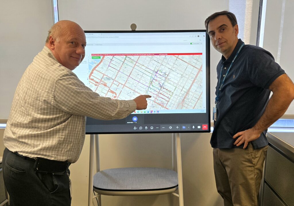
Joe Lenge and Oleg Tosic are using Schneider Electric’s ArcFM Desktop solution to isolate underground primary feeders in Times Square, Manhattan.
Schneider Electric’s ArcFM Solution extends ArcGIS, with streamlined editing, design, and field workflows. ArcFM enables efficient management of electric, gas, steam, and other utility assets while improving data quality and reducing operational overhead. It supports utilities pursuing a modernized digital network model and unified workflows across planning, design, and operations. Both Esri and Schneider Electric solutions serve utilities of all sizes for electric and gas resources.
RESULTS
Con Edison implemented Esri’s ArcGIS with ArcFM Designer XI to simplify and digitize its design-construction-commissioning processes into a GIS workflow.

Con Edison simplified its design/construction process.
A work request is created in its work management system. The design is assigned to a designer in ArcFM Designer XI, who then creates it. It allows engineers to generate an electronic construction view for sharing with contractors. The design is then pushed to a GIS team session using ArcFM on a desktop for review and commissioning of the new part of the network. This has created a seamless, universally adopted process for aligning their GIS data with the real-world state of the network.
PARTNER
Schneider Electric is a global energy‑technology leader, delivering a unified digital platform that electrifies, automates, and digitalizes utility operations end‑to‑end, enabling grids to function as open, interconnected ecosystems that enhance performance, resilience, and sustainability.
Schneider Electric has played a pivotal role in helping Con Edison successfully implement and operationalize Esri’s Enterprise ArcGIS and Schneider Electric’s ArcFM Solution by providing deep technical expertise, hands‑on configuration support, and ongoing advisory services throughout the project lifecycle.
Beyond initial deployment, Schneider Electric’s continued service work—including user enablement, solution optimization, and responsive professional services—has supported broader adoption of ArcGIS‑based workflows across the organization, ensuring Con Edison maximizes the value of its geospatial investments and maintains strong utilization of ArcFM tools for planning, design, construction, operations, and end-to-end asset management.
BENEFITS
By implementing Esri’s ArcGIS and Schneider Electric’s ArcFM Solution, Con Edison can integrate with internal and external stakeholders/sources to enhance and simplify the design experience.

Benefits of implementing an integrated GIS into the workflow.
Through careful planning, execution, change management, and stakeholder engagement, Con Edison has achieved seamless adoption across construction groups. This software now delivers measurable geographic accuracy and spatial analysis of its assets while ensuring greater safety for both employees and the public. Con Edison’s commitment to innovation and safety has set a new benchmark for operational excellence in the industry.
With this digital foundation in place, Con Edison is well-positioned to continue evolving its operations and meet the growing demands of a dynamic urban energy landscape.
NEXT STEPS
As Con Edison advances its grid‑modernization strategy, the next steps center on transitioning to the ArcGIS Utility Network as a foundation for its Clean Energy Mapping Platform and ArcFM Solution XI to create a more unified, data‑driven operational foundation. This evolution will help de‑silo critical asset, network, and operational data, enabling a single authoritative model that can be leveraged consistently across engineering, operations, planning, and customer‑facing teams. By expanding the reach of GIS throughout the utility—into mobile crews, control centers, design environments, and analytics platforms—Con Edison will strengthen situational awareness, streamline workflows, and empower broader collaboration. This transformation positions the utility to better manage a more complex, distributed, and dynamic electric grid.
SUMMARY
Challenge: Con Edison relied on legacy plate-centered mapping applications and butterfly drawings that were labor-intensive, slow to update, and difficult to sync across legacy applications as network complexity increased.
Solution: Con Edison implemented Esri ArcGIS with Schneider Electric’s ArcFM Solution to digitize its network, unify workflows, and enable a spatially accurate, coordinate-based system.
Results: Con Edison established a streamlined, end-to-end GIS-driven design and construction process that aligns system data with real-world network conditions.
Benefits: The new platform improves safety, increases efficiency, enhances data accuracy, and enables seamless collaboration across internal teams and external stakeholders.

