This article was contributed by Presagis, an Esri Partner.
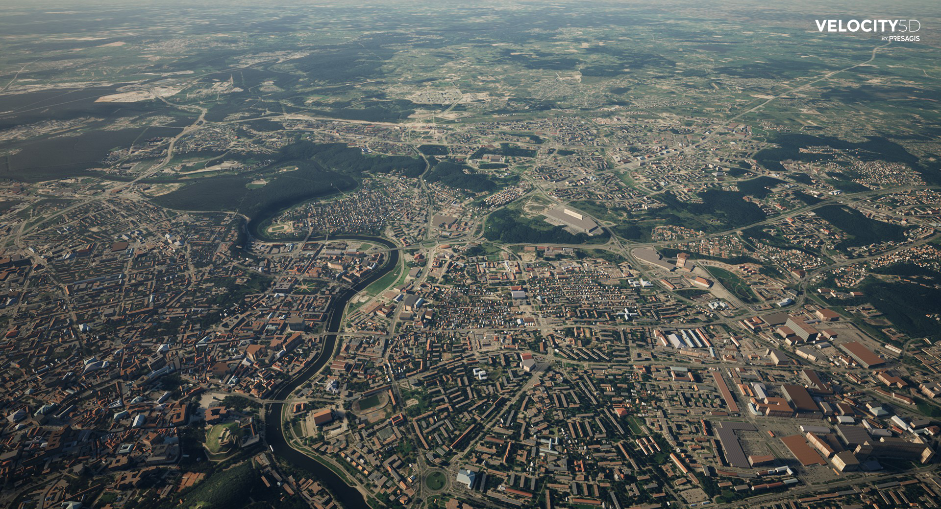
The value of 3D data goes beyond its intrinsic qualities of generating enhanced contextual visualization, insight, and spatial understanding. Increasingly, 3D data is enriched by AI algorithms generating semantic metadata relevant to various industry domains such as architecture, construction, utilities, and autonomous navigation. Lidar and imagery point clouds collected by reality capture devices generate massive and distributed 3D datasets at varying spatial scales and resolutions. Open 3D data standards such as i3S, and 3D Tiles are designed for streaming massive 3D content files for use by mobile and Web applications. All of these trends point towards increased interoperability on the ArcGIS system between 3D open-data standards such as i3S, 3D Tiles, and Constant Database (CDB).
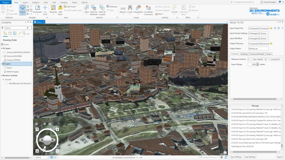
At Presagis, we are developing software tools, cloud services, and workflows for ArcGIS Pro that increase the interoperability of 3D data sources adopted by the modeling, simulation, and gaming communities. The 3D Environments Add-in for ArcGIS Pro does three essential things for users:
- Converts 3D Tiles data into i3S files while preserving domain schemas, such as the One World Terrain (OWT) Ground-Warfighter Geospatial Data Model (GGDM) [1], and preserving attributes assigned to OWT building models (i.e., building height).
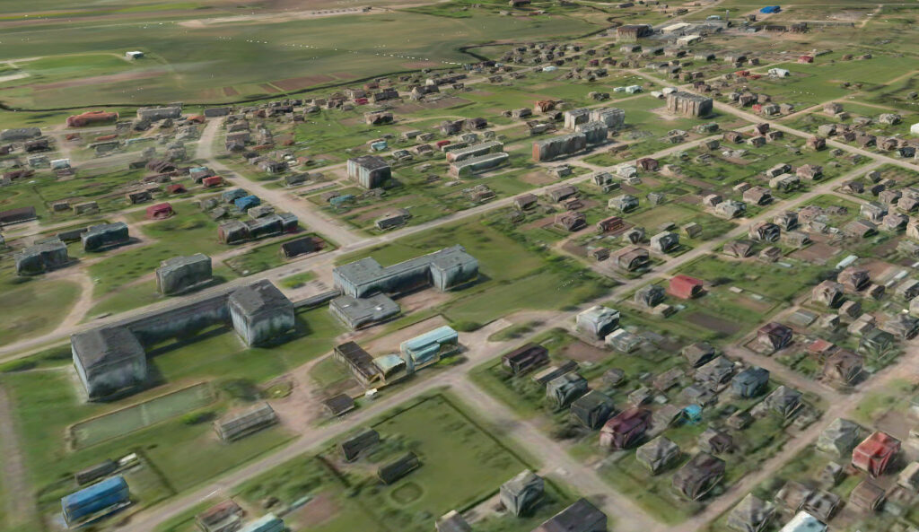
- Extracts CDB layers from sources such as the NGA’s Beyond 3D Program [2], including OpenFlight models to jump-start ArcGIS Pro projects. Layers within CDB include 3D terrain, roads, buildings, vegetation, airports, vertical obstructions, and many other feature and model types.
- Enables Presagis stylized building templates and textures, which can increase the quality of 3D scene visualizations in ArcGIS Pro. Presagis has over 30 years of industry experience modeling 3D buildings with hundreds of textures and templates in the library.
A critical Use Case that the 3D Environments Add-in addresses for the ArcGIS Pro community is OWT data. Maxar’s OWT data is delivered in a version of 3D Tiles called Well Formed Format (WFF) 1.4, which includes multiple glTf [3] extensions and packaging of 3D models, such as buildings and bridges, and vector data, such as roads. The conversion of OWT data into i3S is a simple point-and-click operation that converts the files to include the i3S Scene Layer Package while preserving 3D model attributes using the GGDM schema. In addition, any vector files stored within the OWT Terrain Pack are written into a Geodatabase.
Although the 3D Environments conversion does include all the glTF extensions with this release, more extensions can be provided over time depending on user feedback and the evolution of the i3S library. The 3D Environments Add-in is available on the Esri ArcGIS Marketplace and includes a free evaluation, sample dataset, and a tutorial.
Please click here for more information and download the software at https://www.presagis.com/en/product/3denvironments-addin/.
Footnotes
[1] https://ggdm.erdc.dren.mil/
[2] https://www.asdnews.com/news/defense/2021/10/12/cae-usa-awarded-37m-contract-nga-beyond-3d-project
[3] https://github.com/CesiumGS/3d-tiles/blob/main/extensions/README.md
