A Lesson I Keep Coming Back To
Early in my career, I learned that helping someone in crisis often depends on much more than compassion. It also depends on having the right information at the right moment.
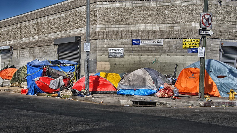
For people experiencing unsheltered homelessness, that moment can happen anywhere. It may be under an overpass, outside a library, near a transit stop, or in a neighborhood that crosses multiple jurisdictional boundaries. Outreach workers are meeting people where they are, building trust, responding to immediate needs, and helping them navigate a path toward housing, health care, and supportive services.
But in a region as large and complex as Los Angeles County, knowing where someone is can be just as important as knowing what they need.
The Challenge of Serving People Across a Vast Region
Los Angeles County spans more than 4,000 square miles, with dense urban corridors, suburban communities, and decentralized funding streams. Street outreach teams often need to determine whether someone qualifies for geographically targeted programs based on where that person is located, including Service Planning Areas and City Council Districts.
Historically, that process created administrative friction. Outreach workers or matching teams had to verify locations against maps, zip code charts, dashboards, or other tools before determining eligibility for certain housing, street medicine, or localized services. Those extra steps could delay referrals and make it more difficult to show local leaders how district-specific funding was connecting people to care.
And when someone is waiting for help, every delay matters.
Turning Location into Action
That is why the work happening through the Los Angeles Homeless Services Authority is so important.
LAHSA uses Clarity Human Services by Bitfocus, an Esri Gold Business Partner and leading provider of software solutions that help communities coordinate homelessness response and care services. Through Clarity’s Outreach Module, field staff can capture client encounters and assessments directly on mobile devices, while Esri ArcGIS spatial mapping tools analyze geographic data in the background.
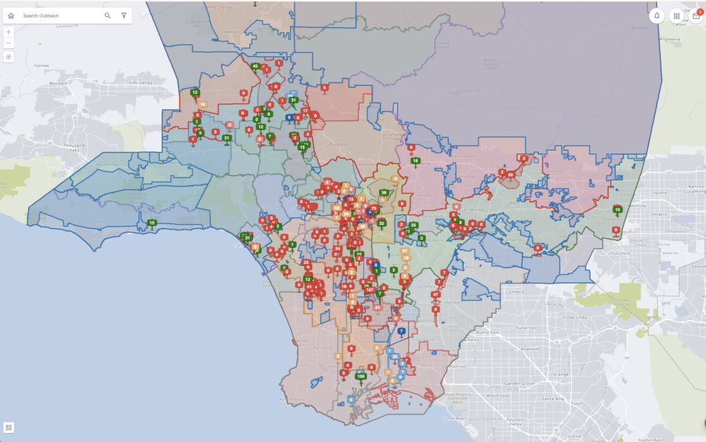
When an outreach worker captures a participant’s latitude and longitude during an encounter or Coordinated Entry System assessment, ArcGIS automatically matches that location against boundary layers for LA County’s Service Planning Areas and City Council Districts. The corresponding fields are then populated directly in the assessment record, removing the need for manual map lookups or zip code cross-referencing.
What stands out to me is not just the technology itself. It is what the technology makes possible.
It gives outreach teams confidence that precise location data is being captured behind the scenes, so they can stay focused on the person in front of them. It helps identify eligibility for geographically targeted resources, including district-allocated interim housing beds, SPA-specific outreach coordination, and local street medicine queues. And it gives program leaders better insight into where services are needed most.
Why Spatial Context Matters in Human Services
In health and human services, location is never just a point on a map.
It can determine which programs are available, which teams should respond, where resources are concentrated, and where gaps still exist. When that information is embedded directly into the systems frontline workers already use, it becomes easier to move from awareness to action.
For LAHSA and its partners, automating spatial boundary matching within Clarity helps outreach workers reduce guesswork, improve point-of-care accuracy, and accelerate connections to the right local resources. Program managers can also visualize encampment concentrations alongside service layers to better understand needs across different SPAs.
The impact is meaningful. In the last fiscal year, from July 2025 to June 2026, LAHSA reported 2,799 completed referrals that resulted in enrollment into a shelter with location-based eligibility.
That number represents more than operational efficiency. It represents people being connected to shelter and support because teams had the information they needed to act.
Building Systems That Support People
One of the most powerful aspects of this work is that it helps turn geographic boundaries into bridges instead of barriers.
Council Districts, Service Planning Areas, and funding boundaries will always be part of large-scale human services operations. But when those boundaries are connected to real-time workflows, they can help guide resources more effectively rather than slowing the process down.
As Bevin Kuhn, Deputy Chief Analytics Officer at LAHSA, shared, mapping participant geolocation directly against Service Planning Area and Council District layers in Clarity has transformed how LAHSA targets care across Los Angeles County. Instead of manually verifying boundary lines, shelter matchers can identify program eligibility and connect participants to district-specific resources nearby, allowing outreach teams to focus more on participants and less on custom location data entry.
That is the kind of transformation that matters: technology working quietly in the background so people can do the deeply human work in front of them.
A Question for All of Us
As I reflect on this story, I keep coming back to a simple question:
What would change if every outreach team, service provider, and human services leader had the spatial context they needed at the exact moment care was being delivered?
For organizations working to address homelessness, public health, behavioral health, or other complex community challenges, I encourage you to look closely at your own workflows. Where are teams still relying on manual lookups? Where do boundaries slow down care? Where could location intelligence help people move faster from first contact to the right support?
The work happening in Los Angeles County reminds us that meaningful progress often begins by making critical information easier to see, share, and act on.
As communities begin preparing for next year’s Point-in-Time Count and other critical planning efforts, now is a valuable time to evaluate the systems and workflows that support outreach, data collection, and service coordination. To learn how organizations are using Clarity Human Services to streamline operations and better connect people to care, visit the Bitfocus page.
Because when someone needs help, geography can help guide the way to care. Now is the time to put location intelligence to work for the people and communities that need it most.