WSP is one of the world’s leading professional services firms, bringing together engineering, advisory, and science-based expertise to help clients solve complex challenges across the built and natural environments. With 83,000 employees worldwide and active projects on all continents, WSP combines global scale with local technical knowledge across sectors including transportation, property and buildings, water, energy, advisory, and earth and environment.
Each season, WSP supports ice road operations in an Arctic environment where field teams collect large volumes of ground-penetrating radar (GPR) data within a short operational window. For a single project, the workflow generated approximately 4.5 million data points over 15 weeks, or about 300,000 records each week.
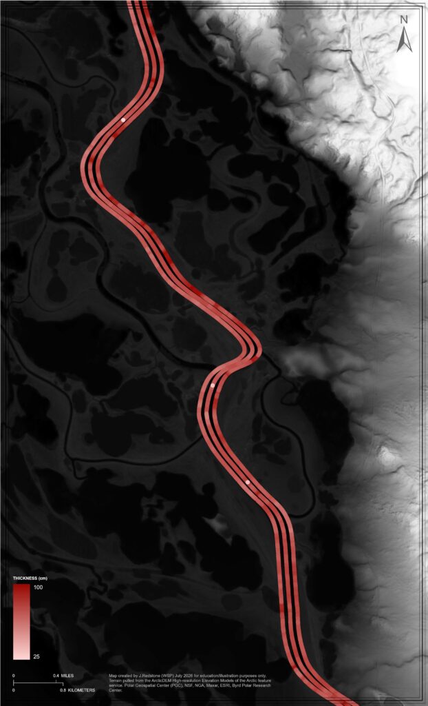
The data was central to the project team’s ability to review conditions to confirm safe work areas, publish updates, and maintain an operational view of the route. But the pace and volume of data collection created pressure on a workflow that had grown organically over time.

Challenge
The original processing model depended heavily on a single expert who understood how to acquire, process, publish, quality check, append, and refresh the data. That concentration of knowledge created a bottleneck and limited the team’s ability to delegate work as project needs grew. The workflow also had to account for multiple routes, different collection scenarios, large datasets, manual quality assurance, and project knowledge that was not yet captured in a form others could easily follow.
WSP recognized that automation alone would not solve the issue. The team first needed to understand the workflow, standardize the data model, and establish governance based on real operational experience.
Solution
WSP used ArcGIS Online as the operational platform for program data, supporting vehicle filtering, data review, and field workflows. The platform helped the team see how users interacted with the data and where the workflow needed to become more consistent.
Across multiple seasons, WSP refined the data model by clarifying attributes such as kilometer posting, survey direction, processing flags, and what constituted new versus updated information. Governance practices emerged from actual project conditions, including coordinate system changes, file naming issues, ArcGIS Online rendering requirements, shifting routes, and end-user filtering needs.
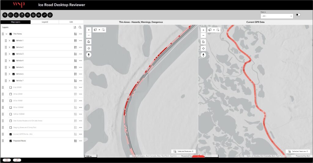
After the process became more predictable, the team used ArcGIS Pro tasks to operationalize expert knowledge. The task pane in ArcGIS Pro embedded workflow documentation, processing guidance, operational checks, and step-by-step instructions into the analysis experience. Instead of relying on one person to remember and execute every detail, WSP created a guided process that enabled consistent execution by additional staff.
Result
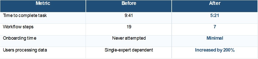
The new ArcGIS software based workflow reduced reliance on a single expert while improving consistency, repeatability, and scalability. The number of users processing data increased by 200 percent, allowing work to be delegated without sacrificing quality.
Operational results were measurable. The time to complete a representative task dropped from nine minutes and 41 seconds to five minutes and 21 seconds. The number of steps was reduced from 19 to 7. Onboarding, which had not previously been attempted because of the complexity of the process, increased by 200 percent.
Measured Operational Improvements
Beyond efficiency gains, WSP strengthened governance, knowledge retention, quality control, and agility. The expert who had previously carried the full workflow could shift toward governance, automation, and improvement while other team members handled consistent processing through the guided task pane.
Key Takeaway
WSP’s experience shows that successful automation starts with operational maturity. By understanding the workflow first, standardizing before automating, and embedding expert knowledge directly within ArcGIS Pro tasks, the team moved from a single-person process to a scalable system built for delegation, governance, and continuous improvement.
Learn more about location intelligence for AEC:
GIS for Architecture, Engineering, and Construction.
Stay Connected with Esri’s AEC Team:
Subscribe to the AEC industry newsletter “Esri News for AEC”.