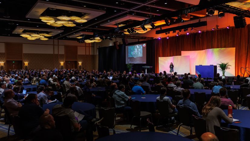
Having worked at Esri for almost 15 years and an Esri partner before that, the Esri User Conference (UC) has been part of my summer for many years. Vacations are planned around it. For some, the UC is a significant part of their vacation. For some, it’s on their bucket list. For some companies, they plan corporate meetings there. For organizations working on modernizing, they often send large contingencies. If you’ve never attended the in-person version in San Diego, put it on your list – a week of keynotes, technical sessions, user presentations, industry demo presentations, a map gallery, socials, special interest group meetings, a lot of friends and a week of drinking out of the GIS firehose. It’s a great week.
For anyone who has participated in a well-delivered virtual conference, it’s not a webinar. It is not a Zoom meeting. It has a lot of the elements of a traditional conference – connecting with experts, networking, exhibitors, plenaries with great speakers, paper presentations, tech sessions, access to resources, and a lot more. Esri staff behind the scenes have been working to be sure all the elements possible that you would get in San Diego, you’ll get this year. Together, we’re going to innovate, connect, and collaborate in new ways.
My first UC as Esri staff was quite a week. I had my presentations all organized. The paper sessions I was moderating were all ready to go. Our demos for the land records booth were all polished. Our Land Records Special Interest Group (SIG) meeting was prepared. We had many preconference organizational meetings all set up. I had partner meetings scheduled. We were organized and ready to go. And then the conference started….
There were so many people – users, newbies, oldies, business partners, families, babies, developers, account managers, event professionals – there were so many people to talk to and meet. There were so many business partners, booths, kiosks, displays, and places to get connected to get information. I got my work done, had all the meetings, but I wasn’t well enough organized to even walk the exhibit floor. There were many other elements of the conference I missed out on as well. Like many things in my life, I said to myself, “Now, that’s not going to happen again.”
This virtual UC is going to have a lot in common with the past UC’s. There is going to be a lot of people and a lot of sessions, user presentations, great plenaries, industry presentations, showcase kiosks, business partners, special interest groups, meetings – it’s a long list of activities and like my first UC without a good plan, its possible to miss out on a lot of what the conference has to offer.
I work with several professional associations, and because of the coronavirus, their annual conferences are being delivered virtually also. There has been input that some people aren’t going to attend their conferences because they won’t get the same experience. They won’t be able to network, and they won’t be able to meet with the people they want to meet with. It’s true that it won’t be the same experience, but if you detail what you want to accomplish, you’ll be able to. That’s where a good plan comes in. The virtual conference platform that Esri is using for the UC provides the ability to visit Esri showcase kiosks, find a special interest group, meet with staff, partners, and network with other attendees, but it requires a plan. Without a plan, it will be a bit difficult to accomplish all you want to.
Land Records SIG Community
Attend a special interest group from the comfort of your home. Here is an ArcGIS StoryMap for the Land Records SIG community.
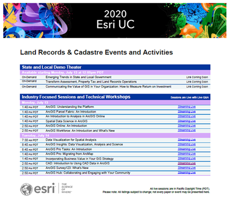
Like any conference, block off the time, maybe put up an away message. Be inspired by the plenaries. Schedule meetings. Review the detailed agenda, schedule, and attend the sessions that interest you and meet your needs. Schedule your meetings with partners. I got a sneak peek of what ProWest is doing – pretty cool. One nice part of this conference, if you have two conflicting sessions you want to attend, many of them will be recorded and delivered on-demand. But don’t rely on the recordings if you don’t have to because you’ll miss out on question and answer sessions and the networking elements. Here is a link to the Industry Fliers that list presentations, tech sessions, showcase schedule, and other relevant information organized by industry – check on these occasionally because they’ll be updated as information becomes available. This will help you find conference content relevant to you. Here is one for Land Records and Cadastre.

It’s going to be a great conference, but don’t wait. List your questions. Log in. Register. Get your Industry Fliers. Check out the plenaries. Review the detailed agenda. Create your schedule and be part of the largest GIS conference in history.

