WhereNext
5D: The New Frontier for Digital Twins
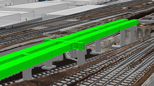
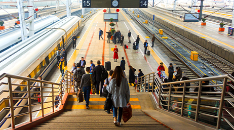
The Long Island Rail Road (LIRR) paired GIS with digital twin models to develop a 5D project management strategy for renovating Jamaica Station.
As leaders and proven problem solvers in the rail community, these heroes have gained deep respect from their colleagues by inspiring others to use GIS in innovative ways.

5D: The New Frontier for Digital Twins

ProRail improves transportation infrastructure
Italian Rail innovates and achieves smart goals
Tracking changes at ÖBB
Smarter rail with location intelligence

Tracking California's high-speed rail construction
Big maps for a big project: A Crossrail story
Improving transportation in South Yorkshire
Join conversations, ask questions, or browse documentation.

Esri User Conference | July 15–19, 2024 | San Diego, California

Instructor-led and self-paced options help individuals apply best practices and quickly learn ArcGIS software. Esri training consultants provide complimentary planning services to identify options that will best meet an organization's immediate, short-term, and long-term workforce training needs.

Esri partners offer specialized solutions built on ArcGIS to solve your real-world challenges.
Sign up to receive the latest news, updates, and helpful tips for transportation professionals.