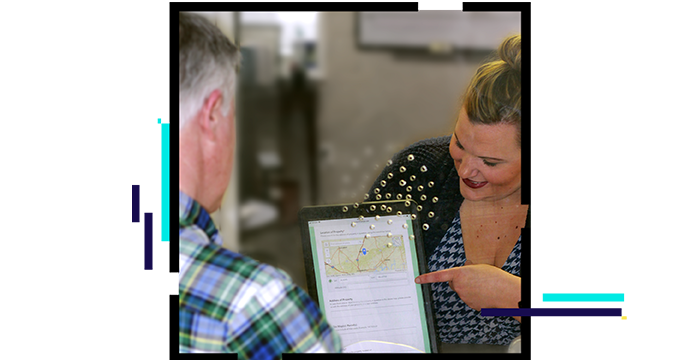
Skip to Content

Customer Care

Map of water utility assets

Helping customers help themselves

Empowering customers to access the information they want, when they want it, increases customer satisfaction. Fast new connections, information on conservation services, and outage restoration are on the top of customers' minds. Location-based data plays an integral role in providing this information in a timely and efficient manner. Esri's ArcGIS technology provides better access to the information they need, resulting in more informed, knowledgeable, and satisfied customers.

Download the ebook

Vital information

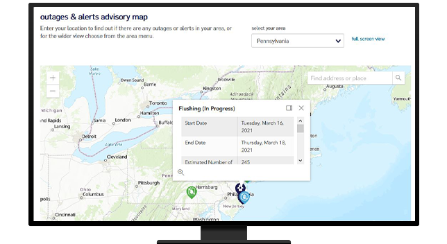
Esri's ArcGIS self-service portals can provide real-time data on boil-water order notices service outages and restoration, and maintenance activities day or night.

Map dashboard of outages and alerts

24/7 communication

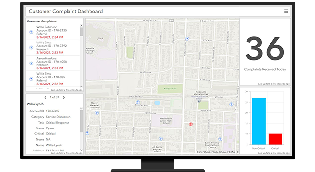
Customers rely on data to help them make decisions on safety in the event of an emergency. Social media integration enables customers to engage directly with utilities, providing valuable feedback and insights.

Outages and alerts advisory map

Improved customer service

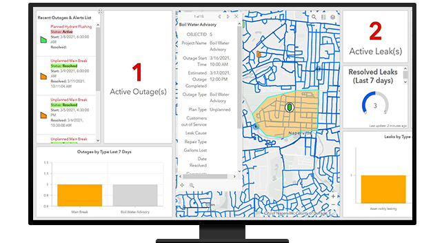
Access to real-time data from field crews and integrated business systems provides customer service representatives with immediate answers to customer questions.

Customer complaint map dashboard

USER STORY

Communication tool increases customer satisfaction

Lehigh County Authority implemented GeoDecisions Notify with ArcGIS to distribute critical information quickly and securely during emergencies.

Go to the user story

Water utilities segments

Previous
Next
See all water industries

Contact sales

Connect with the Esri water utilities team