
Eva Macek
Solution Engineer, Esri


Solution Engineer, Esri

Solution Engineer, Esri
Geospatial AI merges AI, ML, and deep learning with GIS, empowering organizations to gain insights, solve challenges, assess risks, and find opportunities swiftly. Explore GeoAI in ArcGIS to automate workflows, streamline processes, build models, and analyze diverse data seamlessly. We will also discuss the AI assistants available within the ArcGIS system.
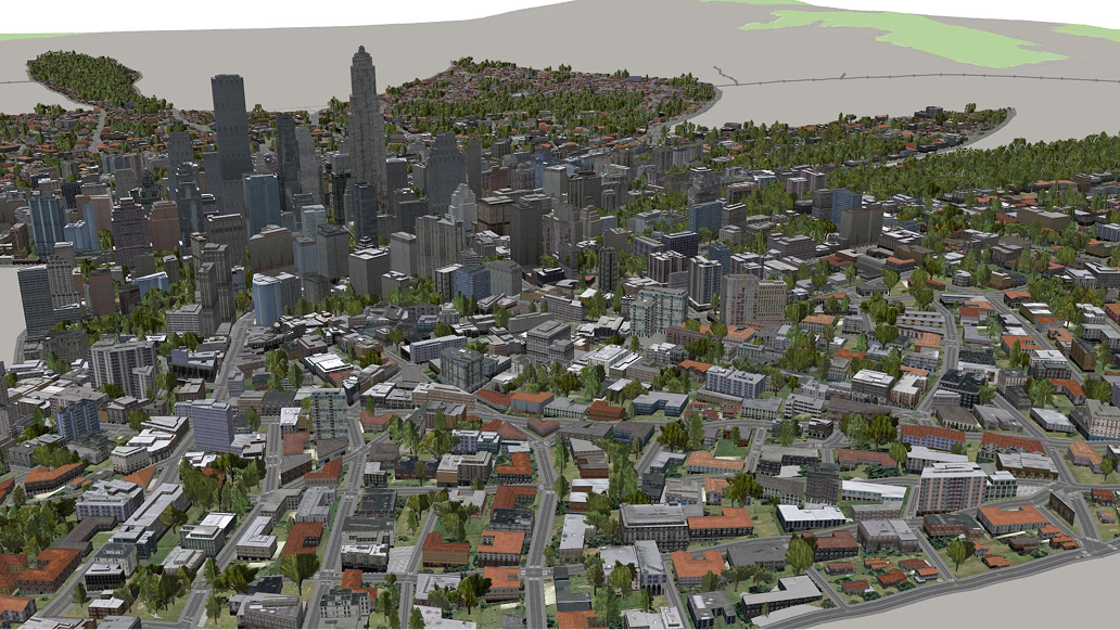
Delve into the realm of data management excellence with a specialized focus on leveraging ArcGIS Urban and ArcGIS CityEngine for efficient 3D GIS data handling. Explore how these advanced platforms empower users to organize, analyze, and visualize spatial data in 3D, enhancing decision-making processes and optimizing urban development strategies. Learn how to effectively structure datasets, integrate diverse data sources, and maintain data integrity for informed decision-making.

Join us to optimize field and mobile workflows with various mobile products. Streamline operations, data collections, and field tasks; ensure real-time data accuracy; and facilitate prompt data sharing for immediate analysis back in the office. Unlock the potential of seamless field data management.

Learn from Esri solution engineers as they share highlights from this year’s Esri User Conference (Esri UC).
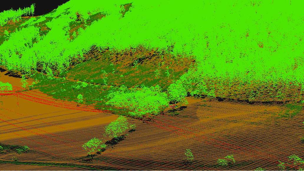
This webinar will showcase a comprehensive image and remote sensing management system that goes beyond mere data storage. Discover how this system enables seamless data storage, efficient search capabilities, and enhanced data discovery, laying the foundation for in-depth analysis, artificial intelligence integration, and immersive reality mapping.

In this webinar, learn how to leverage data sharing capabilities between different organizations. We will review best practices focused on eliminating data duplication and enhancing data integrity through collaborative workflows.

This webinar will explore the critical aspects of data quality management, beginning with important data preparation work that precedes any mapping or analysis. In ArcGIS Pro, we will look at how using the Data Engineering view makes it easier to visualize, clean, and prepare your data.

This webinar explores versioning in geospatial data management, emphasizing its role in data integrity and collaboration. We will discuss various strategies, benefits like change tracking and multi-user editing, and share best practices to enhance data management. Join us to streamline workflows and improve data governance in your organization.

Join us to explore online web editing tools available in ArcGIS Online and ArcGIS Enterprise Portal, specifically highlighting the new addition of ArcGIS Web Editor. ArcGIS Web Editor is a data editing application in ArcGIS Online and ArcGIS Enterprise that streamlines data maintenance workflows. Web Editor provides a streamlined approach to editing for GIS and non-GIS users.

In this webinar, we will be exploring non-coding tools for data manipulation and ETL processes, enabling users without programming skills to manage data effectively. We will highlight user-friendly applications such as ArcGIS Data Pipelines, ModelBuilder and the ArcGIS Data Interoperability extension that can be used to connect data across multiple platforms, perform data preparation operations, and synchronize data systems.