")
I like to think of geodesign as a perfect marriage of art and science. In geodesign, a GIS platform is used to support both the creative act of design and the scientific process of predicting impacts and evaluating outcomes.
We often think of geodesign as a form of landscape architecture, a way of improving the planning process by designing neighborhood-scale developments that balance environmental impacts, economic costs, and quality of life. But geodesign can also be applied to the planning and conservation of land and marine environments.
Recently, the cause of geodesign for landscape conservation received an enormous boost when Esri founders Jack and Laura Dangermond donated $165 million to The Nature Conservancy (TNC) to form the Jack and Laura Dangermond Preserve at Point Conception, roughly 25,000 acres of pristine coastal California.
Bypassed by the main coastal highway, Point Conception may be best known to those who have had the pleasure of riding Amtrak’s Coast Starlight train north of Santa Barbara, or to the generations of hikers who have risked high tides and trespass laws to visit the lighthouse. It was much in the news in the 1970s and 1980s when a terminal for liquefied natural gas was proposed and eventually defeated by popular protests fueled by phrases such as “Keep Conception Immaculate.” The area is also famous for a naval disaster that occurred in 1923, when seven US destroyers ran aground on rocks a few miles north of Point Conception.
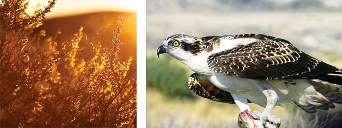
The preserve—whose physical beauty is brilliantly captured in a TNC video—occupies a unique location on the Pacific Coast of North America. It is where the predominantly north-south coast suddenly turns and runs east-west, and where the cold California Current finally relents, allowing warmer water to dominate around the Channel Islands and to the south.
In an article that appeared recently in The Atlantic, Dr. Henry Yang, chancellor of the University of California, Santa Barbara (UCSB), notes, “This is a conservation project of historic significance. The area is recognized globally for its rich biological diversity and ecological significance. As a transition zone from warmer southern species to cooler northern species both on land and in the coastal ocean, it provides a unique place to study and learn how climate affects the ecosystem.” The preserve is also a very significant place in Native American culture and rich in archaeological interest.
Managing a preserve of this size and importance will demand the best that creativity, science, and geodesign have to offer. Yet this opportunity could not have come at a better time. We can now image the earth at finer spatial resolution and more often than ever before, using a vast range of satellite, airborne, and groundbased sensors. We have access to aerial photographs of the area dating back decades. And the geodesign tools that are now available in the Esri platform are powerful and readily understood.
Against this richness, however, are the reality of global climate change and the stresses that we have recently seen in an extended California drought, such as massive late-season wildfires and the catastrophic flooding in neighboring Montecito. The offshore area is rich in oil deposits, and although there has been little new activity in recent years, announcements from Washington, DC, suggest that drilling, production, and their associated environmental hazards may well revisit the area in the future.
The prodigious responsibility of managing the preserve will fall to TNC. In addition to the gift, the Dangermonds will fund an endowed chair in conservation studies at UCSB. The chair will lead a research team that will conduct studies in the preserve in collaboration with TNC and Esri. Among the research questions that will likely dominate their studies are the following:
")
- What range of habitats exists in the preserve, and which of those habitats is most endangered?
- What have been the effects of climate change to date, and what effects can be predicted in the future?
- What has been the nature of human disturbance in the preserve, and how can its effects be mitigated and reversed?
- What interactions exist between the offshore, coast, and landscape segments of the preserve?
- What areas of archaeological interest exist in the preserve?
- What role can the preserve play in national and international networks of conservation areas and ecological research sites? In what ways is it unique?
As James Fallows, the author of The Atlantic article, makes clear, the Dangermonds intend the gift—and the publicity associated with it—to be an example of what other leaders in the tech industry can achieve through actions to conserve the earth’s resources. Not only that, but the Dangermonds want to set an example for anyone who has the means to do so to donate to nature.
“We want to inspire more people to give major contributions toward conservation,” said Jack Dangermond. “Conservation isn’t just being nice to animals or plants, it’s investing in the continued life support systems of humans and all other species on the planet. We need more people to step up to protect our last great places.”
Geodesign is an essential tool for such conservation, and its use in the management of the Jack and Laura Dangermond Preserve will be a model for others to follow.
About the Author
Michael F. Goodchild is emeritus professor of geography at UCSB, where he also holds the title of research professor. He is distinguished chair professor at the Hong Kong Polytechnic University and a research professor at Arizona State University, in addition to holding many other positions at universities around the world. Until his retirement in June 2012, Goodchild held the Jack and Laura Dangermond Endowed Chair in Geography and was the director of the UCSB Center for Spatial Studies.