Tech Time
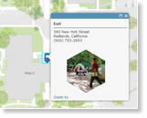
While GIS can do much more than put dots on the map, sometimes that's exactly what's needed. In a few steps, Esri's Bern Szukalski shows how to create a locator map and embed it in your website. Read the blog.
-
Developers can use Esri's new ArcGIS Runtime SDKs to create 3D scenes, use vector tiled layers in ArcGIS Runtime apps, and do much more. Read the blog. Test-drive ArcGIS Runtime capabilities.
-
Esri has created a powerful, modern, and easy-to-use Python API for your Web GIS. It was 18 months in the making. Read the blog. Learn more about the API and install it.
-
In this new Learn ArcGIS lesson, build skills in using Survey123 for ArcGIS to create and submit a survey and analyze results. Take the ArcGIS Online lesson.
Maps & More
-
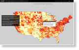
GIS technology is a great tool to use to decide where to target infrastructure spending on roads, bridges, airports, and ports, says Esri's Terry Bills. Read his blog. View the Strengthening America's Infrastructure story map.
-
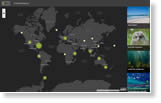
The International League of Conservation Photographers invites you to share your photos and stories about nature on the 1Frame4Nature story map. View the Story Map Crowdsource app.

-
The Septentrio Altus NR2 GNSS Receiver increases data collection accuracy when using Esri's Collector for ArcGIS on Android, iOS, or Windows mobile devices. Order today.
The Last Word
-
The ArcGIS development team shares its latest initiatives such as distributed Web GIS, the spatiotemporal big data store, and raster analytics. Watch the video.
-
Esri staff show how organizations can use Esri technology such as Operations Dashboard for ArcGIS, Web AppBuilder for ArcGIS, and Esri Story Map Journal for situational awareness. Watch the one-hour webinar.