ArcWatch: GIS News, Views, and Insights

June 2016


The ArcWatch Guide to the Esri UC

By Carla Wheeler
ArcWatch Editor

The Esri User Conference (Esri UC) is your oyster. Cool geospatial technology comes together in one place, making the weeklong experience exhilarating. But getting to every technical session, demo, and exhibit on your wish list can be daunting. So we suggest you do some advance planning and check out the ArcWatch Guide to the Esri UC for conference highlights and tips on what to see and where to eat in San Diego. The guide was created using an Esri Story Map Journal app. View the Story Map Journal.


This Story Map Journal serves as a handy guide to Esri UC happenings.

read the article

The Tip

Learn to Make a Demographic Map in Five Minutes

Esri Demographics can add valuable context to your GIS analyses. Just use the Enrich Layer tool in ArcGIS Online, which adds demographics to any map. Read the tip.

Join the Conversation

    The Headlines

    A Cool App
  • A Cool App

    Salt Lake County, Utah, created a useful online interactive map that helps senior citizens and others at risk for heat-related illnesses find air-conditioned facilities, called Cool Zones, in their neighborhoods. Read the article.

  •  
    A New Arctic View
  • A New Arctic View

    DNV GL, based in Norway, has launched The Arctic Risk Map, an online app that contains a wealth of information about oil and gas activities, shipping routes, ice conditions, and wildlife. Read the article.

  •  
    Faces of an Epidemic
  • Faces of an Epidemic

    Esri's Jeremiah Lindemann created the story map Celebrating Lost Loved Ones to honor his brother and other people who have lost their lives to the prescription drug and heroin epidemic. Read the article.

  •  

    The Geospatial Report

  • Mapping Green Infrastructure

    Gary Knell, president and chief executive officer of the National Geographic Society, outlines his organization's partnership with Esri on the Great American Landscape project, which will include a national green infrastructure map. Watch the video.

  • Policy, Maps, and You

    Browse through this collection of maps called Policy, Maps, and You, which includes demographic information that can help both governmental and nongovernmental organizations shape public policy. View the maps.

  • Mapping a Cosmonaut's Photos from Space

    Dave MacLean from the Centre of Geographic Sciences (COGS) in Canada created this Esri Story Map Tour app that maps photographs that Russian cosmonaut Sergey Ryazanskiy shot and then Tweeted from the International Space Station. View the Story Map Tour.

  • Teaching Topography with ArcGIS

    Geography teacher Dennis Hunink of the Netherlands uses Esri's ArcGIS Online and the Collector for ArcGIS app to help his students master subjects such as topography. And he's passing on his knowledge of GIS to fellow teachers. Read the article in GeoInformatics.

  •  


    Tech Time

    Put Your Drone to Work with Drone2Map for ArcGIS

    Put Your Drone to Work with Drone2Map for ArcGIS

    Consumer drones are fun to fly as a hobby, but these newfangled flying machines can also be productive at work, especially when teamed with Esri's new Drone2Map for ArcGIS. The new desktop app takes geolocated photos shot by the drones and turns them into professional imagery products that can be visualized and analyzed in ArcGIS. Read the blog. Get Drone2Map for ArcGIS.

  • Is Your Data Healthy?

    Bring a sample of your data to the 2016 Esri UC for a free data health checkup. Esri staff will diagnose problems or give your data a clean bill of health. Sign up today for an appointment.

  • Add Photos or Logos to Web Maps

    Want to add pictures in pop-ups or use photographs of logos as symbols on your map? Esri's Nuno Ricardo shows you how, using ArcGIS Online. Read his tip.

  • Intro to ArcGIS Pro

    Esri offers two-day instructor-led courses that teach GIS professionals how to get started using ArcGIS Pro. Learn more and register today.

  • Maps & More

    Test Your National Park Knowledge
  • Test Your National Park Knowledge

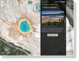
    Identify national park landmarks in the United States using this quiz, embedded into The National Park Bird's-Eye Quiz Esri Story Map Journal. Take the quiz.

  •  
    Where Is My Data?
  • Where Is My Data?

    You asked, and Esri answered. Contributors to the Esri Community Maps Program can now easily see where their data contributions are in the data processing workflow and get an estimated publish date. Learn more.

  •  
    Hardware Offer
  • Hardware Offer

    Esri offers ArcGIS for Desktop/ArcGIS Pro software bundled with Dell and HP hardware that can complement or upgrade your GIS infrastructure. Order today.

  • The Last Word

  • Making the Most of a "Digital Earth"

    Esri chief scientist Dawn Wright says that innovative digital technologies are shedding new light on changes happening to the earth. Sharing workflows and use cases, telling compelling stories, and building public-private partnerships will make these technologies, including digital data collection, analysis, and visualization tools, even more useful. Read Wright's article at DataDrivenJournalism.net.

  • Bringing Science to Life with Story Maps

    The United States Geological Survey (USGS) is transforming complex scientific findings into interesting stories using Esri Story Map apps. One example was a story map on the dangers posed to people by low-head dams and what is being done to reduce the hazard. "You can get the story behind the science," says Gary Latzke from the USGS. Watch the video.