
The US Geological Survey (USGS), with help from Esri, has created a global map of ecological land units (ELUs) to identify nearly 4,000 ecological areas that are unique combinations of four factors: bioclimate, landforms, rock type, and land cover. The World Ecological Land Units Map and its data are important for understanding and managing our world’s ecological resources. In the hands of scientists; resource managers; and, ultimately, policy makers, the map and data can be referenced to ensure that ecologically diverse areas are protected from neglect, development, and overuse.
To familiarize yourself with the concepts that underpin the map and its data, you can use a special Esri Story Map Journal called Explore a Tapestry of World Ecosystems. The story map lets you identify the ecological land unit of any location, switch on maps of each of the four ELU factors, and take a guided tour of some of the most ecologically diverse places on the planet. Investigating locations with the story map is easy. Just click on the map window or take the tour by clicking the tour buttons on the right side of the window.
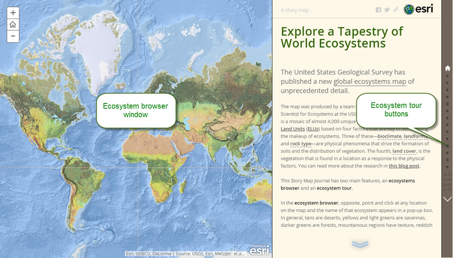
The Explore a Tapestry of World Ecosystems Story Map Journal lets you interact with the map and its data in the browser window and tour ecologically diverse locations by using the tour buttons.
Once you start the tour, you can also switch on thematic maps: bioclimate, landform, rock type, and land cover. You will then see, for example, whether the bioclimate in an area is cold/moist or hot/wet, the land form is hills or flat plains, the rock type is unconsolidated sediment or acid plutonics, and the land cover is shrubland or closed broad-leaved deciduous forest. Photos of the land you are exploring on the map are woven into the narrative about the area.
Here’s how to get the most out of the app.
Step one: Explore the global ELUs map.
Get to know the data at the global level.
- Pan and zoom to find areas you are interested in. Use the controls at the upper left to zoom in, or hold down the Shift key while drawing a box around the area of interest.
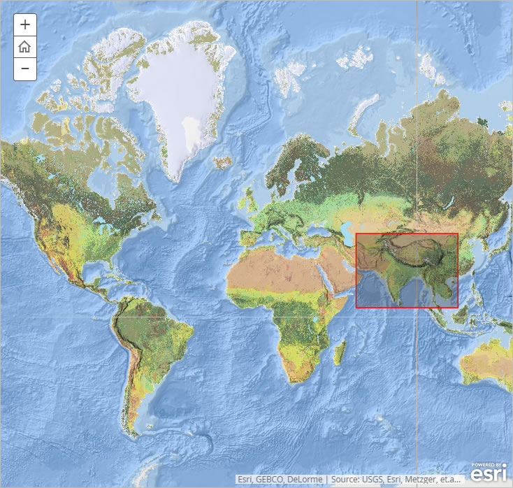
Hold down the Shift key and draw a box to zoom in to your area of interest.
- Click on any location, and the name of the ecosystem will appear in a pop-up.
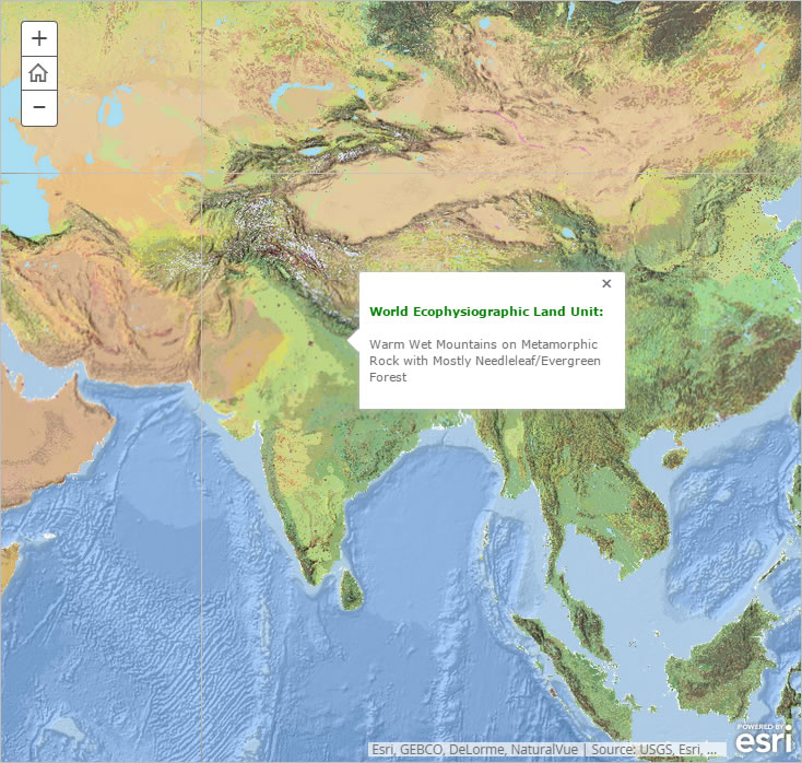
Pop-ups let you find the name of the ecosystem at any location. The name itself is a description of the four ELU factors.
In general, shades of tan represent deserts, yellows and light greens depict savannas, darker greens indicate forests, and texture signifies mountainous regions.
- Click the links in the right pane, as shown below, to see thematic maps of each of the four ELU factors.
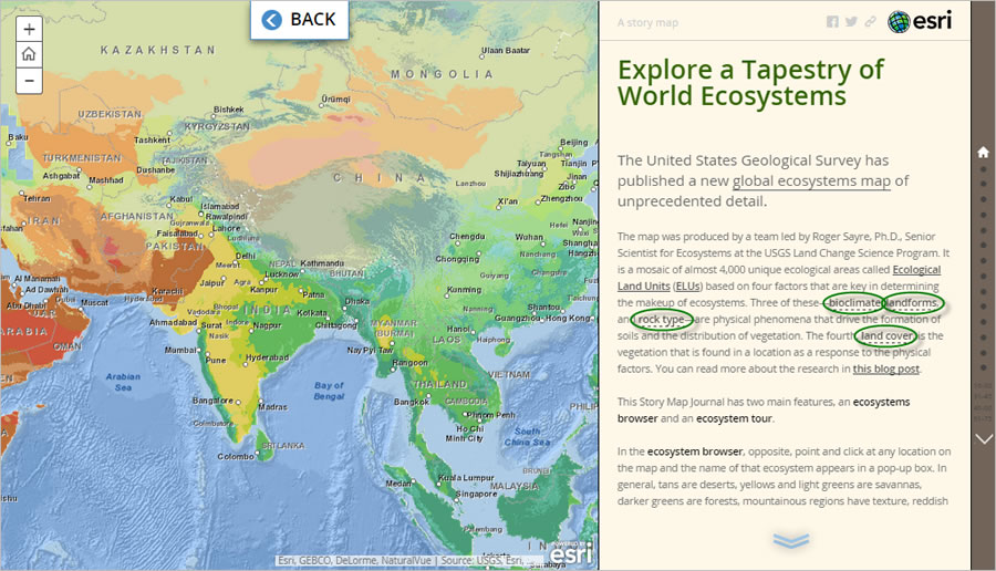
To see individual maps of the four factors used to define the ELUs, you can click the links in the text on the right. The BACK button at the top returns you to the ELU map.
- Click the BACK button at the top to see the ELU map again.
Step two: Take the tour.
After you familiarize yourself with the map, you can start to explore some of the world’s most ecologically diverse locations in more detail.
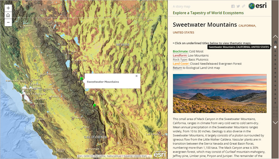
- Clicking the white buttons in the right pane take you to some of the most interesting places on the planet in terms of ecological diversity. Three of these are described below. Click one of the tour buttons (or scroll down) to start the tour. For example, click the first tour button to see the Sweetwater Mountains in California in the United States.
Clicking the tour buttons on the right-hand side will reveal fascinating places that are described in the text and displayed in the pictures.
- The page for any tour spot includes links that change the map so you can see each of the four factors that contribute to the location’s ecology. Click a link to see what the bioclimate, landforms, rock type, or land cover are in that area. A new map will appear that shows the factor you are interested in for the tour location you selected.

The links on a tour page let you see the thematic maps of the four ELU factors.
Three of the factors—bioclimate, landforms, and rock type—are physical phenomena that drive the formation of soils and the distribution of vegetation. The fourth—land cover—is the vegetation that is found in a location with such physical factors.
Here are some particularly interesting places: Susúa and Guánica Forest, Puerto Rico This subtropical forest in southwest Puerto Rico only gets about 30 inches of rain per year, unlike the El Yunque rain forest on the north side of the island which gets more than 200 inches of rain annually. The 1,000-acre park, maintained by Puerto Rico’s Department of Natural Resources, is home to many species—many of which are endangered. Susúa and Guánica Forest is considered the best example of a dry rain forest in the Caribbean. It was designated a forest reserve in 1919 and, in recognition of the efforts to conserve natural processes and resources in the forest, it was designated a United Nations international biosphere reserve in 1981.
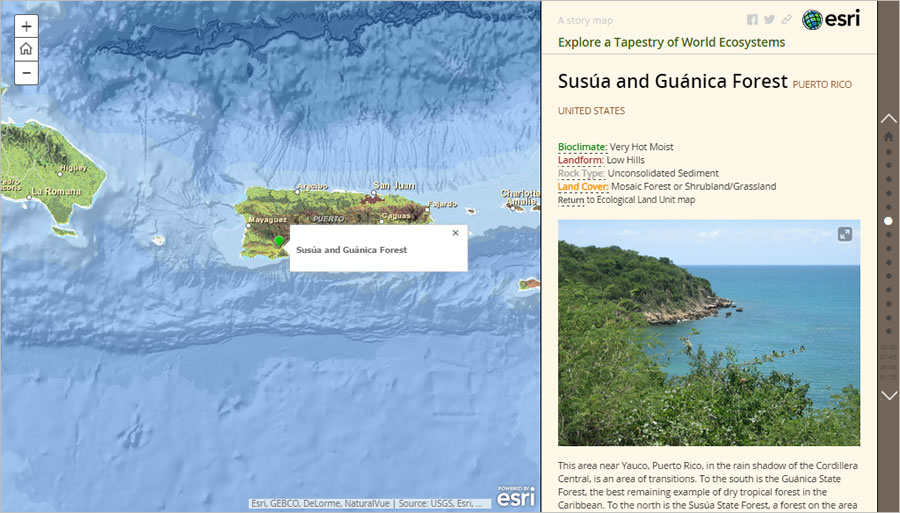
The area highlighted on this map is just north of the Susúa and Guánica Forest in Puerto Rico. It is in a mosaic forest of low hills in the rain shadow of the Cordillera Central mountain range.
Alhama de Aragón, Spain The name of this town is derived from the Arabic word al-hammam, meaning “the baths.” Alhama’s hot springs are the source of one of the primary industries in the area—spa hotels. The carbonate sedimentary rock here is formed by a process of rapid precipitation of calcium carbonate, often at the mouth of a hot spring. The cool, semidry climate in this hilly region makes it ideal for growing fruit including grapes for wine. There are many fruit farms and vineyards in the area.
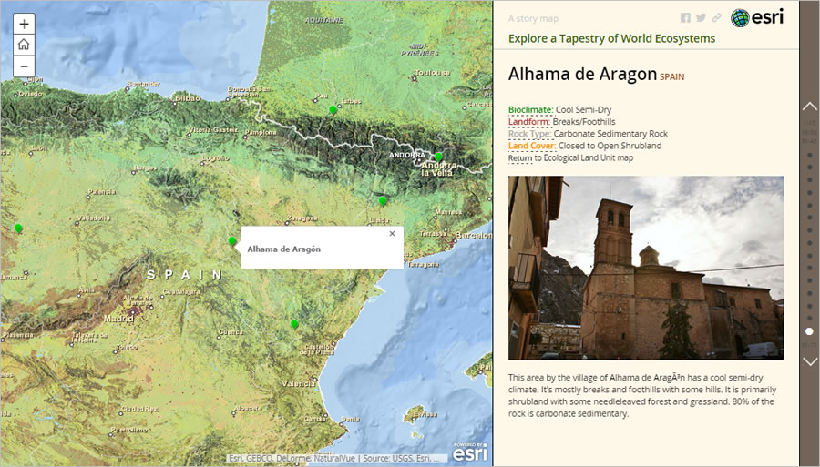
Alhama de Aragón is known for its spa hotels such as Hotel Balneario, which has a five- acre thermal lake with a constant temperature of 93°F (34°C).
The Komati River in the Drakensberg, South Africa Winding rivers, including the Komati, flow through the low-lying area at the base of the Drakensberg portion of the Great Escarpment. The open herbaceous vegetation is bushveld and highveld grassland. This is an important ecological region because it’s one of the last remaining strongholds of several grassland species. This once-expansive region has been disrupted by water transfer projects and drastically reduced in size due to agricultural fragmentation. Consequently, some of the species in the remaining highveld are now threatened with extinction.
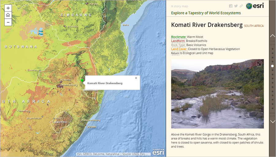
The Komati River Gorge is an ecological stronghold for some of the world’s most threatened grassland species.
Step three: Share the map with others.
Once you’ve explored some of the amazing diversity of our planet through this map, you’ll want to share it with others.
- You can share the ELU map through social media (Facebook or Twitter) using the buttons at the upper right.
- You can also use the share button to copy a hyperlink to the map. Paste the hyperlink in an e-mail or text message to share the map with your friends and colleagues. Or copy the HTML code if you want to embed the story map in a web page. Options to share the map include providing a hyperlink and HTML code.
To learn more about the map and its data, read this blog post. You can also read about the concepts and methods for deriving the ecological land units—see the online PDF booklet published by the Association of American Geographers.
