Technical Talk
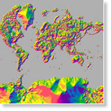
Use elevation data in your GIS applications by tapping into Esri's two world elevation dynamic image services, Terrain and TopBathy. All you need is an ArcGIS organizational account.
-
Esri just released the Multi-Directional Hillshade in ArcGIS Online. You can add it to your desktop or web apps. Read the blog.
-
Esri's Suzanne Foss and Vinay Viswambharan demonstrate the capabilities of ArcGIS Pro, an application that will be included in ArcGIS 10.3 for Desktop.
-
Which ArcGIS Online basemap best works with your map or app? Read this blog and access a matrix to use to make your selection.
-
Using the ArcGIS ModelBuilder application, you can open any model tool, change settings, and quickly run the model to test alternative scenarios. A useful technique to quickly change tool criteria and rerun a model outside of ModelBuilder is to add model parameters. Learn how in this article.
Et cetera
-
Esri chief scientist Dawn Wright talks to ECO magazine about Esri's support for science using GIS and a variety of initiatives.
-
More than 150 organizations from around the world took home a Special Achievement in GIS Award from Esri this year. Find out who won.
-
The next generation of Esri Tapestry Segmentation tells you all about the demographics and lifestyles of every US neighborhood.
-
Join thousands of others interested in geospatial technology for Esri's massive open online course (MOOC) in spatial analysis starting September 3, 2014. Learn more and watch the video.
-
Esri announces the winners of its Storytelling with Maps Contest. See where the winners hail from using what else? A story map.
-
Esri's Linda Hecht interviews Richard Saul Wurman about the Urban Observatory and where it will go next.
Endpoints
-
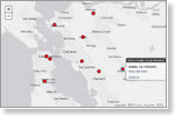
Find out how the Recovers, WorkHands, and thrdPlace apps use GIS maps to promote volunteerism, ready communities for natural disasters, and help skilled trade workers find jobs.
-
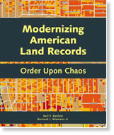
Modernizing American Land Records offers a historical and modern view of American land systems. It considers the opportunities when technology is properly used to connect rights, restrictions, and responsibilities with the location of land features. Buy the book.
-
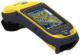
Both the GeoCollector for ArcPad and GeoCollector for ArcGIS for Windows Mobile high-accuracy data collection solutions have been updated to include Trimble's new Geo 7X handheld with an optional range finder module. Learn more about all Esri and Trimble offers.