Tech Time
With Esri Maps for Office, you can make interactive, dynamic maps that add geographic content to your PowerPoint presentations. Read the article.
-
Learn to create a real-time operational view to monitor emergencies using Operations Dashboard for ArcGIS. Take the Learn ArcGIS lesson.
-
Esri has just added new capabilities to ArcGIS Online, including enhancements to smart mapping, scene viewer, and analysis tools.
Read the blog.
-
Esri's Suzanne Boden offers some ArcMap, ArcGIS Pro, and ArcGIS Online shortcuts and tips. Read the blog.
Maps & More

-
Esri president Jack Dangermond believes that GIS and geoanalytics will play a major role in applications for the Internet of Things (IoT). Read the article.

-
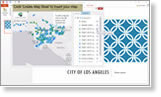
Need a little inspiration for your next map creation? Then check out the Esri Cool Maps gallery for ideas. Read the article.
-
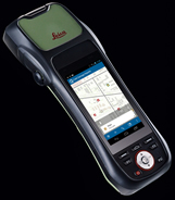
Esri and Leica offer the new ZenoCollector, a high-accuracy solution for ArcGIS using ArcGIS Online and Collector for ArcGIS. Order today.
The Last Word
-
This story map takes you into the Danakil Depression in Ethiopia, Africa, where volcanic activity and blistering temperatures make this one of the hottest places on earth. View the story map.
-
If it has been a while since you dropped in, stop by ArcGIS Marketplace and see new apps from AccuWeather Enterprise Solutions, SmarterBetterCities, and other companies.
Go and explore