Technical Talk

-
National Guard units can use and customize Esri's new Minuteman Viewer, which will help them view operational information and coordinate a response during disasters and other emergencies. Read the blog.
-
With new individual developer plans for ArcGIS Online, all kinds of developers can build apps for their organization, the ArcGIS community, or the world. Read the blog post.
-
During disasters such as fires or floods, the need arises for impact maps. They answer specific questions such as, How many houses will be affected? Read these great tips on how to make an impact map.
-
Visit the GIS Bibliography to find books, journals, reports, and conference materials related to geography, GIS, lidar, and more.
-
Krishnaprasad Jagadish, from the Esri Applications Prototype Lab, used ArcGIS Runtime SDK for iOS to create a unique application to run Urban Observatory on multiple iPads.
-
This colorful poster is packed with story map best practices and tips.
-
Watch this video to see how 3D GIS can help you model and manage interior spaces such as office buildings and hotels.
-
Esri cartographers Aileen Buckley and Kenneth Field explain the cartographic methods they use to make visually pleasing and highly understandable maps.
Et cetera
-
Interested in design and GIS? Register soon for the Geodesign Summit, to be held January 29–30, 2014, at Esri in Redlands, California. Submit your Lightning Talk abstract by October 18, 2013.
-
Submit your maps for Esri Map Book, Volume 29, using this portal. If your map is selected, it will be published and distributed at the Esri International User Conference in 2014. Submission deadline: 5:00 p.m., October 25, 2013.
-
See the locations of some new Community Maps updates in this Esri story map, including Chicago, Illinois; Appleton, Wisconsin; and Village of Alert Bay, British Columbia, Canada. Read the blog.
-
Kick your GIS Day planning into high gear by downloading resources to promote your event. And it isn’t too late to register your 2013 event. See Flickr photos of past GIS Day celebrations.
-
Modeling a City Using Esri CityEngine introduces you to the elements of a 3D city model and the guidelines for GIS data needed to create one. Take the web course.
-
The Data QC with ArcGIS: Automating Validation web course will teach you automated workflows to make sure data adheres to your organization’s quality standards.
Endpoints
-
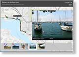
Yes, it’s possible to create a story map in mere minutes. Esri education manager Joseph Kerski created one using photos he took and location information he collected as he walked from the San Diego Convention Center to San Diego International Airport following the Esri International User Conference. Read his blog.
-
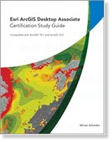
Esri offers exams to certify professionals' expertise in Esri products and technology. New from Esri Press is the Esri ArcGIS Desktop Associate Certification Study Guide. You will get an overview of the skills measured in the ArcGIS Desktop Associate Certification exam. Buy the book.

-
Esri offers US customers three packages with a Juniper Systems Mesa Geo Rugged Notepad. They offer the advantages of both a tablet and a rugged handheld computer. These devices come packaged with ArcPad or can be used with ArcGIS for Windows Mobile.