Technical Talk
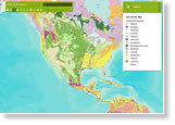
Esri offers several app templates that provide basic map viewing capabilities. One is Storytelling Basic. Another is Storytelling Text and Legend. Find the ideal map viewer to suit your target audience. See your options.
-
What can Esri's Find Hot Spots tool do for you? Watch the video.
-
Esri hosts a free web course that introduces you to the 3D world of procedural modeling using Esri CityEngine.
-
Contributing road data to Community Maps? Use this tool to convert road polyline features and attributes to the Community Maps model so Esri can use your roads in the World Topographic Basemap. Read the blog.
-
Mainstream Renewable Power, headquartered in Dublin, Ireland, uses Esri ArcGIS to manage vast amounts of information related to wind and solar farm projects in Europe, North America, and Africa. Read the article.
-
Want to add Tweets to your map? Here's how using two Esri templates.
-
If you are thinking about Esri technical certification, take one of these free sample question courses.
Et cetera
-
Esri intern Katherine Desy plans to take what she learned at the Esri User Conference back to school and, during her presentations, “blow people away with my interactive maps!" Read the blog.
-
Esri is offering a free trial to ArcGIS 10.1.1 for Desktop Advanced with 10 extensions.
-
Esri's education manager Joseph Kerski guides you through using new capabilities in ArcGIS Online to create and deliver a presentation.
-
Congratulations to the winners of the Esri Climate Resilience App Challenge.
Endpoints
-
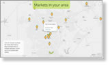
The number of farmers' markets shot up by more than 6,000 venues in the last 20 years in the United States. Find those closest to you using this Esri Story Map. And read the article about the farmers' market phenomenon at Smithsonian.com.
-
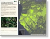
Esri's Allen Carroll interviews Robert Rose from the Wildlife Conservation Society about the problem of ivory poaching. Visit this Story Map Journal to see where elephants have been killed for their tusks and where the population of these animals has steeply declined.

-
Esri offers Cutting Edge servers preinstalled with ArcGIS for Server on both Windows and Linux. These offers include optional database servers preloaded with Microsoft SQL or PostgreSQL.