Fall 2002
Fall 2002 |
|||||||
|
|
|||||||
22nd Annual Conference Draws 11,000 GIS Professionals
Setting a Course for Sustainability |
|||||
Invoking familiar themes of collaboration, cooperation, and sharing, Jack Dangermond told the attendees of Esri's 22nd Annual International User Conference that geography and GIS are necessary tools "if we are to sustain our world. Your work is making a difference regardless of where it's at." "Geography--Sustaining Our World" echoed throughout the halls of the San Diego Convention Center July 8-12, 2002, as nearly 11,000 GIS professionals gathered for the conference that focused on sharing geographic knowledge. "I'm so encouraged that communities are forming from the use and sharing of geographic information," Dangermond, Esri president, said during the opening of the plenary session. "I don't know of any other group that is so multidisciplined and focused on so many different purposes." Elaborating on the sustainability theme, Dangermond said that GIS professionals are "helping to make things more efficient, and that's a key to sustainability." He recalled that Buckminster Fuller coined the phrase "spaceship earth" to inspire individuals to look at the larger concept of humanity's impact on the earth's natural systems. Fuller, who passed away in 1983, was the inventor of the geodesic dome, an architect, engineer, mathematician, poet, and visionary. Humans are having an increased effect on the planet, and Dangermond cited a recent study from the proceedings of the National Academy of the United States of America that says existing data shows human demand might well have exceeded the earth's ability to regenerate its natural resources by approximately 20 percent. "We need to manage this crisis; we need to get conscious of it," he said. And, while financial systems can help to a certain extent to organize and report, "they don't always account for some of the important things--things that sustain you and ultimately sustain life." Dangermond told the assembly that in spite of the context of this news, he feels strongly that geography and GIS provide us with a promising future. "GIS gives us a process for guiding and integrating our human activities with nature." He "Development and implementation of a spatial data infrastructure are prerequisites for promoting sustainable development," said Dangermond, "and for me, the key is you." He said GIS professionals will be special in this activity because they understand what's needed to plan, create good spatial data, and develop a network of collaborators so that we can maintain sustainable development--living within the regenerative capabilities of the biosphere while meeting our present needs without compromising the future. GIS software has evolved from special projects to systems and is now being integrated with the Internet. "As we integrate some of these tools, it's my sense that this will evolve into a 'digital earth' or a nervous system for our spaceship earth. This is exciting and offers a glimmer of hope in what otherwise is difficult for us as individual human beings to deal with," said Dangermond. He concluded by telling the audience, "By working together the GIS community can make a significant contribution to the development of a sustainable future. With our spirit of collaboration, we can make a difference." Making a Difference at Home and AbroadSeveral other distinguished speakers were also part of the plenary program. Nature historian Cynthia Moss was the keynote speaker. Her Amboseli Elephant Research Project (AERP), which collects, analyzes, and disseminates data on African elephants, is now part of the GIS community. She spoke to the audience about her more than 30 years of research at Amboseli National Park in Kenya, where she has intimately studied the ecology and social behavior of a group of more than 1,800 wild African elephants. Moss has set up the African Elephant Conservation Trust to fund AERP and to seed other projects that would share her noninvasive philosophy and methodology. "We can all work together to keep elephants here," she said. For more information on how you can help, visit www.elephanttrust.org. (See "African Elephant Cause Aided by the GIS Community.")
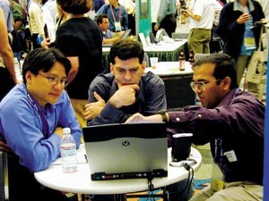
Harvey Croze, cofounder of AERP and former director of the United Nations Environment Programme/Global Resources Information Database in Nairobi, explained the data management and analysis aspect of the elephant research. The project has a continuous data set of spatial information that spans 30 years. In 1972, when AERP began, researchers hand-recorded the information onto paper maps with grid squares. Today, they are recording observations with a global positioning system and using GIS to analyze the distribution of elephant groups. In other highlights of the plenary, Dangermond gave the President's Award to Alan Leidner, assistant commissioner, geographic information systems, New York City Department of Information Technology and Telecommunications. Dangermond acknowledged the work of Leidner and his department "in reconstructing a complete GIS within days after the September 11 tragedy. The GIS community is paying tribute to those who went out of their way to help." Leidner said that GIS technology provided vital information during the emergency, informed millions of people about what was going on immediately after the crisis, and is now being used to assist with rebuilding efforts. In accepting the award Leidner said, "Esri software powered the effort and worked magnificently." He said GIS technology is the highest expression of information technology. "There's something about GIS. It brings data to life." Gilbert Grosvenor, chairman of the board of the National Geographic Society, received Esri's Lifetime Achievement Award for his grassroots commitment to teachers and his unwavering belief that geography matters. Grosvenor's work centers on his determination to see geography taught throughout America's schools. "Educating all people about the impact of geography is the mission of the National Geographic Society and Esri," said Grosvenor. Esri R&D Touches Many TopicsDangermond discussed more than a dozen of Esri's research and development projects. He said one area of concentration will be on evolving GIS software into a more server-centric technology that delivers dynamically integrated services through networks. "Along with Web services protocol, these networks will provide the glue that connects all of the different services," he said. "With these open and interoperable services, the GIS community will be able to dynamically share its knowledge." Dangermond explained that g.net refers to the architecture of distributed services, which builds on the concept of Web services integrated with GIS. Another major, multitiered Esri endeavor involves the integration of spatial data inside database management systems. The project, which Dangermond said is maturing, entails storing a geodatabase within standard relational tables that are optimized to support complex geoprocessing transactions as well as high-performance computing for decision support. "Our vision is to integrate the data environment with tools for image processing and photogrammetry so these tools are doing long transactions on a database repository," said Dangermond. Another step in the process is to replicate parts of the geodatabase at different institutions where long transactions are occurring independent of one another. "This facilitates the notion of distributed geographic data management and, I think, provides us with the key to implementing things such as the National Spatial Data Infrastructure," he said. Dangermond also discussed the integration of survey information, facilitating easy-to-use data modeling within the geodatabase, the complete implementation of geoprocessing within the ArcGIS environment, and a modeling interface, which will enable users to drag and drop data sets and functions. "Standards and interoperability are necessary to make this environment work," said Dangermond, and he explained how Esri was actively working with several international standards organizations. Other Esri development projects, mobile GIS and real-time GIS, will empower people in the field with GIS through the use of global positioning systems and other wireless technology. In the realm of database cartography, there has been progress in the migration toward server-based technology, which calls for "introducing cartographic layers into the database and extending editing tools for cartography," according to Dangermond. This research is aimed at resolving issues with map series development and enabling users to link and view both geographic and schematic data in the database. The Geography Network, Esri's first development project to implement distributed geoprocessing, dramatically expanded its content and chalked up 300 percent more usage over the previous year. An implementation of the g.net architecture, the Geography Network has a strong metadata catalog and open access to multiple clients. "It has thousands of services, makes millions of maps, and responds to several thousand inquiries each day," said Dangermond. Dangermond also introduced a new Web service at Esri called ArcWeb USA, which will be commercially available on a round-the-clock basis providing geoprocessing services (see "Introducing ArcWeb USA"). Growth and StabilityDangermond told the audience that Esri has five purposes--to advance GIS, to support its users and partners, to develop a GIS workforce through education, to support its employees, and to maintain a stable growth pattern. He said the company grew 20 percent last year and now serves approximately 100,000 organizations. "This doesn't Last year Esri began several collaborations with other technology partners. At the plenary, Dangermond announced a new partnership with the SAS Institute, which will respond to users' requests for integrated technology between the two organizations (see "SAS and Esri Team Up to Deliver Spatial Intelligence"). GIS Awareness Through EducationIn the realm of education, Dangermond said that classroom training has increased to 38 courses. Last year, Esri trained approximately 60,000 people in its instructor-led classrooms. The Virtual Campus is another education option that offers affordable self-paced classes and a library of bibliographic data. Esri Press has released more than 40 publications and is focused on providing summary case studies and technical product information. New releases include Mapping Our World, a resource for teachers seeking to bring GIS to their classrooms; Arc Hydro; and Confronting Catastrophe. www.esri.com/esripress Dangermond mentioned several GIS outreach projects in which Esri is actively involved. The Esri conservation program supports more than 4,000 groups with grants, technology, and scholarships, and Esri supports the programs of the Society for Conservation GIS. The fourth annual GIS Day is scheduled for Wednesday, November 20, 2002, and Dangermond encouraged GIS users to open their doors to schools, Businesses, and the public to help spread a better awareness of this important technology. Esri is a principal sponsor of the event. www.gisday.com Promoting GIS education in K-12 schools and at the university level is another Esri project. The My Community, Our Earth program is concentrating on enabling students around the world to analyze issues of sustainable development. Three days before the start of the Esri User Conference, the second annual Esri Education User Conference convened in San Diego. More than 500 educators attended discussions, presentations, and workshops geared toward teaching GIS. www.esri.com/educ A Peek at ArcGIS 9In one of the most captivating demonstrations during the plenary, Dangermond gave the audience a preview of the ArcGlobe application, which will be part of the functionality of the 3D Analyst extension in ArcGIS 9. Calling it "whole earth visualization," he said the method will provide a new way for how we think about He stressed the notion of thematic layers and showed the audience several examples using terrain, vegetation, and population density layers. He also displayed a thematic layer depicting the footprints of the Geography Network across the globe. Interoperability, Performance, and QualityEsri software developers focused the second half of the plenary session on new product enhancements and discussed the direction of Esri research. The main themes of the new product initiatives were expressed in tools for automated geoprocessing and analyses and Web services based on a distributed GIS platform to connect, integrate, and disseminate information. ArcGIS 8.2, ArcGIS StreetMap Europe, ArcGIS Publisher, and ArcReader--Among the recent releases, ArcGIS 8.2 improves integration with ArcIMS, adds an assortment of enhancements including a spatial adjustment toolbar, improved labeling and annotation, metadata improvements, support for the military grid reference system, and two new extensions--ArcGIS StreetMap Europe and ArcGIS Publisher. GIS users can publish and share electronic maps locally, over networks, or via the Internet with ArcGIS Publisher. The published map files are viewable through ArcReader. ArcGIS StreetMap Europe supplies European street map layers, which automatically manage, label, and draw features. www.esri.com/arcgis ArcGIS 3D Analyst 8.2--Another extension, ArcGIS 3D Analyst 8.2, has the added capability of ArcScene, which gives users an interface for viewing multiple layers of three-dimensional data and for creating and analyzing surfaces. ArcView 8.2--The world's most popular desktop GIS software has a new release, ArcView 8.2, an ArcGIS family member that brings state-of-the-art data visualization, query, and map creation to the desktop. It supports the new ArcGIS extensions. www.esri.com/arcview ArcIMS 4, ArcIMS ArcMap Server, and ArcIMS Route Server--The latest version of Esri's GIS for the Internet, ArcIMS 4 is a powerful, scalable, standards-based tool that enables users to create a central repository for publishing and browsing metadata over the Internet. This version, which is now available to Linux and HP-UX users, supports two new extensions--the ArcIMS ArcMap Server and ArcIMS Route Server. ArcMap Server, included at no additional charge, integrates the ArcGIS family of products and enables users to share files created in ArcGIS ArcMap online. The ArcIMS Route Server brings fast, accurate routing along with point-to-point driving directions to Web sites built with ArcIMS 3.1 or ArcIMS 4. www.esri.com/arcims ArcView 3.3--Now available, ArcView 3.3 includes updates to Projection Utility, the Database Access extension, and the Report Writer extension. ArcView 3.3 features better raster assistance and additional data support and comes with eight CDs of data. www.esri.com/arcview3x ArcPad 6 and ArcPad Application Builder 6--Esri's ArcPad 6 and ArcPad Application Builder 6 are the latest mobile GIS introductions in the ArcGIS family of products. ArcPad 6 users can customize with ArcPad Application Builder 6. They can create toolbars with built-in tools, design custom forms for streamlined data collection, build applets, write scripts, and develop extensions to support new file formats and positioning services. ArcPad 6 features extend GPS receiver support, internationalization, and localization. www.esri.com/arcpad MapObjects--Java Standard Edition--Esri's collection of GIS and mapping components, MapObjects, has a new release, MapObjects--Java Standard Edition. Developers can use this suite of more than 900 Java-based GIS and mapping developer components to build custom, cross-platform GIS applications or applets. www.esri.com/mapobjects 2002 Sourcebook·America--Esri Business Information Solutions (Esri BIS) launched its new 2002 Sourcebook·America demographic data CD at the conference. This new edition of Sourcebook·America merges Esri BIS demographic data for every U.S. ZIP Code and county with Esri's ArcReader map display technology (see "Sourcebook·America CD With ArcReader Now Available"). www.esribis.com BusinessMAP 3--BusinessMAP 3 is now shipping. BusinessMAP 3 transforms information from databases, contact managers, spreadsheets, and electronic phone books into maps for analyses and decision making (see "BusinessMAP 3 Now Shipping"). www.esri.com/Businessmap ArcGIS 8.3--David Maguire, director of software products, introduced several presentations by Esri software developers who unveiled new products. The third major phase of ArcGIS was previewed. ArcGIS 8.3 introduces topology into the geodatabase and an improved set of editing tools including a fix topology tool and an error inspector. Disconnected editing where users can work in a check-in/checkout environment and linear referencing for creating, editing, and displaying linear referencing models are other new features. www.esri.com/arcgis ArcGIS Survey Analyst, ArcGIS Tracking Analyst, and ArcScan for ArcGIS--New ArcGIS 8.3 extensions debuting were ArcGIS Survey Analyst, ArcGIS Tracking Analyst, and ArcScan for ArcGIS. ArcGIS Survey Analyst establishes relationships between survey data and a GIS. Surveyors and GIS professionals can use ArcGIS Survey Analyst to improve the accuracy of existing GIS features or to locate new unmapped elements for addition to the GIS database. A powerful complement to the ArcGIS Desktop product line, ArcGIS Tracking Analyst enables visualization and analysis of time-related data by defining temporal events in terms of time, position, and attributes. ArcScan for ArcGIS enables users to work with imagery, extract features, and do raster cleanup. www.esri.com/arcgis ArcWeb USA--ArcWeb USA is Esri's first offering of GIS Web services in the new family of ArcWeb Services products. Developers can use ArcWeb USA to include GIS content and capabilities in their applications without hosting the data or developing the necessary tools. With ArcWeb USA, users have access to U.S. streets, topography, and demographics and can geocode and locate sites (see "Introducing ArcWeb USA"). www.esri.com/arcwebservices A Week Teeming With GIS ActivitiesConference goers attended more than 1,100 technical sessions, paper presentations, and workshops, and more than 150 special interest group meetings were offered. In addition to the Map Gallery where GIS users' work was displayed, there was the Exhibit Hall with more than 300 exhibitors and the Esri Showcase. There were also several special exhibits, including the View from Space, which treated attendees to views of some of the digital imagery compiled by NASA; the USGS' mapping display, Foundations for Enterprise GIS, which presented automated mapping, digital cartography, and spatial database management; and a tribute to New York City featuring maps and posters depicting the role GIS played in the emergency response and recovery efforts. Capping off the week of activities was the Special Achievement in GIS Awards Ceremony with 150 organizations recognized. www.esri.com/sag |

 said there was much we can do to reduce our consumption of resources, and he encouraged everyone to heed the call of Ian McHarg to design with nature. The late McHarg, who spoke at a previous Esri User Conference, was a landscape architect who championed the environmental movement.
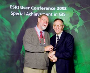
 GIS users, GIS service providers, and a metadata catalog are all ingredients in the g.net structure, which can support many application environments.
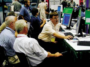 happen by our own initiative," he said. "It happens because of the help that you've given us, and it will continue to get better with your support. We like to envision our organization as a node in a network of other participants--helping users--making the whole thing work."
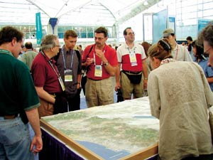 geographic data by better representing three-dimensional information and visualizing it. "It is a fast, seamless interactive system that will enable us to patch, like postage stamps, our information--image data, terrain data, vector data--on a globe."
 ArcGIS 3D Analyst also provides advanced GIS tools for three-dimensional modeling such as cut-and-fill, line-of-sight, and terrain modeling.