Fall 2005
Fall 2005 |
|||||||
|
|
|||||||
From Pharaohs to Geoinformatics |
|
|
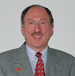
By Prof. Dr.-Ing. Holger Magel, President, FIG
Ladies and Gentlemen—welcome to an extraordinary event in an extraordinary city in an extraordinary country. Egypt as our host country is an ideal and stimulating place for our Working Week 2005 and the Eighth GSDI conference. The motto of our conference "From Pharaohs to Geoinformatics" fits perfectly to this country—and figuratively to all countries and all members of FIG! The surveyors of ancient Egypt are still a model. The pharaonic surveyors demonstrate the timeless contributions of surveyors to shaping and implementing land tenure, land reform, and land management to the benefit of the state and citizens. Here in Egypt we feel both the honorable old spirit of scientific and professional surveying along with the dynamic power of modern surveying and geoinformation. More than elsewhere, these dynamics are personified by the leading people of the Egyptian government. I remember very well my courtesy call to the Prime Minister last year—when he still was in his earlier position as the responsible minister for new technologies. He impressed me deeply by his visions involving information and communication technology and his comprehensive idea of combining activities of surveyors and geoinformation experts. This first joint International Federation of Surveyors/Global Spatial Data Infrastructure Association Conference is an impressive demonstration of our confident mind and will "to shape the change," that is, to change from individual activities to joint and combined contribution, such as those that are needed now for helping the tsunami-hit countries and member associations in these countries. The great interest shown in participating in this event and the hundreds of papers demonstrate very clearly what the old Romans have called the "genius loci," or in English "the spirit of a place." This place is full of the spirit of cooperation. I very much welcome the attendance of so many sister organizations and members of the global family of geospatial information societies as we perhaps never had before. Let Us Not Forget Eratosthenes!Even if we do have very quick pictures, maps, and analyses of natural disasters and environmental damages, etc.—due to satellite positioning and imagery—these are, in the final analysis, based on something else that happened in old Egypt in still another era. Let us now move forward in time to the third century BCE. It was Eratosthenes, the third librarian of Egypt's great Alexandrian Library, who calculated the circumference of the earth using sun shadow measurements between Alexandria in the north, Syene in the middle, and Mero� in the south. With this and other groundbreaking geodetic scientific works, Eratosthenes' research began the extremely successful development of real-time information about our globe toward continuous information about what is happening daily on the earth by satellites and GPS and toward so-called geoinformation as a basis for decisions on land-related aspects. As you all know, 80 percent of political, economic, and other decisions are georeferenced. Without Eratosthenes and his successors—up to our partners, such as the International Association of Geodesy—we wouldn't have this high standard of service today. Both examples, of the pharaonic surveyors and Eratosthenes, lead us to the present and future. The Changing Role of SurveyorsThe traditional role of surveyors has been to contribute to public and private interests and actions. But this is changing, so that today their role includes more equity, more security, and more sustainable development. Now more than ever, there is a need for a balance between public and private sectors and between state and citizens. Surveyors have to adapt to these new sociopolitical dimensions, and they have to deal with new technologies, methods, and tools as has happened every time. Now, surveyors need to explicitly contribute to democracy, good governance, and the establishment of civil society. Due to increasing globalization and related economic and private interests and pressure, democratic structures on local, national, and global levels are now in great danger. More than ever, we should underscore the need and benefit of a functioning and even strengthened democracy for all people, who, at the very least, deserve good living conditions. With our sister organizations, we feel obliged to discuss joint steps without losing our organizational individuality to strengthen our profile as "the geospatial information community and experts" and to jointly present our ideas and "single voice" at the global stage, such as we will at the World Summit on the Information Society in Tunis, Tunisia, in November of this year. This conference in Cairo can therefore become a historic meeting of the joint board of all respective geospatial information societies. Shaping the Change: Challenges to FIG and GSDIThere is no doubt that we both, the surveyor communities and the GSDI family, have reached a very high standard and level of methods, tools, and technical philosophy. There is no doubt, too, that there still exist lots of problems that have to be solved jointly (e.g., between different GIS providers and users) or that the cooperation between surveying and GIS should be intensified to bridge the gap. But ever we should remember that technology is no end in itself. All that we are doing, producing and delivering, must be oriented to a higher and more comprehensive goal and vision: we want to address better social, economic, and environmental issues; in other words, we want to address better sustainable development and to better serve society and our endangered and limited earth. Working toward these overall goals, we are partnering with national governments; sister nongovernmental organizations; and global players, such as the United Nations, the World Bank, and many others. About Intensified Partnership and ContributionsWith regard to these important partnerships, especially with GSDI and our present joint board members, I would like to ask some questions to stimulate discussions and incentives within FIG and with our partners:
FIG strongly supports the approach of UN Secretary-General Kofi Annan to strengthen the role of NGOs in the implementation of the Millennium Development Goals. In his recent report, "In Larger Freedom—Towards Development, Security and Human Rights for All," the Secretary-General points out his philosophy of "help for self-help." He says, "Each developing country has primary responsibility for its own development—strengthening governance, combating corruption, and putting in place the policies and investments to drive private sector-led growth and maximize domestic resources available to fund national development strategies." And he continues with the expected role of developed countries to support the developing countries. All will happen only "with transparent, accountable systems of governance, grounded in the rule of law, encompassing civil and political as well as economic and social rights, and underpinned by accountable and efficient public administration." Ladies and gentlemen, it must be clear to each of us: If we don't succeed to improve living conditions in developing countries, developed countries will have no future as well. Surveying and the spatial data infrastructure are essential, providing such frameworks as rules of laws, individual and public rights, and functioning administrations. Surveyors know very well the weaknesses or strengths of good or bad frameworks for the future of the countries. And FIG and its partners more than ever should feel confirmed and inspired by what Kofi Annan has said about the task of NGOs: "delivering services to people." This must be clear to each of us. |
 At the International Federation of Surveyors (FIG) Working Week and the Eighth Global Spatial Data Infrastructure (GSDI) Association Conference held together in Cairo, Egypt, April 17, 2005, FIG president Prof. Dr.-Ing. Holger Magel reflected on the history of surveying and the critical nature of spatial information in his opening speech. The following has been extracted from his speech.