Fall 2005
Fall 2005 |
|||||||
|
|
|||||||
GIS Helping Manage Our World
|
|
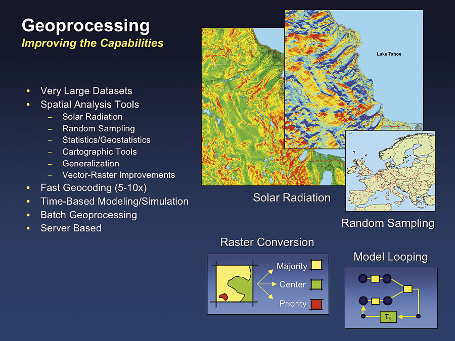
GeoprocessingMany new tools are being added to the geoprocessing environment. They include support for processing very large vector datasets, new tools for solar radiation and random sampling, and improved tools for vector-to-raster conversion. Also, ModelBuilder will support "model looping" for iterative simulation modeling.
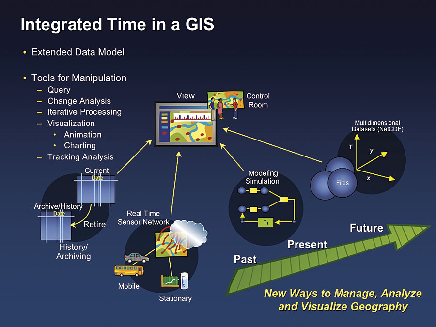
Also at 9.2, all the ArcGIS geoprocessing tools will be available on a server. Users will be able to serve models for complex analysis as a Web service that is accessible from thin clients and interoperable with other services. Temporal GISArcGIS is being extended to support many aspects of time. These improvements extend the basic data model and add new tools for time-based query, change analysis, iterative processing, visualization, and animation. In addition, 9.2 will support history and archiving of change transactions in a geodatabase. ArcGIS 9.2 will provide support for a family of multidimensional data formats called NetCDF. These datasets are widely accepted within the earth science community as a standard for multidimensional data storage.
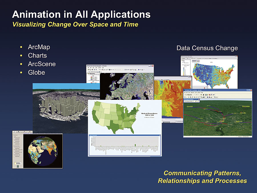
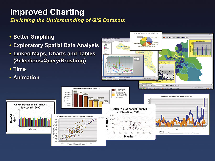
Improved ChartingArcGIS 9.2 will have better charting and graphing tools for scientific exploratory data analysis. It will also support a multiple document interface for dynamic linking between charts, tables, and maps. Users will be able to query in one document (e.g., chart) and see it reflected in graphic highlighting in other documents (e.g., maps).
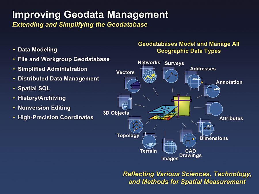
Geodata management is being improved with a large number of technical initiatives.
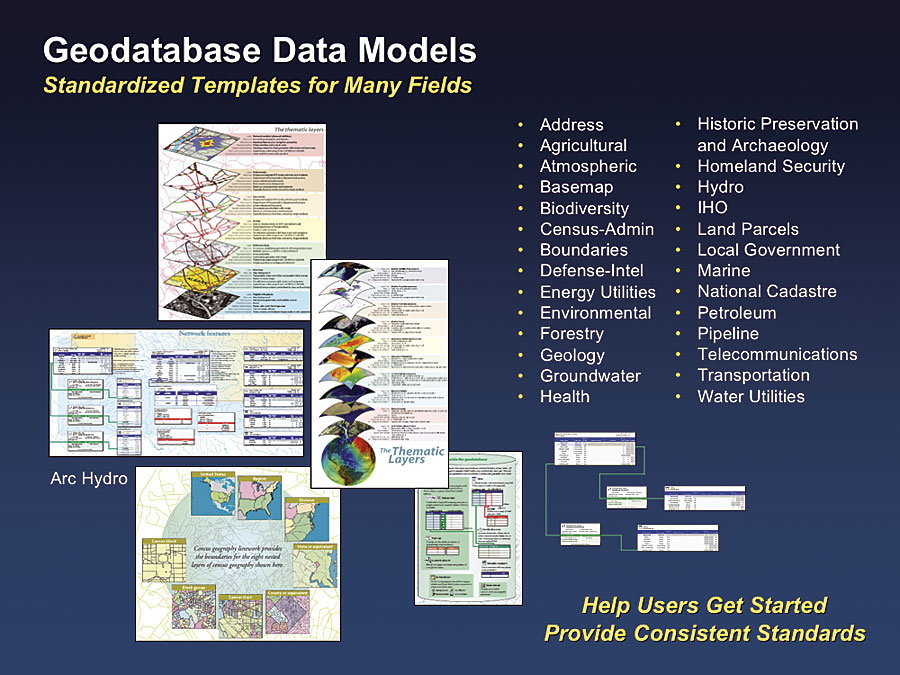
Geodata ModelingEsri is continuing to work with users to develop and support a series of industry-specific GIS data models. These models are open and standards based and can be easily downloaded and applied. This investment has delivered substantial value to our users, helping them get started faster and providing more consistent standards across organizations and institutions. These models are also helping organize the thinking for Web-based collaboration.
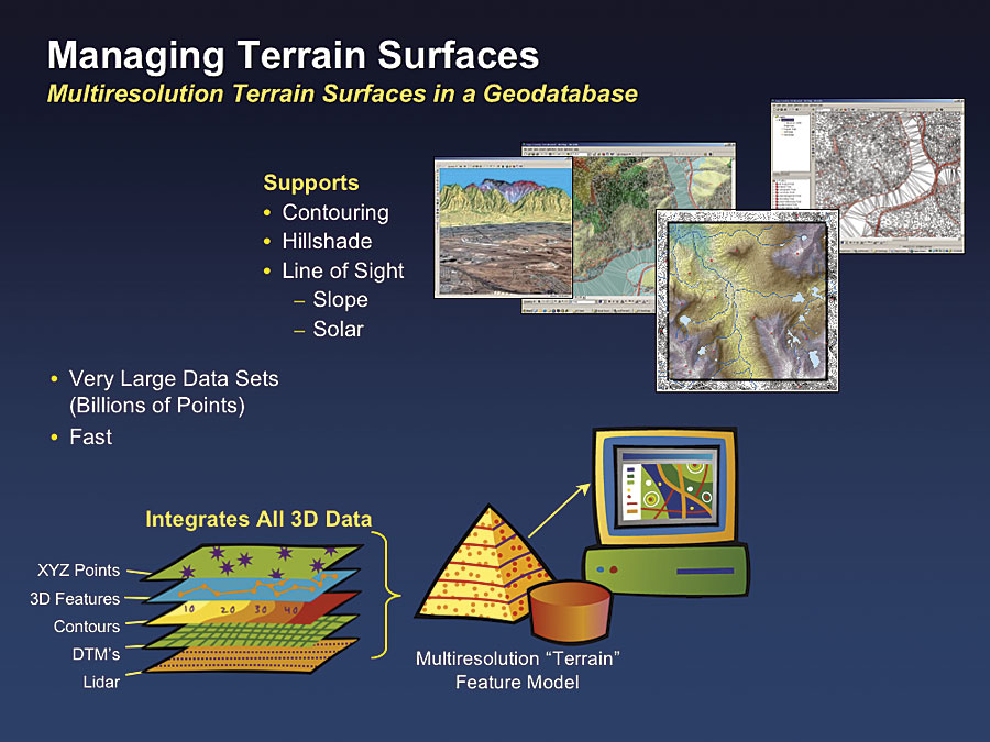
3D Terrain Geodatabase ModelingArcGIS 9.2 will support the management of terrain datasets in a geodatabase. Terrains are a new geodatabase type with all types and formats of 3D data, including support for very large lidar datasets. Terrains organize 3D data into a new data structure conceptually similar to image pyramids with a multiple-resolution feature model. This model can be directly used by ArcGIS software's spatial analysis and 3D visualization tools.
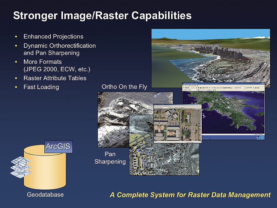
Raster Data ImprovementsAt ArcGIS 9.2, there will be stronger support for image and raster data management and manipulation. This includes better support for projections; the ability to perform dynamic orthorectification; and support for a number of new image types, including JPEG 2000, ECW, and a variety of lesser-known formats. There will also be support for raster attribute tables and faster raster data loading into the ArcSDE environment.
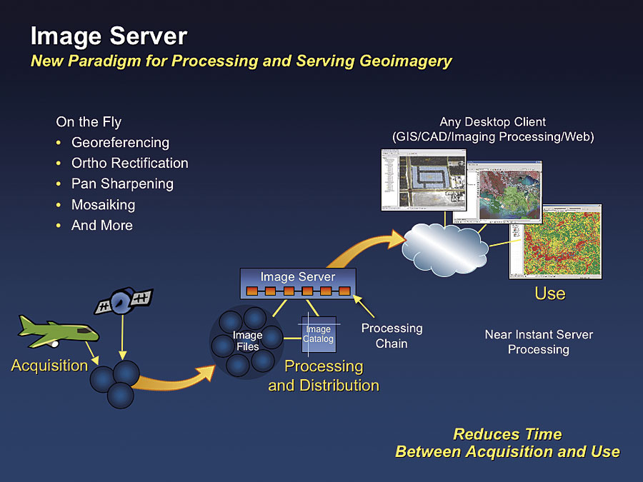
Esri Image ServerAt 9.2, a new image product will be introduced called the Esri Image Server, which will be focused on very fast serving of imagery. The key concept of this new server is that it processes imagery in a server environment dynamically upon request from any type of client. The Esri Image Server provides on-the-fly image processing and introduces a whole new paradigm for image management and processing by simultaneously processing and distributing the images in a modern Web services environment.
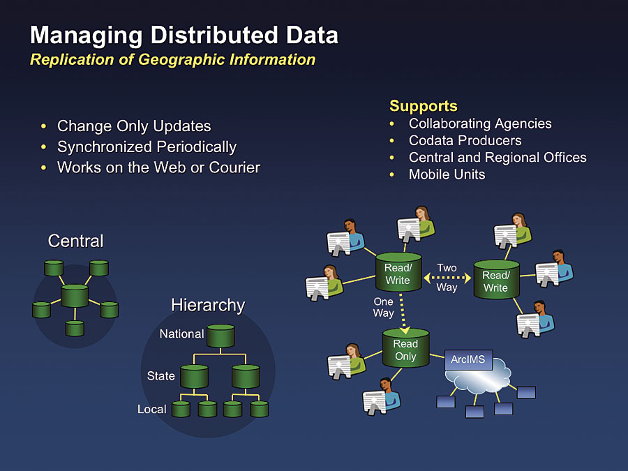
Geodatabase ManagementFor years, users have been asking for capability to replicate geodatabases and do synchronized updates across a network. ArcGIS 9.2 will support this capability by allowing different organizations at different locations to share and update the same virtual geodatabase with multiple distributed copies of the data. This system will support updates being automatically sent back and forth across the Web at some user-defined increment (e.g., hourly, daily, or weekly). ArcGIS keeps the replicated geodatabases in sync. This capability supports not only collaboration but also coproduction and the notion of a central database repository with a number of participating regional offices. Esri sees this capability as being a key technology for building distributed data management partnerships that will form building blocks for implementing a Spatial Data Infrastructure vision. An example is street data that is updated (maintained) locally, regionally, and nationally by a federation of users and shared in a collaborative environment.
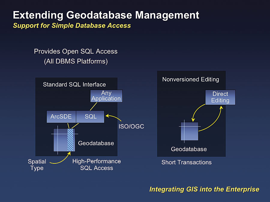
Simpler Database Access and ManagementThe geodatabase is also being extended to provide simpler database access and will include an open SQL interface to spatial data stored in ArcSDE software's high-performance format stored in an Oracle DBMS. This will mean that any SQL programmer will be able to develop applications that access and use ArcGIS data stored in a geodatabase (ArcGIS already includes this capability in DB2 and Informix platforms).
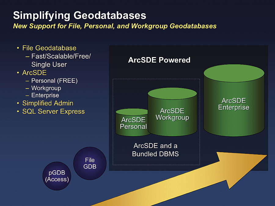
ArcGIS 9.2 will also support nonversioned editing and short transaction workflows. This will allow users to better design the editing process around their workflows and enterprise systems. These two enhancements will better integrate our technology into enterprise computing and make it completely open. File-Based GeodatabasesArcGIS 9.2 will support a file-based version of the geodatabase. These files contain all the intelligence of a standard geodatabase and are fast, simple, and scalable but do not require a DBMS.
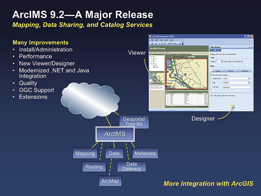
ArcSDE EnhancementsThe ArcGIS 9.2 release will include two new ArcSDE options. ArcSDE Personal embeds a DBMS that will be included at no cost with ArcGIS Desktop, allowing for a single editor and multiple viewers. ArcGIS 9.2 will also introduce a new product, ArcSDE Workgroup, which also embeds a DBMS and allows for small teams to edit and share geodatabase data and will cost considerably less than the current Enterprise ArcSDE. Both of these products (personal and workgroup) will have simplified management and administration (no DBA required) via ArcCatalog. ArcIMS
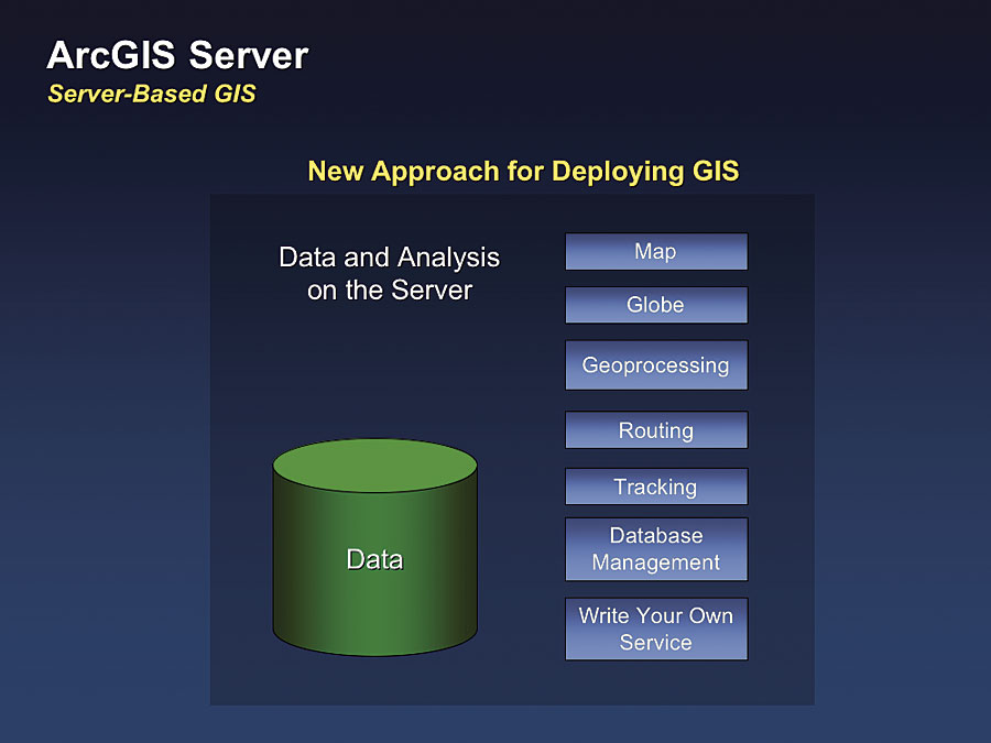
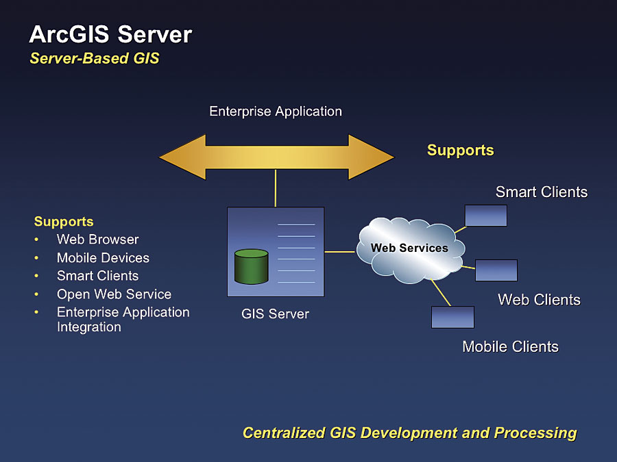
ArcGIS ServerArcGIS Server is Esri's strategic product for large, centralized GIS implementations. It represents a new approach for developing and managing GIS and is best thought of as a system for deploying GIS data management, analysis, and mapping services in a Web services environment. At 9.2, the major functionality additions will be full support for geoprocessing and 3D globe services, and the focus of ArcGIS Server will be more on providing a family of out-of-the-box GIS applications as an integral part of the server environment. ArcGIS 9.2 Server will work in a Web services environment with mobile clients or Web clients. It will also plug directly into enterprise computing environments to support enterprise applications.
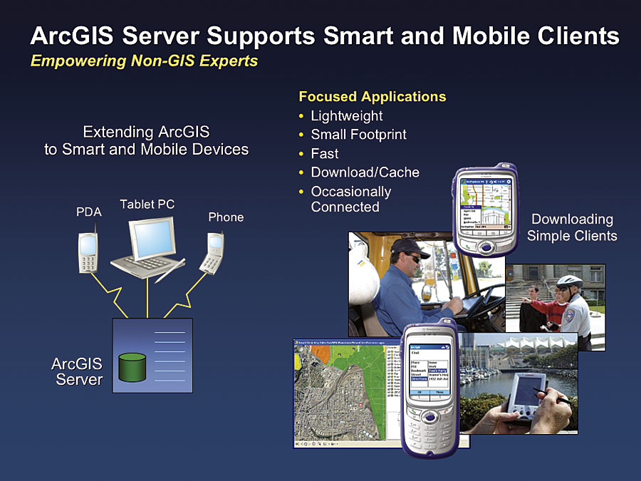
ArcGIS Server includes a free mobile Application Development Framework (ADF) for developers who create custom mobile and smart clients. Smart clients are applications that can run on small, lightweight devices and portable PCs. They support an occasionally connected environment that requires dynamic caching of data and software logic. Examples of such devices include cell phones and PDAs. Mobile ADF-based applications are very fast and support simple and focused applications. When connected, they rely on delegating complex tasks to servers. After users make requests from a client, the request is processed on the GIS server and a result comes back and is stored and displayed on the client.
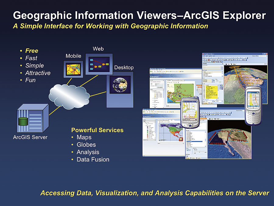
ArcGIS ExplorerArcGIS 9.2 Server will support a new client that works with all the services supported by the ArcGIS Server platform. This application will be a very fast, simple, and attractive way to interact with GIS services and view geospatial data in 2D and 3D. This client is open and standards based and can integrate virtually any map, GIS, or other Web service. It is also free and will initially be released by Esri and the National Geographic Society (NGS) for use in connection with a large set of 3D "global" services associated with NGS MapMachine.
ArcGIS Explorer provides a rich set of tools for exploring geographic information from a variety of sources. This allows users to navigate the data in 2D and 3D and ask questions about the data (such as: What is this? How do I get from here to there? What's this address? Where is�? and much more). ArcGIS Explorer can be used with the terabytes of Esri-hosted data services or with the user's own ArcGIS Server data or even local data. Users can expand ArcGIS Explorer to be able to leverage their server for specific tasks using their data, such as route on the data, derive a line of sight on the surface model, and so much more.
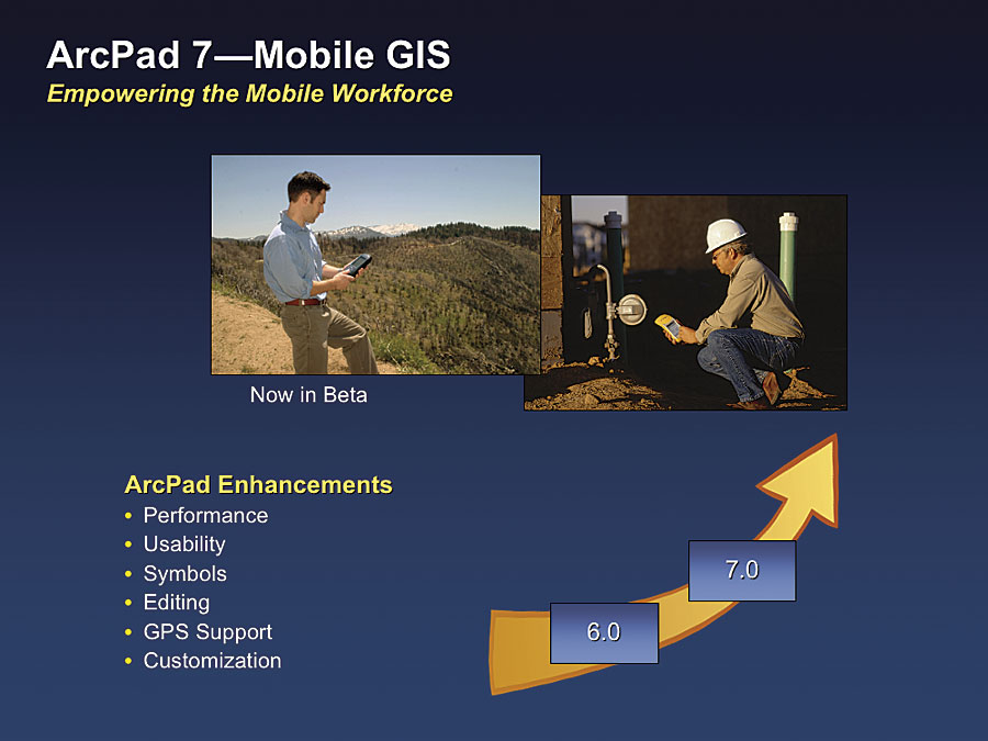
Mobile GISArcPad is Esri's principal product for mobile GIS. This product supports field-based applications, including navigating, editing, query, and simple analysis. A new release of ArcPad will be available shortly and has an enormous set of improvements in performance, functionality, and usability. ArcWeb Services
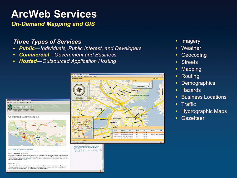
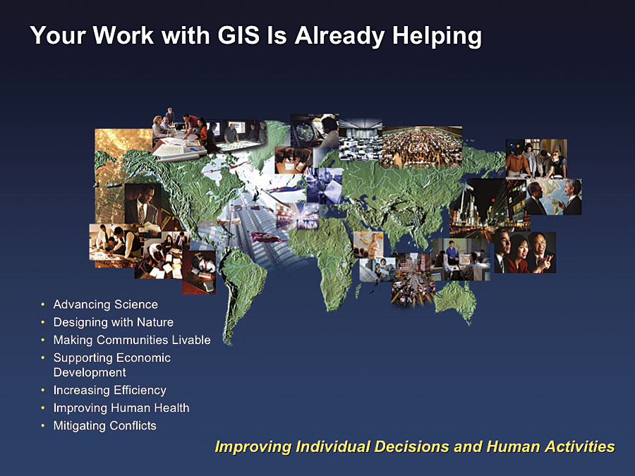
ArcWeb Services currently support hundreds of successful applications including Business Analyst Online, 8 National Geographic Society's MapMachine, United States Department of Agriculture, and many others. ConclusionOur world needs better management and more rational decision-making approaches that consider all the necessary factors. This means taking a geographic science and geographic planning approach. GIS provides the framework for this and is already helping manage our world better. It is helping advance science and design with nature in mind and, as a result, is making our communities more livable. GIS supports better economic development, while increasing efficiency, improving human health, mitigating conflict, and helping defend against violence and terrorism. GIS users are doing amazing things to make the world a better place by helping our world evolve in a more sustainable way.
It will take all of us working together—governments, technology companies, private companies, academicians, and professionals from many fields—building and sharing knowledge with a vision of helping manage our world. See also "Esri's 25th User Conference Continues Tradition of Innovation." |