Fall 2008
Fall 2008 |
|||||||
|
|
|||||||
GIS Analyst Develops Cutting-Edge Enterprise Platform, Helps Battle Recent California Wildfires
David Blankinship at the Forefront of Fire Service Applications |
|||||||
|
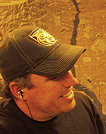
David Blankinship gets uncomfortable with compliments. During the 2007 Esri Homeland Security Summit, as keynote speaker Kate Dargan of the California Department of Forestry and Fire Protection (CAL FIRE) singled him out among the crowd of 200-plus attendees, he smiled awkwardly while those around him clapped with appreciation. California's state fire marshal expressed gratitude for the GIS work Blankinship performed during the terrible outbreak of wildfires that swept through Southern California in October 2007. While hundreds of thousands of acres burned and hundreds of properties were destroyed, there was minimal loss—especially considering the size, scope, and complexity of the numerous simultaneous incidents. Though he is uneasy with praise, the acknowledgment is well deserved. A Colorado Springs, Colorado, Fire Department GIS analyst, Blankinship is at the forefront of applying GIS to the fire service. He's providing nationwide leadership in promoting GIS use in public safety. He not only uses GIS to protect communities and save lives for Colorado Springs but also was integral in responding to both the recent Southern and Northern California wildfire sieges. Joining Colorado Springs Fire DepartmentBlankinship joined the Colorado Springs Fire Department (CSFD) after working in the city's electric and water utility divisions. In 2001, he was recruited by the department, which wanted to successfully bring GIS into its operations. With no previous fire service experience, Blankinship spent many months undergoing training and working side by side with fire staff during incident calls, performing daily fire service functions, and getting a firsthand understanding of how the agency and its firefighters operate.
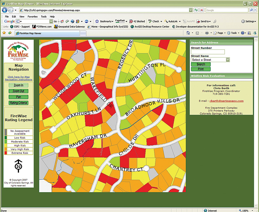
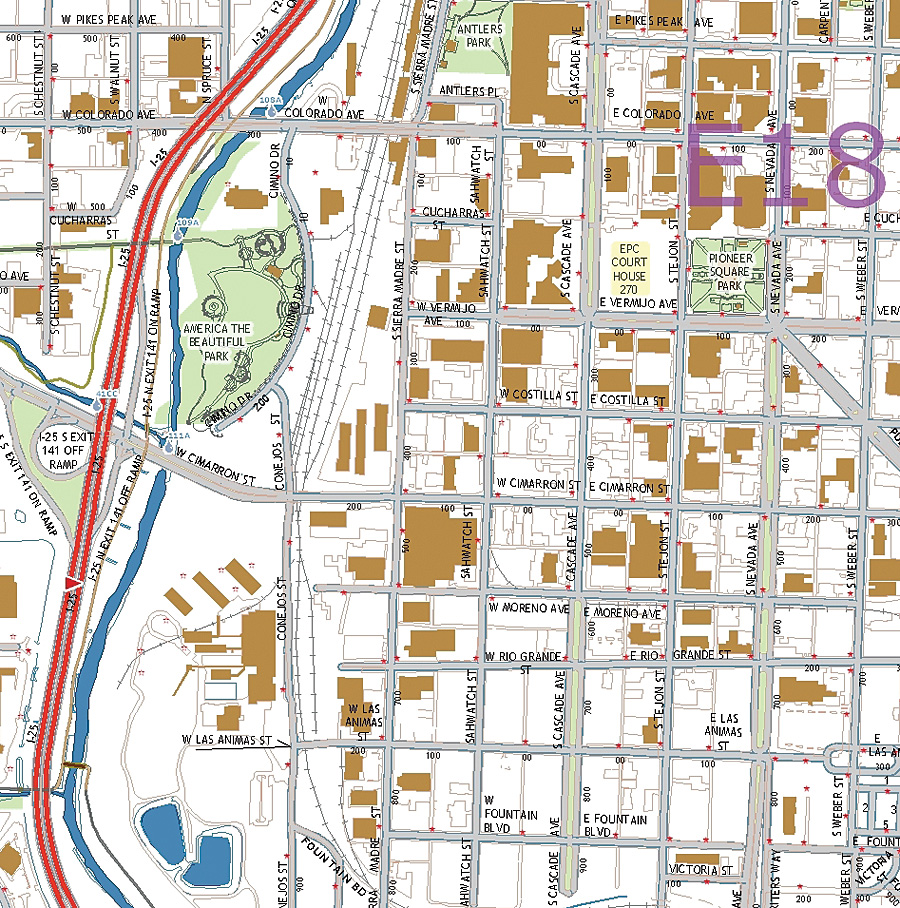
With 500 personnel, CSFD serves 500,000 Colorado Springs citizens residing in a 192-square-mile area. The fire department provides the full range of professional firefighting services, including high-angle rescue, swift-water rescue, heavy rescue/urban search and rescue (USAR), hazmat, wildland fire suppression, fire prevention, code enforcement, engineering, and community education. Blankinship worked with the chief and other fire professionals to build applications that would help improve all aspects of fire operations and risk management activities, including pre-event planning, response, incident command, recovery, and postevent analysis. One of his first true tests of GIS use on a major incident occurred during the 2002 Hayman Forest fire, the largest in Colorado's history up to that time. The disaster scorched 138,000 acres of land and cost $40 million in damages, with 133 homes lost and more than 5,000 residents evacuated. Blankinship helped provide GIS support that included mapping the fire's perimeter and aiding the wildfire response and evacuation. The complex disaster and multiagency response was the first large-scale event where Blankinship used spatial analysis, visualization, and mapping. The lessons learned from this event would prove invaluable to future wildfire response. The initial GIS uses at the department included creating in-vehicle map books; developing fire preplans using parcel and infrastructure data maintained in city databases; and performing analysis for placing station locations; as well as determining dispatch run orders for fire, rescue, and emergency medical services and apparatus. GIS is now used for wildland fire risk analysis, hazardous material storage and permitting, community data sharing, hazardous plume modeling, and consequence assessment. Mobile GIS capability provides first responders with digital maps that link to preplans and other data while en route to an incident. In addition, an automated vehicle location (AVL) application has been integrated with the Colorado Springs intelligent transportation system. Resources are routed from their locations to incidents by a system that manages the traffic signals, providing green lights and clearing traffic to ensure a safe and time-efficient response to emergency calls. "Everything is driven by the end user," says Blankinship. "Firefighters don't care how you do it. They just want to know that they are getting the information they need to do their jobs. So we don't chase technology. We listen carefully to what our firefighters need. They want information that is easy to get and delivered when they need it most. So that's what we try to do." CSFD became an innovator in GIS fire service applications. Agencies from across the United States visited the department or requested that Blankinship come to their departments to share how GIS can be successfully implemented. This collaboration with other fire departments led to his applying GIS skills to complex, multiagency operations outside his own state. Southern and Northern California WildfiresDuring both the Southern California wildfire siege in October 2007 and the more recent outburst of wildfires that occurred in Northern California in June and July 2008, Blankinship was requested to provide assistance. He worked with a team of GIS specialists in both instances to provide local, state, and federal agencies with spatial data capture, integration, mapping, modeling, analysis, and dissemination.
In October 2007, more than a dozen wildfires in Los Angeles, Orange, Riverside, San Bernardino, San Diego, and Ventura counties burned hundreds of thousands of acres, destroyed thousands of homes, and left half a million people at least temporarily displaced. GIS was used in multiple incident command posts, including the Southern California Geographic Area Command Center in Riverside, California, where Blankinship worked to support GIS operations. He was able to collaborate with other GIS analysts to integrate fire perimeter data with remotely sensed data. This information was integrated with existing weather data, as well as predictive weather models, to illustrate hot spots and potential fire spread. When combined with GIS layers that located homes and other developments in harm's way, fire officials were better able to make tactical and strategic resource assignment decisions. Blankinship and many others used ArcGIS software to identify critical facilities and infrastructure, perform property and community damage assessments, place relief centers, carry out evacuations, and develop recovery plans. In June 2008, Blankinship was again recruited to aid in California's latest fire crisis. Agencies used digitally mapped data, spatial analysis, and modeling to better plan and carry out fire suppression operations. GIS was used to assist in the deployment and tracking of California state assets fighting the hundreds of fires taking place throughout Northern California, including more than 18,000 personnel, 1,000 fire engines, 300 bulldozers, and 100 helicopters. GIS experts deployed during the 2007 fires again worked with CAL FIRE and federal and local agencies for tactical planning as part of the overall response. Incident management teams used GIS to map active fire perimeters, hot spots, burned areas, and affected communities. Protection priorities were established with the assistance of GIS by assessing highly flammable accumulations of vegetation combined with steep terrain that threatened homes, infrastructure, and natural resource values. GIS-generated maps were also used for public information sharing, including fire locations, road closures, damaged properties, evacuations, shelter locations, and Red Cross assistance. "We integrated multiple data sources from sensors and aerial assets, such as the United States Air Force Global Hawk and Air National Guard RC26 planes," says Blankinship. "GIS was used to quickly disseminate intelligence to incident commanders, planning units, and analysts deployed at different fire incident command posts. This supplied the beginnings of a comprehensive common operating picture of what was happening on the ground." The Next GIS PhaseToday, CSFD is working on the next phase of GIS in managing fires with an enterprise information system that is truly groundbreaking. The Community Risk project is an interactive process—involving community government, community emergency services, the public, and federal/state/local stakeholders—that develops a "living" risk assessment. It will visualize and assess hazards, capture changing conditions based on environmental changes or man-made development, and aid mitigation and response activities. With this next phase, as with each previous one, Blankinship is quick to point out that leadership and people are the key to any GIS or technology success. "Technology integration has more to do with people than it actually has to do with technology," he says. "It has everything to do with an organization taking a hard look at the tools that are available and systematically supporting tools that make our job better. It's been the leadership of the Colorado Springs Fire Department and chief Manuel Navarro [retired] and chief Steve Cox—their vision and support—that helps us as we work toward continued success in our department." More InformationFor more information, contact David Blankinship (e-mail: dblankinship@springsgov.com, tel.: 719-385-7217). |
 This article is part of an ongoing series honoring individuals who have made a difference in the world by applying a GIS solution to challenges or needs within conservation or their communities. Since these unique individuals have been selected for their innovations or special achievements in a particular field, the series is appropriately named GIS Heroes. Esri recognizes David Blankinship as a GIS hero.