2011 Esri International User Conference Overview
The Esri International User Conference (Esri UC) convened in San Diego, California, July 11–15, 2011, where a new approach to GIS was introduced: ArcGIS as a complete system, open access, and cultural thinking have come together to become the conduit for shifting GIS into an unprecedented era of sharing and collaboration.

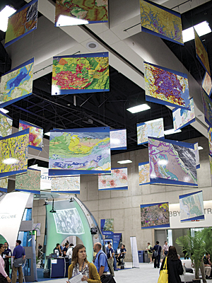
Above and below: More than 14,000 GIS professionals gathered in San Diego, California, in July.
The stories that 14,000 people brought to the conference, the capabilities demonstrated in ArcGIS 10.1, the new platform for ArcGIS Online, and cloud GIS services added to the momentum that is driving change in the way people share and participate in improving our world.
Welcoming the GIS user community to the Esri UC Plenary Session, Esri president Jack Dangermond laid out his GIS vision for 2012 and years ahead. Leading with the conference theme, "GIS—Understanding Our World" (see cover article), he presented work that the GIS community is doing and talked about how ArcGIS is evolving.
Setting the stage to introduce the collaborative abilities being built into ArcGIS technologies, Dangermond explained, "Our world is changing rapidly, and humans are causing it, which is creating many challenges. We need collective intelligence and understanding that helps us meet these challenges." He further noted that GIS is changing rapidly and is coevolving with other enabling technologies for measurement, data, computing, connectivity, science, GIS virtualization, bandwidth, collaboration, social networking, and cloud platforms. He presented innovations and enhancements in ArcGIS 10.1 and other Esri products that support connected technologies.
New Product Highlights
ArcGIS Online—A new cloud-based GIS platform that can be used anywhere by anyone on a desktop, a browser, a smartphone, or tablet. Users can register data in a group as Web Map Service, KML, and other files. The new platform accelerates GIS in your projects and the projects of those with whom you work. Nearly 100,000 maps and apps have been published to ArcGIS Online, and about 5,000 are being added every week. ArcGIS Online search capabilities make it easy to search the gallery; access the maps users need; share with groups; and, most importantly, make their own maps.
Community Analyst—Esri's GIS cloud service that extends the reach of GIS in an organization. The map service offers more than 6,000 variables to work with, including US Census 2010 data, population projections up to the year 2015, federal data, and Centers for Disease Control and Prevention data.
Lidar Data Support—ArcGIS 10.1 is adding dramatic improvements for lidar data in LAS format, including quick viewing, update and analysis, data management, and sharing capabilities. Users can create a lidar data layer and view lidar points in a 3D preview window in ArcGIS for Desktop, edit LAS point classification, add LAS files to a mosaic dataset, share lidar-derived surfaces and intensity data as image services, and access image services for lidar data downloads.
ArcGIS Runtime—Software development kits for building custom solutions (native 64 bit with small installation size) for ArcGIS for Windows Mobile, iOS, Android, Windows, and Linux. It delivers performance for fast application start-up and map display and deployment.
ArcGIS for Local Government Initiative—Fifty templates for building apps and creating maps.
Keynote Speakers
Tim and Michele Schilling described their Rwanda project, which raised the economy of the country and the income of its farming families (see "Rwanda's Green Living Project"). The Schillings worked to bring individual farmers together and developed a method and standard that would raise the quality of Rwanda's coffee to be one of the world's most outstanding. Improved quality raised demand and pricing, which, in turn, improved the economy of the country.
European Environment Agency director Jacqueline McGlade explained how just one degree of temperature change impacts the earth (see "Citizens Help Validate Authoritative Environmental Monitoring"). She noted that we must change our behavior and adapt to the realities of climate change. McGlade also urged GIS users to tell their stories about the positive ways they are helping the planet.
User Stories
The City of Boston, Massachusetts, described how its enterprise GIS is bringing together local government services and engaging its citizens.
Clark Magnet High School science teacher Dominique Evans-Bye and senior Yeprem Chavdarian presented the school's award-winning GIS projects, which tracked toxic runoff from land to sea, chemical impacts on marine life, and fast-water flood channel analysis for at-risk schoolchildren.
Throughout the week, attendees presented hundreds of papers about how they are using ArcGIS in their work for visualization, analysis, work processes, prediction, planning, and better understanding our world. Special Interest Groups met to network and share. Users engaged with Esri experts and GIS vendors and consultants to solve problems and meet challenges. User stories were also demonstrated on the walls of the Map Gallery, which provided a reference for people to improve their own maps and applications. The Map Gallery entry Municipal Development Plan Calgary by the City of Calgary, Canada, won the title Best Overall.
Awards
Dangermond recognized 140 Special Achievement in GIS Award winners and presented Esri's Enterprise GIS Award to the Singapore GeoSpatial Collaborative Environment, which put GIS at the core of local government. He presented the President's Award to the Federal Service of State Registration Cadastre and Mapping of Russia, which built a national cadastral system for the entire country (see "Russia Introduces E-government"). A Making a Difference Award was given to Research Center for Disaster Reduction Systems, Kyoto University professor Haruo Hayashi for providing support maps that dealt with Japan's earthquake, tsunami, and fallout disasters. A second Making a Difference Award was given to Geneva International Centre for Humanitarian Demining and accepted by director Daniel Eriksson.
Save the date for the 2012 Esri International User Conference in San Diego, California, to be held July 23–27.