
As part of ArcGIS Online, Esri Maps for Office enables the use of familiar Microsoft Office tools to quickly and easily map and share data.
Users can create maps directly in Excel and add them to PowerPoint presentations and other documents. They can publish and share maps on ArcGIS Online that others in an organization can then use to visualize and interact with their data. Maps published on ArcGIS Online can also be viewed or embedded in web pages or desktop and mobile applications.
All that’s needed to get started using Esri Maps for Office is an ArcGIS Online paid or trial subscription, along with Microsoft Office 2010 or later.
Make Maps Directly in Excel
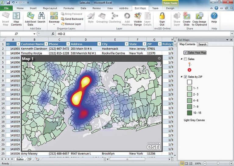
Users can create interactive maps of their Excel data—not only maps of locations (e.g., customer addresses, sites by map coordinates, facilities, businesses, opportunities, distribution points) but also maps of geographic data, such as color-coded maps of sales by ZIP code or enrollment by state.
Through tight integration of Esri Maps for Office with ArcGIS Online, users can access a variety of background maps, including street, satellite, and topographic maps. They can also reuse and incorporate (mash up) any map to which their organization provides access, as well as tens of thousands of maps published by Esri’s worldwide user community.
Impact Your Audience
Maps are powerful communication tools that help users get their points across quickly and efficiently. Maps can also help them look at their data in different ways to gain additional insight.
Once a map has been made, the results can be immediately shared with others by adding them to PowerPoint presentations or by one-click publishing to ArcGIS Online. Both interactive and static maps can be shared. Users have full control over the map symbols and map styling so that they can tell their stories the way they want.
Part of ArcGIS Online
With the ArcGIS Online collaboration capabilities and valuable content, Esri Maps for Office enables the use of familiar Microsoft Office tools to quickly and easily map and share data inside and outside an organization.
Esri Maps for Office is made available as a component of ArcGIS Online. It’s delivered as an add-in to Microsoft Office, and current ArcGIS Online subscribers can get it as part of their subscription.
For more information, visit esri.com/software/esri-maps-for-office.
See also “ArcGIS Online: What’s New?.”