Spring 2008
Spring 2008 |
|||||||
|
|
|||||||
International Engineering and Construction Contractor Uses GIS to Better Serve Its Divisions and Customers
Michels Corporation Improves Collaboration and Communication |
|||||
Highlights
From its humble beginnings as a pipeline construction company in Brownsville, Wisconsin, almost 50 years ago, Michels Corporation has grown to one of the top 100 contractors and one of the top 10 utility contractors in the United States, according to Engineering News-Record. Michels Corporation continues to be a family-owned business working in design-build construction for the utility, transportation, communication, and infrastructure markets. The company takes pride in its innovation and leadership in the marketplace, always looking for a better way of doing business.
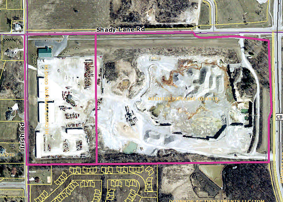
To help maintain its history of innovation, Michels chose to invest in GIS because it offered the ability to visualize the corporation's assets and to plan for future projects and development. "GIS technology has helped Michels plan and execute projects for our customers," states chief executive officer Pat Michels. "We view our use of GIS as an important step in enabling Michels to be more collaborative with our customers." Esri had demonstrated itself as the industry standard and was already being used by many of the companies and agencies Michels works with on a daily basis. Because of that, ArcGIS software was chosen to better communicate with clients who also use GIS for utility infrastructure planning, design, and bidding. The company first started using ArcGIS in 2004 to assist in asset management and to track permits. Dave Melum, environmental compliance specialist in the Michels Materials Division, states that GIS allows him to see and analyze this information by location, giving the division a better understanding of Michels' real estate holdings, property leases, and local and state permits. Furthermore, he is able to quantify future reserves by mapping the aggregate resources, operations permits, and test sites. The adoption of ArcGIS also allows Michels to manage the deployment, performance, and maintenance of its organizational assets. This is leading to cost and time savings by improving equipment and staff productivity, reducing capital outlays, and enabling better decision making. The corporation can now recognize assets that are underutilized and is eliminating holdings with limited strategic value based on market conditions and future development. Prior to using ArcGIS, real estate, permitting, and project information were handled by different groups within the corporation. Michels finds that GIS provides the tools it needs to analyze how every facet of its design relates to its environment. For example, it uses GIS to find out how future growth of a community will affect the pattern of streets and community services. Michels also uses GIS to solve construction layout problems and provide a new way of thinking about predesign analysis.
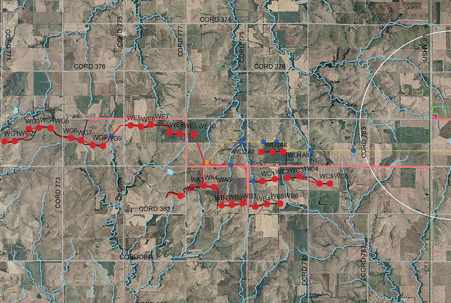
Doug Heider, outside plant/GIS manager of Mi-Tech, Michels' engineering division, uses GIS for design and management of information for third-party clients, including telecommunication companies nationwide. "Adding ArcGIS to our engineering toolbox allows us to provide many value-added benefits for our current customers," he says, "and to better communicate with our customers throughout the life of their project from design to construction status to as-builts. By creating our project data in real-world coordinates and using our software's data interoperability, we can create a standardized method to interact with the many entities that are normally involved in large utility construction projects. It is not uncommon to have to deal with five or more permitting agencies, including multiple cities and counties, Department of Transportation, Department of Natural Resources, railroads, and other utility companies." GIS gives Michels the tools it needs to bring together the multiple dataset types that come with dealing with all those different entities. At the end of a project, the company can provide its customers with very accurate and feature-rich products in any format they wish. This is becoming important, as most government agencies have adopted GIS technology and many are requiring as-builts be sent to them in a format compatible with their software. Recently, Michels adopted ArcGIS Server software to support an even wider range of internal operations, as well as provide a platform for job tracking by its clients. To oversee the deployment of ArcGIS Server, Michels recently hired Phil Paradies as GIS manager. As part of the implementation, Paradies started an enterprise-wide GIS database on ArcSDE. He has been transferring geospatial datasets that were acquired during the previous two years and adding new geospatial data from around Michels' nine-state operating area. More InformationFor more information, contact Phil Paradies, GIS manager, Michels Corporation (e-mail: pparadie@michels.us; tel.: 920-465-8018, ext. 4248). |