Spring 2010
Spring 2010 |
|||||||
|
|
|||||||
Esri International User Conference Combines Visionary Thinking and Practical Applications
2010 Esri UC Attendees to Explore the New Generation of GIS |
|||||
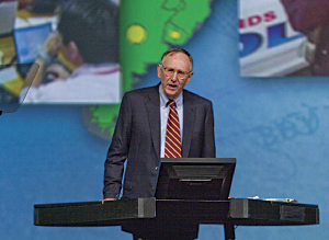
The 30th annual Esri International User Conference (Esri UC) will take place July 12–16 at the San Diego Convention Center in California. Attendees from the global community of GIS professionals will find that for one week, in one place, they have everything related to GIS at their fingertips. "Our users are inspired people doing important work with GIS," says Esri president Jack Dangermond. "They continue to astound us each year with the quantifiable, meaningful, powerful differences they're making in the world. We want to produce an event of great use and meaning to them, something both informational and empowering. The user conference should provide everything a user needs, whether it's help with a project or finding out what the latest Esri technology can do for their organization. It's a forum where creativity and new ideas are appreciated and shared." Geospatial Technology, GeoDesign, ArcGIS 10, and More
As the world's largest GIS conference, the Esri UC has a broad and deep agenda that focuses on geospatial technology developments, best practices, and tips and tricks. Attendees will find a wide range of technical workshops, user presentations, GIS concept and industry focus sessions, and Special Interest Group (SIG) and Regional User Group (RUG) meetings. The Plenary Session will offer engaging speakers, technology demonstrations, prestigious awards, and a special youth presentation. Past speakers have included Ralph Nader and Dr. Jane Goodall. The Map Gallery is a collection of illustrative maps from more than 100 countries, and there are special displays from organizations such as the National Geographic Society and the Smithsonian. And the Exhibit Pavilion houses many hardware, software, solution, and data vendors. The summer release of ArcGIS 10 will be a major emphasis this year. Modern interfaces, mapmaking time-savers, easier data creation and management, enhanced editing and sharing capabilities, and new ways to perform analysis and modeling are just some of the improvements. Unmatched in HighlightsThere are a number of conference highlights, which add to the Esri UC experience. There is a User Software Applications Fair where participants show custom applications and maps that meet specific end-user requirements. There is also an Esri Showcase with special areas featuring federal, defense, and public safety GIS applications. Midweek, the Special Achievement in GIS (SAG) awards honor organizations for their extraordinary use of GIS, having demonstrated vision and leadership in applying the technology to better serve society, such as faster 911 response and information-rich public Web sites. The GIS Kids Camp caters to families, providing children of all ages with a way to explore GIS. The popular Thursday Night Party, open to ticketed guests, always boasts a new theme, ranging from Mardi Gras to a Renaissance Faire to Oktoberfest. Another draw is the Spatial Outlet and Bookstore, which sells souvenirs and award-winning GIS and Esri Press books; it also hosts author signings. Play a Part
SIG and RUG meetings are available for hosting and ideal for collaborating with others of the same interest, industry, or region. The Academic GIS Program Fair gives representatives from higher education GIS programs a place to discuss their offerings with attendees, touch base with alumni, and meet students from the Student Assistantship Program. More information about participating is available at www.esri.com/uc. Why Attend?In a nutshell, attendees will be able to
The registration deadline is May 21. Special rate hotel rooms can also be booked online at www.esri.com/uc. Staying in downtown San Diego at a participating conference hotel offers the best value and convenience when it comes to travel, amenities, networking, and attending events at the convention center. Special rates are not guaranteed after June 10. More InformationThis event is for all Esri GIS users. To learn more, register, reserve rooms, and participate, visit www.esri.com/uc. There is also a customizable letter of justification to attend available for download. Note, a certain number of complimentary conference registrations may be available with your organization's ArcGIS software maintenance plan.
|

 Attendees have an important role in making the conference a success and worthwhile for their peers. GIS work can be showcased during the Plenary Session; videos, screen shots, and images from users will be used in Dangermond's presentation (submission deadline: May 28). Map Gallery and Virtual Map Gallery participants will share their paper and digital maps to illustrate the power of GIS (submission deadline: June 14). Lightning talks, which debuted and proved popular at the Esri UC last year, are quick user presentations given in five minutes or less; even more talks will be featured this year throughout the conference week.