Spring 2010
Spring 2010 |
|||||||
|
|
|||||||
Tap Into the Global Celebration on GIS Day 2010 |
||||||||
|
The 12th annual GIS Day celebration will be held Wednesday, November 17, 2010. GIS Day takes place every year during Geography Awareness Week, a geographic literacy initiative sponsored by the National "Because of our inventive and dedicated users, GIS Day continues to gain momentum," says Esri president Jack Dangermond. "It's celebrated in more than 80 countries on six continents. The spirit of collaboration is very powerful, and GIS Day is one of the ways we can share geospatial technology and take important steps toward the next generation of GIS." What You'll GainGIS Day is a stimulating and fun break from the everyday; it benefits both attendees and hosts. Past participants have used the event as a chance to
How to ParticipateWhether you're new to GIS Day or a seasoned veteran of the festivities, there are plenty of resources to help plan an event. Begin by brainstorming ideas with colleagues, visiting the GIS Day Web site (www.gisday.com) to register your event and download the free materials, then connecting with your community to get the word out. Need some more ideas? There are plenty of examples available of how organizations and communities have commemorated GIS Day. Here are a few events from last year to get those creative juices flowing. Abu Dhabi Systems & Information Centre
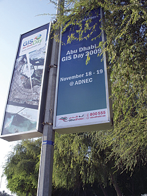
In honor of GIS Day, the Abu Dhabi Systems & Information Centre (ADSIC), located in the United Arab Emirates (UAE), hosted a hologram presentation given by Dangermond. This was one of the biggest GIS Day events in 2009, with approximately 5,000 people in attendance, and it was only the second time the city has joined the celebration. What became a two-day event, showcasing GIS champions and complete with an exhibition, was held under the patronage of His Highness General Sheikh Mohammad bin Zayed Al Nahyan, Abu Dhabi Crown Prince, Deputy Supreme Commander of the UAE Armed Forces and Chairman of the Abu Dhabi Executive Council. Dangermond's enlarged, full-length virtual presence at the Abu Dhabi National Exhibition Center highlighted ADSIC's Abu Dhabi Spatial Data Infrastructure (AD-SDI) program. "[This] will provide a foundation for what I call the next generation of GIS applications—GeoDesign—not simply observing geography, but designing the future . . . integrating the science and information side with the creative, right-brain design side . . . People will be able to evaluate quickly the consequences of different, alternative designs." City of Johannesburg
The City of Johannesburg, South Africa, had its sixth annual GIS Day event last year, introducing the Joburg2009 aerial photography and oblique imagery. The city manager commented on imagery's crucial role in a large city to reduce fieldwork and the importance of coordinating imagery across municipal boundaries. Other staff members from city departments enthusiastically detected changes between the new and old (2006) aerial photography. Emergency Management Services commented on how oblique imagery will assist in calculating the water pressure required to reach the top of area buildings. Also, guided tours gave the Corporate Geo-Informatics (CGIS) staff an opportunity to demonstrate and generate awareness about GIS applications in local government. Approximately 300 visitors were taken through the online maps Web site and received GIS information packets. Liberec, Czech Republic
GIS Day was recognized for the ninth time last fall in Liberec, a town located in northern Bohemia and the seat of the Regional Administration. The number of participants has increased every year, so Liberec had a weeklong program ready, turning the 2009 holiday into the longest celebration of GIS Day in the Czech Republic. The main program was prepared for schools; classes learned GIS basics, had access to ArcGIS workstations, and played a competitive knowledge geogame called "Maps Wandering." The organizers used children's natural curiosity to fuel tasks in which the students used interactive Web maps or ArcGIS applications to find solutions. The regional library held an exhibition of maps, and one entire day was devoted to the "GeoCup" event, a GIS skills competition between university students from the Czech and Slovak republics. Another highlight was a GIS Day video prepared for the entire Czech Republic by children's television, which also provided news footage and youth-conducted interviews during the events. Nearly 1,000 visitors, 31 schools, eight organizers, and six partners participated. McLean County, IllinoisGIS Day in the Land of Lincoln—McLean County, Illinois—was another success. The daylong open house focused on GIS demonstrations, presentations, a geography quiz, and prize drawings including a TomTom portable GPS navigation tool. The gathering was a collaborative effort by several local governments, academia, and national sponsors. Attendees included elected public officials, planners, engineers, assessors, students, government employees, information technology professionals, and the general public. The morning session included a proclamation, declaring November 18, 2009, as GIS Day by the local leadership. This was signed by McLean County board chairman Matt Sorensen, City of Bloomington mayor Steve Stockton, Town of Normal mayor Christopher Koos, Illinois Wesleyan University president Richard Wilson, and Illinois State University president Alvin Bowman. Sorensen cut the GIS Day cake, which included a tribute to the 200th anniversary of U.S. President Abraham Lincoln's birth. Washington State Department of TransportationGeography Awareness Week and GIS Day 2009 were observed at the Washington State Department of Transportation headquarters in Olympia and offices in Tumwater. More than 800 people stopped by the GIS displays. The main feature of the week was the annual GIS seminar. Presentations included the Howard Hanson Dam & Green River Valley Flood Impact Assessment; Light Detection and Ranging (LiDAR) and Its Application on the SR 410 Landslide; and SR View 3, Traffic Planning Trends, and Other Transportation Data Office Initiatives. More InformationSave the date, November 17, 2010, and start planning your GIS Day activities by visiting www.gisday.com.
|