Summer 2002
Summer 2002 |
|||||||
|
|
|||||||
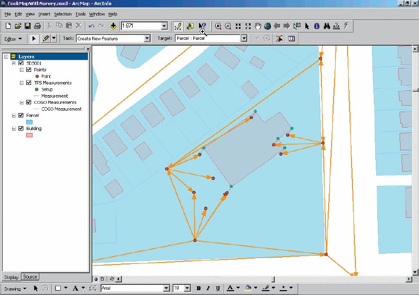
Integrates Survey Data and GIS
ArcGIS Survey Analyst |
|||
ArcGIS Survey Analyst is a new extension that includes tools that allow professional surveyors and GIS technicians to work together in an integrated system. Professional surveyors can use ArcGIS Survey Analyst to store and manage survey measurements collected in electronic or paper field books. GIS technicians can use the survey measurements stored with the Survey Analyst extension to incrementally improve their GIS data and evaluate the accuracy of features. GIS technicians will be able to improve the accuracy and value of their system due to the addition of a new type of data layer--a survey layer. Typically, GIS data layers have been created by digitizing features from existing maps or photographs, scanning data, converting data, and other techniques. This automation process has yielded two types of spatial data: raster data and vector data. ArcGIS Survey Analyst allows the storage of survey measurements in a geodatabase as a third type of spatial data. ArcGIS Survey Analyst is an extension to ArcView, ArcEditor, and ArcInfo. It is scheduled to be available later this year. To learn more about ArcGIS Survey Analyst and to obtain evaluation software, call Esri at 1-800-447-9778, or call your Esri regional office, or contact your local reseller. Outside the United States, please contact your local Esri distributor. To learn more about GIS for surveyors, visit www.esri.com/surveying. |